This article needs additional citations for verification .(August 2020) |
Goddar is a river flowing in the Vellore district of the Indian state of Tamil Nadu. [1]
This article needs additional citations for verification .(August 2020) |
Goddar is a river flowing in the Vellore district of the Indian state of Tamil Nadu. [1]

Arcot is a town and urban area of Ranipet district in the state of Tamil Nadu, India. Located on the southern banks of Palar River, the city straddles a trade route between Chennai and Bangalore or Salem, between the Mysore Ghat and the Javadi Hills. As of 2018, the city had a population 129,640. The sweet makkan peda is a local speciality while Arcot biryani, a rice-based traditional food, is also served here.
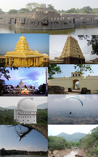
Vellore, also spelt as Velur, is a city and the administrative headquarters of Vellore district in the Indian state of Tamil Nadu. It is located on the banks of the Palar River in the northeastern part of Tamil Nadu and is separated into four zones that are further subdivided into 60 wards, covering an area of 87.915 km2 and housing a population of 423,425 as reported by the 2001 census. It is located about 137.20 kilometres (85 mi) west of Chennai, and about 213.20 kilometres (132 mi) east of Bangalore. Vellore is located on the Mumbai–Chennai arm of the Golden Quadrilateral. Vellore is governed under a mayor and the Vellore Municipal Corporation. It is a part of both the Lok Sabha and state assembly constituencies of Vellore.

Palar is a river of southern India. It rises in the Nandi Hills in Chikkaballapura district of Karnataka state, and flows 93 kilometres (58 mi) in Karnataka, 33 kilometres (21 mi) in Andhra Pradesh and 222 kilometres (138 mi) in Tamil Nadu before reaching its confluence into the Bay of Bengal at Vayalur about 75 kilometres (47 mi) south of Chennai. It flows as an underground river for a long distance only to emerge near Bethamangala town, from where, gathering water and speed, it flows eastward down the Deccan Plateau. The Towns of Bethamangala, Santhipuram, Kuppam, Ramanaickenpet, Vaniyambadi, Ambur, Melpatti, Gudiyatham, Pallikonda, Anpoondi, Melmonavoor, Vellore, Katpadi, Melvisharam, Arcot, Ranipet, Walajapet, Kanchipuram, Walajabad, Chengalpattu, Kalpakkam, and Lattur are located on the banks of the Palar River. Of the seven tributaries, the chief tributary is the Cheyyar River.
Gudiyetram, colloquially Gudiyattam is a municipality in Vellore district in the state of Tamil Nadu in India. It lies between Bangalore and Chennai and the district of Vellore is 33 km away from the town. In 2011, the town had a population of 235,672. The municipality derives its name from 'Gudiye-tram' in Tamil which means habituation of people. The ancient occupation of the people of Guidyatham was handloom weaving.

Vellore district is one of the 38 districts in the Tamil Nadu state of India. It is one of the eleven districts that form the north region of Tamil Nadu. Vellore city is the headquarters of this district. As of 2011, the district had a population of 1,614,242 with a sex ratio of 1,007 females for every 1,000 males. In 2017 Vellore district ranked eleventh in list of districts in Tamil Nadu by Human Development Index.
Kaveripakkam is a town panchayat in Ranipet district in the Indian state of Tamil Nadu.

Thiruvalluvar University is a public state university in the city of Vellore, Tamil Nadu, India. It was established by the Government of Tamil Nadu, under the Thiruvalluvar University Act, 2002. The university was named after the Tamil poet and sage Thiruvalluvar.
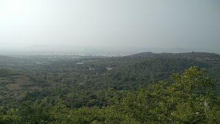
ASanambut is a village panchayat of 27 km² area in a panchayat union (Vellore Taluk, Vellore district, Tamil Nadu, India. It has a population of 5000 people. Under its governance are three villages – Asanambut, Kallaraparai, and Kuruvankottai. Its main rain-fed lake is about 9.5 acres. This village is in the foothills of the Javadi Hills and is very close to the Palar river.
Vellore taluk is an administrative division (taluk) in Vellore district of the Indian state of Tamil Nadu. The headquarters of the taluk is the town of Vellore.

Amirthi Zoological Park is a zoo in Vellore district in the Indian state of Tamil Nadu. It was opened in 1967 and is about 25 kilometres (16 mi) from the Vellore city. The area of the park is 25 hectares and one can find beautiful water falls.
The Nemili block is a revenue block in the Vellore district of Tamil Nadu, India. It has a total of 52 panchayat villages.
The Vellore block is a revenue block in the Vellore district of Tamil Nadu, India. It has a total of 22 panchayat villages.
The Kaniyambadi block is a revenue block in the Vellore district of Tamil Nadu, India. It has a total of 24 panchayat villages. Kaniyambadi is also included in the Vellore metropolitan area. This locality is a 20 minute drive from the Vellore Town bus terminus via Bagayam and Adukampaarai. It includes an engineering school called Ganathipathy Tulasis Engg College.
Malattar is a river flowing in the Vellore district of the Indian state of Tamil Nadu.
The Kaundinya River is a non-perennial river and tributary of the Palar River flowing in the Chittoor district of Andhra Pradesh and Vellore district of Tamil Nadu.
Melmonavoor or Melmanavur or Melmonavur is a village panchayat in Vellore district, located to pincode 632010. It is located 4.5 kilometres from the city of Vellore. About Melmanavur According to Census 2011 information the location code or village code of Melmanavur village is 630799. Melmanavur village is located in Vellore Tehsil of Vellore district in Tamil Nadu, India. Vellore is the district & sub-district headquarter of Melmanavur village. As per 2009 stats, Melmonavoor is the gram panchayat of Melmanavur village.
Tirupattur district, or Tirupathur district, is one of the 38 districts in the southern Indian state of Tamil Nadu. The district was formed in 2019 by the division of Vellore district into three smaller districts. Its creation alongside Ranipet district was announced on 15 August 2019, and it was officially declared on 28 November 2019. The town of Tirupattur serves as the district headquarters.

Ranipet district is one of the 38 districts of Tamil Nadu, India, formed by trifurcating Vellore district. The Government of Tamil Nadu has announced its proposal on 15 August 2019, together with Tirupattur district. However, it was officially declared on 28 November 2019 by Tamil Nadu Government. The town of Ranipet would serve as the district headquarters.

Tirupathur or Tirupattur is the headquarters of Tirupathur district in the state of Tamil Nadu in India and is one of the oldest inhabited places in the state, with a history of over 1,600 years. The town is known for an abundance of sandalwood in the surrounding hills. It is located about 89 km (55 mi) from Vellore, 85 km (53 mi) from Hosur, 60 km (37 mi) from Dharmapuri, 50 km (31 mi) from Krishnagiri, 50 km (31 mi) from Thiruvannamalai, 210 km (130 mi) from Chennai, and 125 km (78 mi) from Bangalore.
