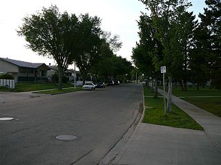
Boyle Street is a neighbourhood located in central Edmonton, Alberta, Canada, immediately east of the downtown core. The neighbourhood is bounded by Grierson Hill to Rowland Road until Alex Taylor Road and then Jasper Avenue east until 82 Street by the south, 82 Street by the east, 97 Street by the west, and the LRT tracks to the north, with Jasper Avenue and 103A Avenue running through the neighbourhood.
York is a neighbourhood in north east Edmonton, Alberta, Canada located just to the west of the District of Clareview. It is bounded on the north by 144 Avenue, the east by 50 Street, the south east by Manning Drive, the south by 137 Avenue, and on the west by 66 Street.

Elmwood is a neighbourhood in west Edmonton, Alberta, Canada that was a part of the Town of Jasper Place prior to Jasper Place's amalgamation with Edmonton in 1964. It is a residential neighbourhood located to the south east of West Edmonton Mall and to the south west of Meadowlark Health and Shopping Centre. Residents also have ready access to the Misericordia Community Hospital located just north of Elmwood in the neighbourhood of West Meadowlark Park.
Meadowlark Park is a residential neighbourhood in west Edmonton, Alberta, Canada. Bounded by 95 Avenue to the north, 156 Street to the east, 87 Avenue to the south, and 163 Street to the west, the neighbourhood was originally part of the Town of Jasper Place. It became part of Edmonton in 1964 when Jasper Place amalgamated with the city.
Tamarack is a residential neighbourhood in southeast Edmonton, Alberta, Canada. It was established in 2006 through the adoption of the Tamarack Neighbourhood Area Structure Plan (NASP). It is one of the neighbourhoods located within The Meadows area.
Secord is a neighbourhood located in west Edmonton, Alberta, Canada. It covers an area of approximately 248 hectares.
Heritage Valley Town Centre is a neighbourhood in southwest Edmonton, Alberta, Canada that was established in 2009 through the adoption of the Heritage Valley Town Centre Neighbourhood Area Structure Plan (NASP).
Crystallina Nera East is a neighbourhood in northeast Edmonton, Alberta, Canada. Subdivision and development of the neighbourhood is guided by the Crystallina Nera East Neighbourhood Structure Plan (NSP), which was originally adopted as the Joviz NSP by Edmonton City Council on September 2, 2011.
Starling is a neighbourhood in northwest Edmonton, Alberta, Canada that was established in 2010 through the adoption of the Big Lake Neighbourhood Two Neighbourhood Structure Plan (NSP).
Edgemont is a residential neighbourhood in west Edmonton, Alberta, Canada that was established in 2011 through the adoption of the Edgemont Neighbourhood Area Structure Plan (NASP).
Hawks Ridge is a neighbourhood in northwest Edmonton, Alberta, Canada that was established in 2010 through the adoption of the Big Lake Neighbourhood Three Neighbourhood Structure Plan (NSP), which was renamed as the Hawks Ridge NSP in July 2011.
Hays Ridge is a neighbourhood that is under development in southwest Edmonton, Alberta, Canada. Subdivision and development of the neighbourhood is being guided by the Hays Ridge Neighbourhood Area Structure Plan (NASP), which was adopted by Edmonton City Council on April 16, 2012. The neighbourhood is named after Helen Hays.
Cy Becker is a neighbourhood in northeast Edmonton, Alberta, Canada and named after one of Alberta's first bush pilots and finest wartime flying aces, Cy Becker staked his claim in history by making the first air mail delivery to remote northern communities.
Northmount is a neighbourhood in northwest Edmonton, Alberta, Canada. It and the Evansdale neighbourhood to the north comprise Edmonton's Dickinsfield community.
Big Lake is a residential area in the northwest portion of the City of Edmonton in Alberta, Canada. It was established in 1991 through Edmonton City Council's adoption of the Big Lake Area Structure Plan, which guides the overall development of the area.
Castle Downs is a residential area in the northwest portion of the City of Edmonton in Alberta, Canada. The area was originally to be called Athabasca Downs, but when the city rejected the name, the developer used their second choice: Castle Downs. The names of the communities were based on European castles, and Castle Downs became the first area in Edmonton to be named in a thematic way. According to former Names Committee secretary Nancy Diettrich “The castles were chosen to recognize the different ethnic groups in the area.” It was originally established in 1971 through Edmonton City Council's adoption of the Castle Downs Outline Plan, and then extended northward in 1983 through the adoption of the Caste Downs Extension Area Structure Plan. Combined, these two plans guide the overall development of the area.
The Palisades is a residential area in the northwest portion of the City of Edmonton in Alberta, Canada. It was established in 1984 through Edmonton City Council's adoption of the Palisades Area Structure Plan, which guides the overall development of the area.
Heritage Valley is a residential area in the southwest portion of the City of Edmonton in Alberta, Canada. It was established in 2001 through Edmonton City Council's adoption of the Heritage Valley Servicing Concept Design Brief, which guides the overall development of the area. The theme of neighbourhood names within Heritage Valley is "Edmontonians of the Century".
Paisley is a future neighbourhood in southwest Edmonton, Alberta, Canada. Subdivision and development of the neighbourhood will be guided by the Heritage Valley Neighbourhood 12 Neighbourhood Area Structure Plan (NASP) adopted by Edmonton City Council on August 29, 2011. The neighbourhood was officially named in 2012 after Brian Paisley, founder of the Edmonton International Fringe Festival.


