Elmwood, Edmonton

Last updated
Elmwood
Neighbourhood
2007-06-21 Elmwood Compessed.jpg
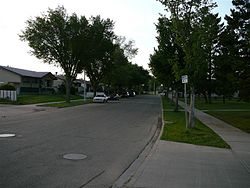
A residential street in Elmwood
Edmonton agglomeration-blank.svg
Red pog.svg
Elmwood
Location of Elmwood in Edmonton
Coordinates: 53°30′58″N113°36′14″W / 53.516°N 113.604°W / 53.516; -113.604
CountryFlag of Canada (Pantone).svg  Canada
Province Flag of Alberta.svg  Alberta
City Edmonton
Quadrant [1] NW
Ward [1] sipiwiyiniwak
Sector [2] Mature area
Area [3] [4] Jasper Place
Government
[5]
  Administrative body Edmonton City Council
  CouncillorSarah Hamilton
Area
[6]
  Total1.02 km2 (0.39 sq mi)
Elevation
674 m (2,211 ft)
Population
 (2012) [7]
  Total2,613
  Density2,561.8/km2 (6,635/sq mi)
  Change (2009–12)
Decrease2.svg−0.9%
  Dwellings
1,070

Elmwood is a neighbourhood in west Edmonton, Alberta, Canada that was a part of the Town of Jasper Place prior to Jasper Place's amalgamation with Edmonton in 1964. It is a residential neighbourhood located to the south east of West Edmonton Mall and to the south west of Meadowlark Health and Shopping Centre. [8] Residents also have ready access to the Misericordia Community Hospital located just north of Elmwood in the neighbourhood of West Meadowlark Park.

Contents

A low rise apartment in Elmwood 2007-06-21 Elmwood Row Houses Compressed.jpg
A low rise apartment in Elmwood

The neighbourhood is bounded by 87 Avenue on the north, 159 Street on the east, Whitemud Drive to the south, and 170 Street to the west. In addition to West Meadowlark Park, other residential neighbourhoods located around Elmwood are Meadowlark Park to the northeast, Lynnwood to the east, Patricia Heights and Westridge to the south, Callingwood North to the southwest, Thorncliff to the west, and Summerlea to the northwest.

Located just to the north of Whitemud Drive, with entry ramps at both 159 Street and 170 Street, residents of Elmwood have easy access to destinations on the south side, including Whyte Avenue and the University of Alberta, and Fort Edmonton Park.

The community is represented by the Elmwood Community League, established in 1964, which maintains a community hall and outdoor rink located at 164 Street and 83 Avenue. [9] [10]

Demographics

In the City of Edmonton's 2012 municipal census, Elmwood had a population of 2,613 living in 1,070 dwellings, [7] a -0.9% change from its 2009 population of 2,637. [11] With a land area of 1.02 km2 (0.39 sq mi), [6] it had a population density of 2,561.8 people/km2 in 2012. [6] [7]

See also

Related Research Articles

Summerlea, Edmonton Neighbourhood in Edmonton, Alberta, Canada

Summerlea is a neighbourhood located in west Edmonton, Alberta, Canada. It is bounded by 170 Street to the east, 178 Street to the west, 95 Avenue to the north and 87 Avenue to the south. Summerlea is home to West Edmonton Mall, one of Edmonton's best-known tourist destinations. The mall occupies almost the entire southern half of the neighbourhood.

West Jasper Place, Edmonton Neighbourhood in Edmonton, Alberta, Canada

West Jasper Place is a residential neighbourhood in west Edmonton, Alberta, Canada. Originally part of the Town of Jasper Place, West Jasper Place became a part of Edmonton when Edmonton and Jasper Place amalgamated on August 17, 1964.

Windsor Park, Edmonton Neighbourhood in Edmonton, Alberta, Canada

Windsor Park is a south central neighbourhood in the City of Edmonton, Alberta, Canada. It is located immediately to the west of the University of Alberta north campus and overlooking the North Saskatchewan River valley to the north, west, and south west. It shares a short boundary with the neighbourhood of Belgravia to the south.

Lynnwood, Edmonton Neighbourhood in Edmonton, Alberta, Canada

Lynnwood is a residential neighbourhood in west Edmonton, Alberta, Canada. Its location gives residents good access to downtown, the University of Alberta, MacEwan College, and West Edmonton Mall. It became a part of Edmonton when the Town of Jasper Place amalgamated with Edmonton in 1964.

Meadowlark Park, Edmonton Neighbourhood in Edmonton, Alberta, Canada

Meadowlark Park is a residential neighbourhood in west Edmonton, Alberta, Canada. Bounded by 95 Avenue to the north, 156 Street to the east, 87 Avenue to the south, and 163 Street to the west, the neighbourhood was originally part of the Town of Jasper Place. It became part of Edmonton in 1964 when Jasper Place amalgamated with the city.

Jasper Park, Edmonton Neighbourhood in Edmonton, Alberta, Canada

Jasper Park is a neighbourhood in west Edmonton, Alberta, Canada that was once a part of the Town of Jasper Place. It became a part of Edmonton when Jasper Place amalgamated with Edmonton in 1964. It is a smaller residential neighbourhood bounded on the south by 87 Avenue, on the east by 149 Street, on the west by 156 Street, and on the north by 92 Avenue.

West Meadowlark Park, Edmonton Neighbourhood in Edmonton, Alberta, Canada

West Meadowlark Park is a residential neighbourhood in west Edmonton, Alberta, Canada located just east of West Edmonton Mall. The area was originally part of the Town of Jasper Place, and became a part of Edmonton when Jasper Place amalgamated with Edmonton in 1964.

Sherwood, Edmonton Neighbourhood in Edmonton, Alberta, Canada

Sherwood is a small neighbourhood in west Edmonton, Alberta, Canada. Originally part of the Town of Jasper Place, it became a part of Edmonton when Jasper Place amalgamated with Edmonton in 1964.

Glenwood, Edmonton Neighbourhood in Edmonton, Alberta, Canada

Glenwood is a large neighbourhood in west Edmonton, Alberta, Canada. The neighbourhood has a mixture of residential and commercial development. Glenwood became a part of Edmonton in 1964, when the Town of Jasper Place amalgamated with Edmonton.

Lansdowne, Edmonton Neighbourhood in Edmonton, Alberta, Canada

Lansdowne is a neighbourhood in south west Edmonton, Alberta, Canada overlooking the Whitemud Creek Ravine. The Snow Valley Ski Hill is located near the neighbourhood. The neighbourhood is situated directly across from Michener Park, a residential complex for students staying at the University of Alberta.

Jackson Heights, Edmonton Neighbourhood in Edmonton, Alberta, Canada

Jackson Heights is a residential neighbourhood in the Mill Woods area of Edmonton, Alberta, Canada. It is located in the Burnewood area of Mill Woods. The neighbourhood was named in 1976 after Annie May Jackson. Jackson "became the first female police officer in Canada when she was appointed to the Edmonton Police Department in 1912."

Elmwood Park, Edmonton Neighbourhood in Edmonton, Alberta, Canada

Elmwood Park is a neighbourhood in north central Edmonton, Alberta, Canada.

Laurier Heights, Edmonton Neighbourhood in Edmonton, Alberta, Canada

Laurier Heights is a residential neighbourhood in west Edmonton, Alberta, Canada overlooking the North Saskatchewan River valley. A portion of the neighbourhood along Buena Vista Road is located in the river valley, and this portion is sometimes called Buena Vista.

Lymburn, Edmonton Neighbourhood in Edmonton, Alberta, Canada

Lymburn is a residential neighbourhood located in west Edmonton, Alberta, Canada. It is named for attorney general John F. Lymburn.

Empire Park, Edmonton Neighbourhood in Edmonton, Alberta, Canada

Empire Park is a residential neighbourhood in southwest Edmonton, Alberta, Canada. A major shopping centre, Southgate Centre, is located at the west end of the Neighbourhood.

Quesnell Heights, Edmonton Neighbourhood in Edmonton, Alberta, Canada

Quesnell Heights is a neighbourhood in west Edmonton, Alberta, Canada. It is bounded by the Rio Terrace neighbourhood across 149 Street to the west, Whitemud Drive to the north and east, the North Saskatchewan River valley to the south, Quesnell Heights is also the smallest neighbourhood in Edmonton.

Rio Terrace, Edmonton Neighbourhood in Edmonton, Alberta, Canada

Rio Terrace is a neighbourhood in west Edmonton, Alberta, Canada. It is bounded by the Patricia Heights neighbourhood across 156 Street to the west, the Lynnwood neighbourhood across Whitemud Drive to the north, the Quesnell Heights neighbourhood across 149 Street to the east, and the North Saskatchewan River valley to the south.

Patricia Heights, Edmonton Neighbourhood in Edmonton, Alberta, Canada

Patricia Heights is a neighbourhood in west Edmonton, Alberta, Canada. It is bounded by the Patricia Ravine of the North Saskatchewan River valley and ravine system to the south and southwest, the Westridge neighbourhood to the west, the Elmwood and Lynnwood neighbourhoods across Whitemud Drive to the north, and the Rio Terrace neighbourhood across 149 Street to the east.

Callingwood North, Edmonton Neighbourhood in Edmonton, Alberta, Canada

Callingwood North, originally known as Callingwood Campus, is a neighbourhood in west Edmonton, Alberta, Canada. It is bounded by the Lymburn neighbourhood across 178 Street to the west, the Thorncliff neighbourhood across Whitemud Drive to the north, the Westridge neighbourhood across 170 Street to the east, and the Callingwood South neighbourhood across 69 Avenue to the south.

References

  1. 1 2 "City of Edmonton Wards & Standard Neighbourhoods" (PDF). City of Edmonton. Archived from the original (PDF) on May 3, 2014. Retrieved February 13, 2013.
  2. "Edmonton Developing and Planned Neighbourhoods, 2011" (PDF). City of Edmonton. Archived from the original (PDF) on September 4, 2013. Retrieved February 13, 2013.
  3. "The Way We Grow: Municipal Development Plan Bylaw 15100" (PDF). City of Edmonton. 2010-05-26. Archived from the original (PDF) on May 2, 2015. Retrieved February 13, 2013.
  4. "City of Edmonton Plans in Effect" (PDF). City of Edmonton. November 2011. Archived from the original (PDF) on October 17, 2013. Retrieved February 13, 2013.
  5. "City Councillors". City of Edmonton. Retrieved February 13, 2013.
  6. 1 2 3 "Neighbourhoods (data plus kml file)". City of Edmonton. Retrieved February 22, 2013.
  7. 1 2 3 "Municipal Census Results – Edmonton 2012 Census". City of Edmonton. Retrieved February 22, 2013.
  8. "Meadowlark Health & Shopping Centre". First Capital Realty . Retrieved 2019-04-04.
  9. "Elmwood Community League". Elmwood Community League. Retrieved October 8, 2017.
  10. Kuban, Ron (2005). Edmonton's Urban Villages: The Community League Movement . University of Alberta Press. ISBN   9781459303249.
  11. "2009 Municipal Census Results". City of Edmonton. Retrieved February 22, 2013.