Gordon's Ferry

Last updated
Gordon's Ferry
Location map Bakersfield.png
Red pog.svg
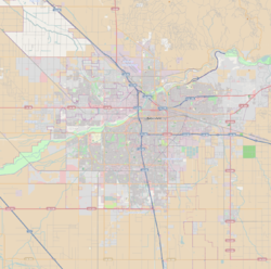
Location of Gordon's Ferry in Bakersfield, California
USA California location map.svg
Red pog.svg
Gordon's Ferry (California)
Location Bakersfield, California
Coordinates 35°25′32″N118°58′4″W / 35.42556°N 118.96778°W / 35.42556; -118.96778
Area Northeast Bakersfield
BuiltFerry (1853),
Bridge (1901)
Governing bodyCity of Bakersfield
Official nameGordon's Ferry on the Kern River
DesignatedJanuary 17, 1937 (1937-01-17)
Reference no.137

Gordon's Ferry is both a geographical location and a historic site in Bakersfield, California. It is located where China Grade Loop crosses the Kern River and meets with Alfred Harrell Highway in Northeast Bakersfield. It is named after a ferry that used to cross the river near the existing bridge. It was one of the only eastern crossings, until 1877, when the Jewett Avenue bridge was constructed farther west. [1] It is California Historical Landmark #137. [2]

Contents

History

The 49ers, on their way to the gold fields during the California Gold Rush, used this place as a ford crossing. In 1853, as the Kern River Gold Rush began, Major Aneas Gordon begin operating a ferry at the crossing of the Stockton - Los Angeles Road. It was an overhead cable type, with a flat bottom boat. With a growing number of settlers coming to the region, the ferry experienced much traffic.

Butterfield Overland Mail

In 1857, the Butterfield Overland Mail 1st Division was established and used the ferry on its San Francisco to St. Louis postal route. The stage company would establish a station at that location (one of six in Kern County), which was called the Kern River Station. [1] [3]

Butterfield Overland Mail continued to use the ferry until the outbreak of the American Civil War in 1861. Because the original route crossed into the Confederacy, the U.S. postmaster directed Butterfield to change to the Central Overland Route. Kern River Station would continue to be used by other stagecoach companies until the railroad made them obsolete. The ferry would continue to be used by settlers and residents until 1877, when the Jewett Avenue bridge was constructed to the west. [1]

Oilfield and bridges

As a river crossing, Gordon's Ferry sat empty for many years. However, oil was discovered in the Kern River Oil Field in 1899 (the first oil discovery in Kern County). The oilfield was just north of Gordon's Ferry. Oil was hauled out by trains, which were located in Sumner and Bakersfield, which is south of the river. As a result, in 1901 a wooden bridge was constructed at the previous ferry crossing.

It would later be replaced with the concrete bridge that exists today. [1] In 1937, the site would be declared a California Historical Landmark--the first in Kern County. [4]

The California Historical Landmark reads:

NO. 137 GORDON'S FERRY ON THE KERN RIVER - Gordon's Ferry was an overhead cable-type of ferry operated during the 1850s by Major Gordon. An adobe station house was located on the south bank of the Kern River, just a few yards to the west of this marker, which also served as a station on the Butterfield Overland Mail Route from 1856 to 1860. Registred June 6, 1934.

The marker is located near the Kern River bridge, on China Loop, 1,000 ft South of Round Mountain Road, Bakersfield.

See also

Related Research Articles

<span class="mw-page-title-main">Bakersfield, California</span> City in California, United States

Bakersfield is a city in Kern County, California, United States. Bakersfield is the largest city and county seat of Kern County. The city covers about 151 sq mi (390 km2) near the southern end of the San Joaquin Valley, which is located in the Central Valley region.

<span class="mw-page-title-main">Butterfield Overland Mail</span> Stagecoach service in the US (1858–1861)

Butterfield Overland Mail was a stagecoach service in the United States operating from 1858 to 1861. It carried passengers and U.S. Mail from two eastern termini, Memphis, Tennessee, and St. Louis, Missouri, to San Francisco, California. The routes from each eastern terminus met at Fort Smith, Arkansas, and then continued through Indian Territory (Oklahoma), Texas, New Mexico, Arizona, Mexico, and California ending in San Francisco. On March 3, 1857, Congress authorized the U.S. postmaster general, at that time Aaron V. Brown, to contract for delivery of the U.S. mail from St. Louis to San Francisco. Prior to this, U.S. Mail bound for the Far West had been delivered by the San Antonio and San Diego Mail Line since June 1857.

Kingston is a former town that was originally in Fresno County, until 1909 when that territory south of Kings River was transferred to Kings County, California. It was located on the south bank of the Kings River 8.5 miles (13.7 km) northwest of Hanford at Whitmore's Ferry.

The Butterfield Overland Mail in Indian Territory was part of the overall Butterfield Overland Mail service (1857–1861) created by Congress March 3, 1857. The route crossed Indian Territory from Colbert's Ferry to Fort Smith, Arkansas which was the Center for the Overland Mail's' 7th Division. Fort Smith was also the junction point of the south bound coaches with the Memphis mail and its passengers. From Fort Smith the 7th Division route crossed the Poteau River into Indian Territory into the Choctaw Nation at Skullyville and left the Chickasaw Nation at Colbert's Ferry into Texas. There were 12 stage stations in Indian Territory, located from 13 to 19 miles (31 km) apart. The total length of the route across the territory was approximately 197 miles (317 km). The Butterfield route met with the Texas Road near Geary's Station and followed it southward to the Red River.

Colbert's Ferry was an important Red River crossing between Texas and Indian Territory from about 1853 to 1899. Both the Texas Road and the Butterfield Overland Mail route crossed here. It was located on the Texas Road about 3 miles (4.8 km) southeast of present–day Colbert, Bryan County, Oklahoma. The nearest town on the Texas side of the river is Denison.

<span class="mw-page-title-main">Oak Grove Butterfield Stage Station</span> Overland Mail stagecoach stop in California

Oak Grove Butterfield Stage Station is located in the western foothills of the Laguna Mountains, in northern San Diego County, California. It is located on State Route 79, 13 miles (21 km) northwest of Warner Springs and Warner's Ranch. The station was built on the site of Camp Wright, an 1860s Civil War outpost.

<span class="mw-page-title-main">Kern River Oil Field</span> Oil field in the San Joaquin Valley of California

The Kern River Oil Field is a large oil field in Kern County in the San Joaquin Valley of California, north-northeast of Bakersfield in the lower Sierra foothills. Yielding a cumulative production of close to 2 billion barrels (320,000,000 m3) of oil by the end of 2006, it is the third largest oil field in California, after the Midway-Sunset Oil Field and the Wilmington Oil Field, and the fifth largest in the United States. Its estimated remaining reserves, as of the end of 2006, were around 476 million barrels (75,700,000 m3), the second largest in the state. It had 9,183 active wells, the second highest in the state. The principal operator on the field is Chevron Corporation

Woody is an unincorporated community in Kern County, California, in the United States. It is located in the foothills of the Greenhorn Mountains, 25 miles (40 km) north-northeast of Bakersfield at an elevation of 1,654 feet (504 m).

Kern River Slough is a former settlement in Kern County, California.

<span class="mw-page-title-main">Transportation in Kern County, California</span>

Kern County’s transportation system was quoted as the “unseen industry.” Located at the southern end of the San Joaquin Valley, the county is at a prime location to ship goods west to the central coast, south to ports in Los Angeles, and east to corridors that connect to the rest of the country. It is also on major corridors that link to all northern points.

<span class="mw-page-title-main">Butterfield Overland Mail in California</span> Historic route by state

The Butterfield Overland Mail in California was created by the United States Congress on March 3, 1857, and operated until June 30, 1861. Subsequently, other stage lines operated along the Butterfield Overland Mail in route in Alta California until the Southern Pacific Railroad arrived in Yuma, Arizona in 1877.

<span class="mw-page-title-main">Butterfield Overland Mail in Texas</span> Route of mail service created in 1857

In Texas, the Butterfield Overland Mail service created by Congress on March 3, 1857, was operated until March 30, 1861.

Fountain Springs was a settlement established in Tulare County, California, before 1855, at the junction of the Stockton–Los Angeles Road and the road to the Kern River gold mines. From 1858 to 1861, Fountain Springs was a station on the Butterfield Overland Mail route, 14 miles (23 km) southeast of Tule River Station and 12 miles (19 km) north of Mountain House. The site of the settlement was 1+12 miles (2.4 km) northwest of the California Historical Landmark No. 648 on the southwest corner of County Roads J22 and M 109 in Tulare County.

<span class="mw-page-title-main">Lyons Station Stagecoach Stop</span> Historical site in Newhall, Santa Clarita, California

The Lyons Station Stagecoach Stop,, was a tavern and stagecoach stop near the southwest corner of Newhall Avenue and Sierra Highway, by Eternal Valley Cemetery. The site is located in the present day Newhall section of Santa Clarita, in Los Angeles County, California.

The Stockton–Los Angeles Road, also known as the Millerton Road, Stockton–Mariposa Road, Stockton–Fort Miller Road or the Stockton–Visalia Road, was established about 1853 following the discovery of gold on the Kern River in Old Tulare County. This route between Stockton and Los Angeles followed by the Stockton–Los Angeles Road is described in "Itinerary XXI. From Fort Yuma to Benicia, California", in The Prairie Traveler: A Hand-book for Overland Expeditions by Randolph Barnes Marcy. The Itinerary was derived from the report of Lieutenant R. S. Williamson on his topographical survey party in 1853, that was in search of a railroad route through the interior of California.

Tejon Creek, originally in Spanish Arroyo de Tejon, is a stream in Kern County, California. Its headwaters are located on the western slopes of the Tehachapi Mountains, and it flows northwest into the southern San Joaquin Valley.

Posey Creek Station of the Butterfield Overland Mail 1st Division was located on Posey or Poso Creek, in the southeastern San Joaquin Valley, in present-day Kern County, California.

Mountain House or Willow Springs Station, in what is now Kern County, California, was a stage station of the Butterfield Overland Mail, located 12 miles (19 km) south of Fountain Spring Station, and 15 miles (24 km) northeast of Posey Creek Station at Willow Springs on Willow Springs Creek.

Stickneys Ferry was a settlement established in what became Tulare County after the Williamson Expedition of the Pacific Railroad Surveys of 1853 and before 1857, on what became the Stockton - Los Angeles Road and the crossing of the White River. It was probably established sometime between 1854 and 1856 because of the Kern River Gold Rush.

<span class="mw-page-title-main">Mirror Building</span> California historic landmark

The Mirror Building also called the Butterfield Overland Mail Company Los Angeles Building was a large building in the City of Los Angeles. Butterfield Overland Mail Company built the large brick building in 1858. The Mirror Building was designated a California Historic Landmark (No.744) on July 5, 1960. The Mirror Building had business offices and housing space for traveling workers. There was a large stable in the back of the buildings for the horses, along with a large workshop to repair the stagecoaches. The first Butterfield Overland Mail stagecoach from St. Louis to arrive was on October 7, 1858. The Butterfield Overland Mail Company was founded by John Butterfield, he later would be the founder of American Express. While the Mirror Building was being built the Butterfield Overland Mail Company rented space from the Bella Union Hotel. The Los Angeles Butterfield Overland Mail Company closed in 1861.

References

  1. 1 2 3 4 History Archived 2011-08-24 at the Wayback Machine . Panorama Vista Preserve. Accessed: 04-11-2011.
  2. "Gordon's Ferry". Office of Historic Preservation, California State Parks. Retrieved 2012-10-07.
  3. Gordon's Ferry Archived 2011-07-26 at the Wayback Machine . Bakersfield Life. Accessed: 04-11-2011.
  4. Kern County Historical Chronology Archived 2011-09-29 at the Wayback Machine . Kern County Museum. Accessed: 04-11-2011.