Tirurangadi is a municipal town in Malappuram district of Kerala, India. It is a historic town famed for its active participation in the freedom struggle, especially those dating back to the 1920s. It serves as a local taluk and is located, 30 km south of Calicut and 140 km north of Ernakulam.

Karipur is a locality in the Kondotty taluk of the Malappuram district of Kerala, India, 25 km (16 mi) from the city of Malappuram. It is best known as the site of Calicut International Airport, serving travellers of mainly the South Malabar region. Other than that, it is a small hamlet that comes under the jurisdiction of Kondotty Municipality and Pallikkal gram panchayat. Karipur forms a portion of the Malappuram metropolitan area as of 2011 Census.

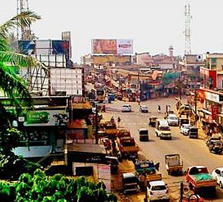
Malappuram is a city in the Indian state of Kerala, spread over an area of 158.20 km2 (61.08 sq mi) including the surrounding suburban areas. The first municipality in the district formed in 1970, Malappuram serves as the administrative headquarters of Malappuram district. Divided into 40 electoral wards, the city has a population density of 1,742 per square kilometre. According to the 2011 census, the Malappuram metropolitan area is the fourth largest urban agglomeration in Kerala after Kochi, Calicut, and Thrissur urban areas and the 26th largest in India with a total population of 1.7 million. It is the fastest growing city in the world with a 44.1% urban growth between 2015 and 2020 as per the survey conducted by Economist Intelligence Unit (EIU) based on the urban area growth during January 2020. Malappuram is situated 54 km southeast of Calicut and 90 km northwest of Palakkad. It is the first Indian municipal body to provide free Wi-Fi connectivity to its entire residents. Malappuram is also the first Indian municipal body to achieve the International Organization for Standardization certificate. It is also the first complaint-free municipality in the state.
Kondotty is a developing town, municipality, and aerotropolis in the Malappuram district state of Kerala, India which is located near Calicut International Airport, 24 km from Malappuram. It is the headquarters of Kondotty Taluk, which was declared as the seventh taluk in Malappuram district by chief minister Oommen Chandy on 23 December 2013.

Melattur is a town in Malappuram district of Kerala. It is situated on the banks of the Velliyar river. The name Melattur came from the Malayalam words 'Mele' (above), 'Aaru' (river) and 'Ooru' (place); i.e., 'place near upstream'. There are places named Edayattur, and Keezhattur on the banks of the river Olippuzha. The town is well connected to Perinthalmanna (17 km [11 mi]), Manjeri (23 km [14 mi]), Mannarkkad (24 km [15 mi]), Pandikkad (8 km [5.0 mi]) and Karuvarakundu (11 km [6.8 mi]) by road. Melattur Railway Station is a minor railway station on the Nilambur - Shornur Line.

Mankada is a hillside village in the Malappuram district of Kerala state. It is located 15 km (9.3 mi) from Malappuram and is part of the Malappuram parliament constituency. The municipal town of Perinthalmanna is just 10 km (6.2 mi) away. Also, the municipal towns of Manjeri and Malappuram are just 15 km (9.3 mi) away. Mankada Kadannamanna Kovilakam was the seat of ruling family of the erstwhile Kingdom of Valluvanad.
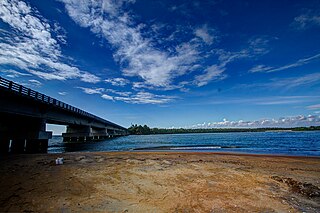
Kadalundi River (Kadalundipuzha) is one of the four major rivers flowing through Malappuram district in the Indian state of Kerala. The other three are the Chaliyar, the Bharathappuzha and the Tirur River. This rain-fed river is 130 kilometres (81 mi) long and is one of the most important rivers in the district. Kadalundi River is also the sixth longest River in Kerala. Kadalundi River passes through [Karuvarakundu, Tuvvur [Melattur, Kerala|Melattur]], Pandikkad, Manjeri, Malappuram, Panakkad, Parappur, Vengara, Tirurangadi, Parappanangadi, Vallikkunnu, and empties itself into Arabian sea at Kadalundi Nagaram in Vallikkunnu on the northwestern border of the district. It is formed by the confluence of the Olippuzha River and the Veliyar River. The Kadalundi originates from the Western Ghats at the western border of the Silent Valley and flows through the district of Malappuram. It has two main tributaries namely Olipuzha and Veliyar. Olipuzha and Veliyar merges together to become Kadalundi River near Melattur. Kadalundi River traverses through the historical regions of Eranad and Valluvanad. The Kadalundi River drains an area of 1274 km² and has a length of 120 km. The ancient port of Tyndis, which was the second-largest trading port of Chera dynasty, only after to Muziris, is identified with the mouth of this river at Vallikunnu. The Kadalundi Bird Sanctuary spreads over a cluster of islands where the Kadalundipuzha River flows into the Arabian Sea. There are over a hundred species of native birds and around 60 species of migratory birds in large numbers annually.

Mampad is a growing town in Malappuram district, Kerala, India. located about 08 km east of Nilambur city. Nearby places include Edavanna, Areacode, Manjeri, Wandoor and Pandikkad. It is under the Wandoor Assembly Constituency. Kozhikode-Nilambur-Gudalur SH pass through here. The Mampad town is now developing day to day. Most people are engaged in agriculture and business activities. Hindus, Christians and Muslims co-exist in harmony adding to the diversity in faith and religion. The land is famous for football. The land where Asif Zahir Mampad Rahman played. He contributed a lot to the Malappuram district.
The importance and antiquity of education in Kerala are underscored by the state's ranking as among the most literate in the country. The educational transformation of Kerala was triggered by the efforts of the Church Mission Society missionaries, who were the pioneers that promoted mass education in Kerala, in the early decades of the 19th century. The local dynastic precursors of modern-day Kerala—primarily the Travancore Royal Family, the Nair Service Society, Sree Narayana Dharma Paripalana Yogam and Muslim Educational Society (MES)—also made significant contribution to the progress on education in Kerala. Local schools were known by the general word kalaris, some of which taught martial arts, but other village schools run by Ezhuthachans were for imparting general education. Christian missionaries and British rule brought the modern school education system to Kerala. Ezhuthu palli was the name used in earlier times. The word was derived from the schools run by the Buddhist monasteries. For centuries villages used to setup an ezhuthupally or ashan pallikoodam with one or two teachers. Students used to go this school from nearby areas and learn languages, literature, mathematics, grammar etc. After completing this students may continue study about specific subjects such as ayurveda, astrology, accounting etc. Censuses during 1800 shows that Travancore, Cochin, Kannur areas have many such schools. Even name list of ashans were used to be published along with the census.

Vengara is a town in Malappuram district of Kerala state. It is situated in the Vengara Grama Panchayat and is located in Tirurangadi Taluk.

Thenhipalam is a census town and a panchayat in Tirurangadi taluk in Malappuram district of Kerala, India, with a population of 27,273 as per 2001 census, consisting of 13,293 males and 13,980 females. Tenhipalam forms a portion of the Malappuram metropolitan area as of 2011 Census. University of Calicut, the first university in the Malabar region, is located north-west part of the Panchayat. 'Chelari' is the main commercial place in Tenhipalam panchayat while 'Panambra' is considered the headquarters of the panchayat. The small town between Chelari and the university is called Kohinoor.
Athavanad is a village in the Tirur Taluk, in the Malappuram District of the state of Kerala, India. The town lies on the National Highway 17, between Kuttippuram and Valanchery. Puthanathani is the main town of the Athavanad village and the village office is located in Athavanad Para & Kurumbathoor. Nearby towns include Valanchery, Kalpakanchery, Tavanur, Tirunavaya, Kuttippuram, Irimbiliyam, and Edayur.

Tuvvur is a village in Malappuram district in the state of Kerala, India. This village has mosques, temples, churches and people of different religions are living in this village.
Kendriya Vidyalaya Malappuram is a school run by Kendriya Vidyalaya Sangathan located in Malappuram, Kerala. It was established in 1986.
Perinthalmanna is a major town and municipality in Malappuram district, Kerala, India. It serves as the headquarters of the Perinthalmanna Taluk, and a block and a Revenue Division by the same name. It was formerly the headquarters of Valluvanad Taluk, which was one of the two Taluks in the Malappuram Revenue Division of the erstwhile Malabar District during the British Raj. The town is located 23 kilometres (14 mi) southwest to the city of Malappuram at the centre of the Kozhikode–Malappuram–Perinthalmanna–Palakkad National Highway 966.
Panakkad Pokoya Thangal Memorial Higher Secondary School, Kottukkara, or P.P..M.H.S.S. India, was established in 1976 and run by the Nediyiruppu Muslim Educational Socialization. The school is situated 2 km away from kondotty and close to National Highway 213.
College of Applied Science Malappuram, is established in 1993, affiliated to University of Calicut and is managed by Institute of Human Resources Development (IHRD) established by Govt. of Kerala.

Malappuram district is an education hub of the state of Kerala, India with four universities, two medical colleges, two law colleges and several engineering and arts colleges. The city has several educational institutions from the school level to higher education. Kendriya Vidyalaya, Jawahar Navodaya Vidyalaya, Malabar Special Police HSS, Government Girls Higher secondary school, Govt. Boys, St.Gemmas HSS, Islahiya HSS, A.U.P School, Sree Arunodaya Vidya Nigethan etc. to name a few schools. The city is lacking an Engineering College under Government despite having the largest number of students appearing and excelling in respective entrance exams. Govt. College, Malappuram, which is the oldest college in the city, started in 1972, College of Applied Science Malappuram and Govt. College for Women started this year along with many other private colleges serves the higher educational purpose. Govt.TTI and MCT TTI are few teachers training institutes. The Regional Directorate of Higher Secondary Education and Regional Office (Malabar) of State Open School are located in the city inside the Civil Station.
Devadhar Government Higher Secondary School is a State Government owned Higher Secondary School located in K Puram, near Tanur in Malappuram district of Kerala State. It is run by Department of General Education and Department of Higher Secondary Education of Government of Kerala. It has two sections. Oldest, started in 1919, works under Department of General Education catering classes from Five to Ten and latest under Department of Higher Secondary Education holds 11 & 12. Higher Secondary Sections were started in 1990.

Eranad Taluk comes under Perinthalmanna revenue division in Malappuram district of Kerala, India. Its headquarters is the city of Manjeri. Eranad Taluk contains two municipalities - Manjeri and Malappuram. Most of the administrative offices are located in the Civil Station at Malappuram and the Mini-Civil Station at Manjeri.
