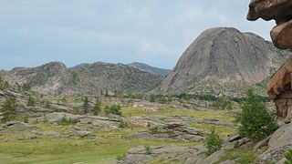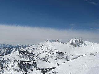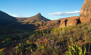
The St. Francois Mountains in southeast Missouri are a mountain range of Precambrian igneous mountains rising over the Ozark Plateau. This range is one of the oldest exposures of igneous rock in North America. The name of the range is spelled out as Saint Francois Mountains in official GNIS sources, but it is sometimes misspelled in use as St. Francis Mountains to match the anglicized pronunciation of both the range and St. Francois County.

The Front Range is a mountain range of the Southern Rocky Mountains of North America located in the central portion of the U.S. State of Colorado, and southeastern portion of the U.S. State of Wyoming. It is the first mountain range encountered as one goes westbound along the 40th parallel north across the Great Plains of North America.

The Wind River Range is a mountain range of the Rocky Mountains in western Wyoming in the United States. The range runs roughly NW–SE for approximately 100 mi (160 km). The Continental Divide follows the crest of the range and includes Gannett Peak, which at 13,802 ft (4,207 m), is the highest peak in Wyoming; and also Fremont Peak at 13,750 ft (4,191 m), the third highest peak in Wyoming. There are more than 40 other named peaks in excess of 12,999 ft (3,962 m). With the exception of the Grand Teton in the Teton Range, the next 19 highest peaks in Wyoming after Gannett are also in the Winds.

The Granite Mountains are a short subrange of the Rocky Mountains in central Wyoming of the United States. The range runs approximately 100 mi (160 km) E-W along the south side of the Shoshone Basin, and north of the Sweetwater River, in eastern Fremont County and western Natrona County. The highest point is McIntosh Peak at 8,058 feet (2,456 m). Independence Rock is at the east end of the range, and Split Rock was a prominent landmark on the Oregon Trail. The region is rich in uranium and other mineral deposits.
The Salvesen Mountains or Salvesen Range is a mountain range on the southern tip of South Georgia, rising to a maximum elevation of 2,330 metres (7,644 ft). They were created 127 million years ago and are made mainly from granite. The Cretaceous granite is embedded into the Jurassic basaltic lavas and dolerite dykes. Both of which are black so they create a striking colour contrast in exposures. Both the granite and the basalt were formed from rising magma formed on the divergent plate boundary where the southern Atlantic Ocean opened. The main ranges of South Georgia famously crossed by Ernest Shackleton in 1916, are less rugged and precipitous than the Salvesen Mountains as they are formed from folded sandstone. These were formed from sand deposition, the sediment for which was derived from erosion of the igneous rocks and rifting continental blocks.

The Sheep Hole Mountains are a mountain range in the Mojave Desert, to the north of Joshua Tree National Park, in San Bernardino County, California. The mountains were once Chemehuevi hunting grounds.

The Chemehuevi Mountains are a mountain range that are found at the southeast border of San Bernardino County in southeastern California and are adjacent the Colorado River. Located south of Needles, California and northwest of the Whipple Mountains, the mountains are oriented in a north–south direction, and stretch for approximately 15 miles (24 km) in length.

Granite domes are domical hills composed of granite with bare rock exposed over most of the surface. Generally, domical features such as these are known as bornhardts. Bornhardts can form in any type of plutonic rock but are typically composed of granite and granitic gneiss. As granitic plutons cool kilometers below the Earth's surface, minerals in the rock crystallize under uniform confining pressure. Erosion brings the rock closer to Earth's surface and the pressure from above the rock decreases; as a result the rock fractures. These fractures are known as exfoliation joints, or sheet fractures, and form in onionlike patterns that are parallel to the land surface. These sheets of rock peel off the exposed surface and in certain conditions develop domical structures. Additional theories on the origin of granite domes involve scarp-retreat and tectonic uplift.

The Needle Mountains are a subrange of the San Juan Mountains of the Rocky Mountains located in the southwestern part of the U.S. State of Colorado. Much of the range is protected in the Weminuche Wilderness of the San Juan National Forest. The range is notable for having some of the most rugged mountains in the state, and includes many technical climbs and scrambles. A small but dramatic east–west subrange in the northern section is known as the Grenadier Range.

East Spanish Peak is a prominent mountain summit that is the lower of the two Spanish Peaks in the Rocky Mountains of North America. The 12,688-foot (3,867 m) peak is located in the Spanish Peaks Wilderness of San Isabel National Forest, 9.3 miles (14.9 km) southeast by south of the Town of La Veta, Colorado, United States, on the drainage divide between Huerfano and Las Animas counties. The Spanish Peaks are two large igneous stocks which form an eastern outlier of the Culebra Range, a subrange of the Sangre de Cristo Mountains. East Spanish Peak is higher than any point in the United States east of its longitude; it is also the easternmost point in the United States over 12,000 feet (3,700 m), 11,000 feet (3,400 m), and 10,000 feet (3,000 m) feet above sea level.

Rendezvous Mountain is a large mountain massif located in the southern Teton Range in the U.S. state of Wyoming. The highest point on Rendezvous Mountain is Rendezvous Peak. The western and northern flanks of the mountain are in Grand Teton National Park, while much of the remainder of the massif is in the Bridger-Teton National Forest.

The White Tank Mountains are a mountain range in central Arizona. The mountains are on the western periphery of the Phoenix metropolitan area, primarily flanked by the suburban cities of Buckeye to the southwest, and Surprise to the northeast. The mountain range is home to the White Tank Mountain Regional Park and is a regional recreation hub.

Granite Mountain is a 7,628-foot (2,325 m) mountain located in Yavapai County, Arizona that covers roughly 12 square miles (31 km2). It was once known as Mount Gurley, for the first governor of the Arizona Territory, John A. Gurley. Its southwest face has a sheer granite cliff approximately 500 feet high that is one of the best locations for rock climbing in the state of Arizona. It is located in the Granite Mountain Wilderness, which is managed as a part of the Prescott National Forest. The mountain stands at the northern end of the Sierra Prietas, and borders Skull Valley on the west, on the northwest by the Santa Maria Mountains, and east by the Williamson Valley.

The Salinian Block or Salinian terrane is a geologic terrane which lies west of the main trace of the San Andreas Fault system in California. It is bounded on the south by the Big Pine Fault in Ventura County and on the west by the Nacimiento Fault. It was named for the Salinas Valley in Monterey County, California.
The Granite Range is a mountain range in Washoe County, Nevada west of the town of Gerlach and the lower Black Rock Desert playa.

The Trout Creek Mountains are a remote, semi-arid Great Basin mountain range mostly in southeastern Oregon and partially in northern Nevada in the United States. The range's highest point is Orevada View Benchmark, 8,506 feet (2,593 m) above sea level, in Nevada. Disaster Peak, elevation 7,781 feet (2,372 m), is another prominent summit in the Nevada portion of the mountains.

The Granite Wash Mountains are a short, arid, low elevation mountain range of western-central Arizona, in the southeast of La Paz County. The range borders a slightly larger range southeast, the Little Harquahala Mountains; both ranges form a section on the same water divide between two desert washes. The washes flow in opposite directions, one northwest to the Colorado River, the other southeast to the Gila River.

Static Peak is a mountain peak in the U.S. state of Colorado, within State Forest State Park and part of the Never Summer Mountain Range. It is located in a chain of peaks and lies between Nokhu Crags to the north and Mount Richthofen to the south. To the east lie the shallow basins of Snow Lake and to the west the mountain descends directly into the deep waters of Lake Agnes.
McCurdy Mountain is a mountain summit in the Tarryall Mountains range of the Rocky Mountains of North America. The 12,172-foot (3,710 m) peak is located in the Lost Creek Wilderness of Pike National Forest, 28.2 miles (45.4 km) east of the Town of Fairplay in Park County, Colorado, United States. Like its neighbor, Bison Peak, McCurdy Mountain features a variety of unusual granite formations.

Granite Peak is the highest mountain in both the Santa Rosa Range and Humboldt County, in Nevada, United States. It is the eighteenth-most topographically prominent peak in the state. The peak is located within the Santa Rosa Ranger District of the Humboldt-Toiyabe National Forest, about 12 miles north of the small town of Paradise Valley and 23 miles southeast of the small town of McDermitt. It is the highest mountain for over 80 miles in all directions.


