
The Shire of Moyne is a local government area in the Barwon South West region of Victoria, Australia, located in the south-western part of the state. It covers an area of 5,481 square kilometres (2,116 sq mi) and in June 2018 had a population of 16,887. It includes the towns of Port Fairy, Koroit, Mortlake, Macarthur, Peterborough, Caramut, Ellerslie, Framlingham, Garvoc, Hawkesdale, Kirkstall, Panmure, Mailors Flat, Purnim, Wangoom and Woolsthorpe. It also entirely surrounds the City of Warrnambool, a separate local government area. It was formed in 1994 from the amalgamation of the Shire of Belfast, Shire of Minhamite, Borough of Port Fairy, and parts of the Shire of Mortlake, Shire of Warrnambool, Shire of Dundas, Shire of Mount Rouse and Shire of Hampden.

Stawell, is an Australian town in the Wimmera region of Victoria 237 kilometres (147 mi) west-north-west of the state capital, Melbourne. Located within the Shire of Northern Grampians local government area, it is a seat of local government for the shire and its main administrative centre. At the 2021 census, Stawell had a population of 6,220.

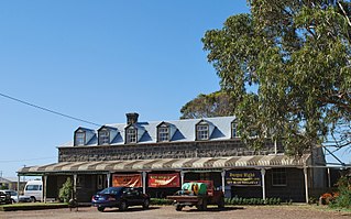
Peterborough is a town on the Great Ocean Road in Victoria, Australia, approximately three hours' drive from Melbourne. The town is situated on land to the west side of the mouth of the Curdies River.

Port Fairy is a coastal town in south-western Victoria, Australia. It lies on the Princes Highway in the Shire of Moyne, 28 kilometres (17 mi) west of Warrnambool and 290 kilometres (180 mi) west of Melbourne, at the point where the Moyne River enters the Southern Ocean.

Koroit is a small rural town in western Victoria, Australia a few kilometres north of the Princes Highway, 18 kilometres (11 mi) north-west of Warrnambool and 272 kilometres (169 mi) west of Melbourne. It is in the Shire of Moyne local government area located amidst rolling green pastures on the north rim of Tower Hill. At the 2016 census, Koroit had a population of 2,055. The town borrows its name from the Koroitch Gundidj people who occupied the area prior to European colonisation.

Panmure is a small town in the south west of Victoria, Australia. At the 2006 census, Panmure and the surrounding area had a population of 421. Situated on the Princes Highway, the town is half way between Terang and Warrnambool.
Yambuk is a town in Victoria, Australia.

Tyrendarra is a locality in south west Victoria, Australia. The locality is split between the Shire of Glenelg and the Shire of Moyne local government areas, with most being in the former. It is on the Princes Highway, 338 kilometres (210 mi) south west of the state capital, Melbourne. The Tyrendarra township lies within a bend of Darlot Creek, before it enters the Fitzroy River—which also flows through the locality.

Henty is a town in southwestern Victoria, Australia. The town is located in the Shire of Glenelg local government area, 373 kilometres (232 mi) west of the state capital, Melbourne.
Purnim is a small town in Victoria, Australia. The town is located 250 kilometres (155 mi) south west of the state capital, Melbourne, on the Hopkins Highway midway between Warrnambool and Mortlake. At the 2006 census, Purnim and the surrounding area had a population of 459.
Woorndoo is a town in the Western District of Victoria, Australia. The town is in the Shire of Moyne local government area, 259 kilometres (161 mi) west of the state capital, Melbourne. At the 2016 census, Woorndoo and the surrounding area had a population of 169. The population of the town proper is around 50.

Macarthur originally known as Eumeralla, is a town in the Western District of Victoria, Australia on the Hamilton-Port Fairy Road. It is in the Shire of Moyne local government area and the federal Division of Wannon. At the 2016 census, Macarthur and the surrounding area had a population of 522.
Caramut is a town in the Western District of Victoria, Australia on the Hamilton Highway. It is in the Shire of Moyne local government area and the federal Division of Wannon.
Woolsthorpe is a small town in the Shire of Moyne, Victoria, Australia. It is situated at the intersection of the Woolsthorpe-Heywood, Koroit-Woolsthorpe, and Warrnambool-Caramut Roads, on the banks of Spring Creek. There is a local pub, the National Hotel. At the 2016 census, Woolsthorpe had a population of 422, down from 694 in 2006. The nearest large town is Warrnambool 26.5 kilometres further south.
Hexham is a township in Victoria, Australia.

Garvoc is a town in the Western District of Victoria, Australia. The town is located in the Moyne Shire local government area, 223 kilometres (139 mi) south west of the state capital, Melbourne.
Brucknell is a locality in the Western District of Victoria, Australia. It is located in the Shire of Corangamite and Moyne.
Ellerslie is a locality in western Victoria, Australia on the Hopkins Highway. The locality is in the Shire of Moyne local government area, in what is commonly known as the Western District.
Ballangeich is a locality in western Victoria, Australia on the Hopkins Highway. The locality is in the Shire of Moyne local government area, in what is commonly known as the Western District. It sits approximately 247 kilometres (153 mi) west of the state capital, Melbourne.
Ecklin South is a small town in the Western District of Victoria, Australia. It is located mostly in the Shire of Corangamite with a small portion in the Shire of Moyne.

