Cycle sport is competitive physical activity using bicycles. There are several categories of bicycle racing including road bicycle racing, cyclo-cross, mountain bike racing, track cycling, BMX, and cycle speedway. Non-racing cycling sports include artistic cycling, cycle polo, freestyle BMX, mountain bike trials, hardcourt bike polo and cycleball. The Union Cycliste Internationale (UCI) is the world governing body for cycling and international competitive cycling events. The International Human Powered Vehicle Association is the governing body for human-powered vehicles that imposes far fewer restrictions on their design than does the UCI. The UltraMarathon Cycling Association is the governing body for many ultra-distance cycling races.

Woodall Mountain is the highest natural point in the U.S. state of Mississippi at 806 feet. It is located just off Mississippi Highway 25, south of Iuka in Tishomingo County in the northeast part of the state.

The Diablo Range is a mountain range in the California Coast Ranges subdivision of the Pacific Coast Ranges in northern California, United States. It stretches from the eastern San Francisco Bay Area at its northern end to the Salinas Valley area at its southern end.
Foundation Ice Stream is a major ice stream in the Pensacola Mountains of Antarctica. The ice stream drains northward for 150 nautical miles along the west side of the Patuxent Range and the Neptune Range to enter the Ronne Ice Shelf westward of Dufek Massif.

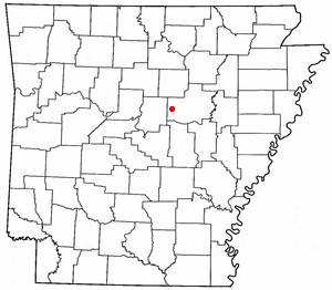
Romance is an unincorporated community in west-central White County, Arkansas, United States. The community is located approximately halfway between the town of Rose Bud to the north, and the unincorporated community of El Paso to the south. Alternately, the community is about 16 miles (26 km) northwest of Beebe, and less than 5 miles (8 km) east of Mount Vernon.

Powell Butte is an extinct cinder cone butte in Portland, Oregon, United States. It is part of the Boring Lava Field, which includes more than 80 small volcanic edifices and lava flows in the Portland–Vancouver metropolitan area. The region around Powell Butte has a cool climate, and the butte and its surroundings feature meadows, rivers, and mixed forests. Powell Butte hosts the Powell Butte Nature Park, which includes about 612 acres (2.48 km2) of trails for biking, hiking, and horseback riding.

The Withrow Moraine and Jameson Lake Drumlin Field is a National Park Service–designated privately owned National Natural Landmark located in Douglas County, Washington state, United States. Withrow Moraine is the only Ice Age terminal moraine on the Waterville Plateau section of the Columbia Plateau. The drumlin field includes excellent examples of glacially-formed elongated hills.

The Passumpsic River is a 22.7-mile-long (36.5 km) tributary of the Connecticut River, in Vermont. Though primarily a Caledonia County river, it is the only river to flow through all three counties of the Northeast Kingdom.

The geology of Kansas encompasses the geologic history and the presently exposed rock and soil. Rock that crops out in the US state of Kansas was formed during the Phanerozoic eon, which consists of three geologic eras: the Paleozoic, Mesozoic and Cenozoic. Paleozoic rocks at the surface in Kansas are primarily from the Mississippian, Pennsylvanian, and Permian periods.
Monkey Mountain refers to both a hill in Jackson County, Missouri and the nature preserve surrounding it. Its elevation is 948 ft (289 m). The mountain is located at 39°00′21″N94°10′55″W.
Hunt's Hill is a former mining camp in Nevada County, California, United States. Hunt's Hill was located in the Sierra Nevada foothills about 6 miles in a straight line southeast of Nevada City and about 2 miles northwest of You Bet, on the north side of Greenhorn Creek, not far from the present intersection of Red Dog and Buckeye Roads. Hunt's Hill was founded in 1852 by a miner named Hunt. It was located on one of the deepest parts of the rich Blue Lead channel of gold-bearing gravel. In 1855, one of the mining claims established by some French miners, was “jumped". During the fight, one of the French miners lost an eye. Thereafter, that mine, and sometimes the town, were called Gouge Eye. By 1857, the town boasted two saloons, a hotel, a blacksmith and stable, a butcher shop, a boot and shoe store, and several grocery stores. In 1858, a stage line from Nevada City arrived. In 1866, seven cement mills for extracting gold from the “blue cement” were operating in the area. By 1880, the town was reduced to a combined store and saloon and a few houses. In 1895, one directory summed up the state of the community thus: "At the present time there is not much doing there." Since that same directory identified the town's justice of the peace and constable, what little happened must have been interesting. Today, it is just a historic site.

Cooper Mountain Nature Park is a 231 acres (93 ha) nature park in the Portland metropolitan area in the U.S. state of Oregon. Opened in 2009, the park is owned and operated by Metro, the regional government in the Oregon portion of the metro area. The park is named after Cooper Mountain, the primary geological feature in the area near Beaverton. Maintained by the regional Tualatin Hills Park and Recreation District, the natural area has 3.5 miles (5.6 km) of hiking trails. It is one of THPRD's two nature parks, along with the Tualatin Hills Nature Park.

Aravaipa Creek is a drainage between three mountain ranges in southwest Graham County, Arizona – the Galiuro Mountains, the Santa Teresa Mountains and the Pinaleno Mountains. These mountains are part of the high altitude Madrean Sky Islands located in southern Arizona and New Mexico in the United States, and northern Sonora and Chihuahua states in Mexico.

The Black Hills of Yavapai County are a large mountain range of central Arizona in southeast Yavapai County. It is bordered by the Verde Valley to the east. The northwest section of the range is bisected from the southeast section by Interstate 17, which is the main route connecting Phoenix to Sedona, Oak Creek Canyon, and Flagstaff. This bisection point is the approximate center of the mostly northwest by southeast trending range. The northwest section contains a steep escarpment on the northeast with the Verde Valley, the escarpment being the location of the fault-block that created the historic mining district at Jerome. The United Verde Mine was one of the largest copper mines in the United States, producing large quantities of copper, gold, silver and zinc.

Rum Hill is a mountain located in Central New York Region of New York northwest of the Hamlet of Pierstown. Red House Hill is located southeast, Metcalf Hill is located south, Allen Lake and Mohegan Hill are located north-northwest and Otsego Lake is located east of Rum Hill.
Badeau Hill is a mountain located in Central New York region of New York northwest of Elk Creek, New York.
Stone Quarry Hill is a mountain in the Central New York region of New York. It is located northwest of East Worcester.
Kilkenny Hill is a mountain in the Central New York region of New York, United States. It is located northwest of Unadilla, New York. Kilkenny Hill is part of the Northern Allegheny Plateau Ecoregion.
Gallis Hill is a 794-foot-tall (242 m) mountain in the Catskill Mountains region of New York. It is located northwest of Kingston in Ulster County. Jockey Hill is located north-northeast, and Morgan Hill is located west of Gallis Hill. In 1927, the Conservation Department built a steel fire lookout tower on the mountain. In 1950, the tower was closed and disassembled then moved to Overlook Mountain, where it still remains today.


