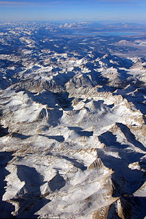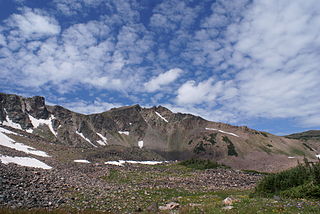
The Sierra Nevada is a mountain range in the Western United States, between the Central Valley of California and the Great Basin. The vast majority of the range lies in the state of California, although the Carson Range spur lies primarily in Nevada. The Sierra Nevada is part of the American Cordillera, an almost continuous chain of mountain ranges that forms the western "backbone" of the Americas.

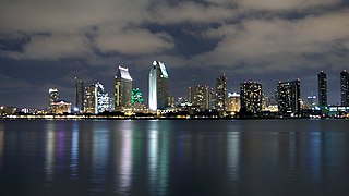
Southern California is a geographic and cultural region that generally comprises the southern portion of the U.S. state of California. It includes the Los Angeles metropolitan area, the second most populous urban agglomeration in the United States. The region generally contains ten of California's 58 counties: Imperial, Kern, Los Angeles, Orange, Riverside, San Bernardino, San Diego, Santa Barbara, San Luis Obispo and Ventura counties. The Colorado Desert and the Colorado River are located on southern California's eastern border with Arizona, and San Bernardino County shares a border with Nevada to the northeast. Southern California's southern border with Baja California is part of the Mexico–United States border.

The Humboldt–Toiyabe National Forest (HTNF) is the principal U.S. National Forest in the U.S. state of Nevada, and has a smaller portion in Eastern California. With an area of 6,289,821 acres (25,454.00 km2), it is the largest U.S. National Forest outside Alaska.

The Klamath Mountains are a rugged and lightly populated mountain range in northwestern California and southwestern Oregon in the western United States. As a mountain system within both the greater Pacific Coast Ranges and the California Coast Ranges, the Klamath Mountains have a varied geology, with substantial areas of serpentinite and marble, and a climate characterized by moderately cold winters with very heavy snowfall and warm, very dry summers with limited rainfall, especially in the south. As a consequence of the geology and soil types, the mountains harbor several endemic or near-endemic trees, forming one of the largest collections of conifers in the world. The mountains are also home to a diverse array of fish and animal species, including black bears, large cats, owls, eagles, and several species of Pacific salmon. Millions of acres in the mountains are managed by the United States Forest Service. The northernmost and largest sub-range of the Klamath Mountains are the Siskiyou Mountains.

The Transverse Ranges are a group of mountain ranges of southern California, in the Pacific Coast Ranges physiographic region in North America. The Transverse Ranges begin at the southern end of the California Coast Ranges and lie within Santa Barbara, Ventura, Los Angeles, San Bernardino, Riverside and Kern counties. The Peninsular Ranges lie to the south. The name Transverse Ranges is due to their east–west orientation, making them transverse to the general northwest–southeast orientation of most of California's coastal mountains.

Conglomerate is a clastic sedimentary rock that is composed of a substantial fraction of rounded to subangular gravel-size clasts. A conglomerate typically contain a matrix of finer grained sediments, such as sand, silt, or clay, which fills the interstices between the clasts. The clasts and matrix are typically cemented by calcium carbonate, iron oxide, silica, or hardened clay.

Sonoma Valley is a valley located in southeastern Sonoma County, California, in the North Bay region of the San Francisco Bay Area. Known as the birthplace of the California wine industry, the valley is home to some of the earliest vineyards and wineries in the state, some of which survived the phylloxera epidemic of the 1870s and the impact of prohibition in the early 20th century. Today, the valley's wines are protected by the U.S. Federal Government's Sonoma Valley and Carneros AVAs.

The Park Range, elevation approximately 12,000 feet (3,700 m), is a mountain range in the Rocky Mountains of northwestern Colorado in the United States. The range forms a relatively isolated part of the Continental Divide, extending north-to-south for approximately 40 miles (64 km) along the boundary between Jackson (east) and Routt counties. It separates North Park in the upper basin of the North Platte River on the east from the Elk River basin in the watershed of the Yampa River the west. It rises steeply out of the Yampa River basin, forming a climatic barrier that receives much snowfall in winter. The northern end of the range lies in Wyoming and is known as the Sierra Madre Range.

Eureka Valley is located in Inyo County, in eastern California in the southwestern United States. It is approximately 28 miles (45 km) long and up to 10 miles (16 km) wide, with elevations varying from 2870 feet up to 8456 feet. The southern section of the valley is now part of the Death Valley National Park - Death Valley itself lies just to the southeast. To the north is Deep Springs Valley, Fish Lake Valley, and the White Mountain Range. To the east the Last Chance Range rises over 5500 feet above the valley floor. To the west are the Saline Mountains, and to the southwest lies Saline Valley.

The Diablo Range is a mountain range in the California Coast Ranges subdivision of the Pacific Coast Ranges in northern California, United States. It is stretches from the eastern San Francisco Bay area at its northern end to the Salinas Valley area at its southern end.

The Sierra Ancha is a mountain range in Gila County, in central Arizona. It lies between Roosevelt Lake to the south, the Tonto Basin to the west, Cherry Creek to the east, and Pleasant Valley to the north. The range is one of several, including the Bradshaw Mountains, Mingus Mountain of the Black Hills, and the Mazatzal Mountains, which form a transitional zone between the lowland deserts of southern Arizona and the Colorado Plateau of northeastern Arizona. The highest point in the range is Aztec Peak, at an elevation of 2345 m (7694 ft).

The Blythe Intaglios or Blythe Geoglyphs are a group of gigantic figures incised on the ground near Blythe, California, in the Colorado Desert. The ground drawings or geoglyphs were created by humans for an, as yet, unknown reason.

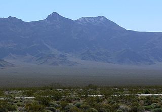
The Nopah Range is located in Inyo County, California, United States, near the eastern border with Nevada.

The Coast Ranges of California span 400 miles (644 km) from Del Norte or Humboldt County, California, south to Santa Barbara County. The other three coastal California mountain ranges are the Transverse Ranges, Peninsular Ranges and the Klamath Mountains.

The Santa Ana sucker is a freshwater ray-finned fish, endemic to California. It is closely related to the mountain sucker and has dark grey upper parts and silvery underparts. It grows to a maximum length of 25 cm (10 in), but most adults are much smaller than this. It feeds on algae, diatoms and detritus on the floor of shallow streams with sand, gravel or cobble bottoms. It is found in only a few streams in southern California, and many of these in the Greater Los Angeles metropolitan area have been restricted to concrete channels. Because of its small area of occupancy and vulnerability, the International Union for Conservation of Nature has rated this fish as "endangered".

Kings Mountain is an unincorporated community in San Mateo County, California, located along State Route 35 between Skeggs Point and Pise Mountain. This is about seven miles (11 km) north of Woodside Road (SR84). In the U.S. Geological Survey, National Geographic Names Database, the area is identified only as a geographic feature of type "summit" and not as a populated place. The community is inside area code 650 and uses the Woodside ZIP Code 94062.

The Wet Mountains are a small mountain range in southern Colorado, named for the amount of snow they receive in the winter. They are a sub-range of the Sangre de Cristo Mountains, in the southern Rocky Mountains System. There are three variant names of mountain range: Cuerno Verde, Greenhorn Mountains, and Sierra Mojada.

The Gravel Hills are a low mountain range in the central Mojave Desert, in northwestern San Bernardino County, California.

The Las Guijas Mountains are a small northwest - southeast trending mountain range in southern Pima County, Arizona. The range is approximately 12 kilometres (7.5 mi) long by 4 km (2.5 mi). Surrounding ranges includes the Cerro Colorado Mountains to the northeast, the Tumacacori Mountains of Santa Cruz County to the east, the San Luis Mountains to the south and the Baboquivari Mountains across the Altar Valley to the west. Arivaca is immediately to the southeast and the old mining townsite of Las Guijas is in the wash just north of the range.


