Related Research Articles

The Appalachian Trail, also called the A.T., is a hiking trail in the Eastern United States, extending almost 2,200 miles (3,540 km) between Springer Mountain in Georgia and Mount Katahdin in Maine, and passing through 14 states. The Appalachian Trail Conservancy claims the Appalachian Trail to be the world's longest hiking-only trail. More than three million people hike segments of it each year.

Interstate 81 (I-81) is a north–south Interstate Highway in the eastern part of the United States. Its southern terminus is at I-40 in Dandridge, Tennessee; its northern terminus is on Wellesley Island, New York at the Canadian border, where the Thousand Islands Bridge connects it to Highway 137 and ultimately to Highway 401, the main Ontario freeway connecting Detroit via Toronto to Montreal. The major metropolitan areas along the route of I-81 include the Tri-Cities of Tennessee; Roanoke in Virginia; Hagerstown in Maryland; Harrisburg and the Wyoming Valley in Pennsylvania; and Binghamton and Syracuse in New York.

The Tuscarora Trail is a 252-mile (406 km) hiking trail in the eastern United States, following the Appalachian Mountains through portions of Virginia, West Virginia, Maryland, and Pennsylvania. Its route is roughly parallel to, and to the west of, the Appalachian Trail.

The Great Appalachian Valley, also called The Great Valley or Great Valley Region, is one of the major landform features of eastern North America. It is a gigantic trough, including a chain of valley lowlands, and the central feature of the Appalachian Mountains system. The trough stretches about 1,200 miles (1,900 km) from Quebec in the north to Alabama in the south and has been an important north–south route of travel since prehistoric times.

Appalachia is a geographic region located in the central and southern sections of the Appalachian Mountains of the eastern United States. Its boundaries stretch from the western Catskill Mountains of New York into Pennsylvania, continuing on through the Blue Ridge Mountains and Great Smoky Mountains into northern Georgia, Alabama, and Mississippi, with West Virginia being the only state in which the entire state is within the boundaries of Appalachia. In 2021, the region was home to an estimated 26.3 million people, of whom roughly 80% were White.

The Eastern Continental Divide, Eastern Divide or Appalachian Divide is a hydrological divide in eastern North America that separates the easterly Atlantic Seaboard watershed from the westerly Gulf of Mexico watershed. The divide nearly spans the United States from south of Lake Ontario through the Florida peninsula, and consists of raised terrain including the Appalachian Mountains to the north, the southern Piedmont Plateau and lowland ridges in the Atlantic Coastal Plain to the south. Water including rainfall and snowfall, lakes, streams and rivers on the eastern/southern side of the divide drains to the Atlantic Ocean; water on the western/northern side of the divide drains to the Gulf of Mexico. The ECD is one of six continental hydrological divides of North America which define several drainage basins, each of which drains to a particular body of water.

The Ridge-and-Valley Appalachians, also called the Ridge and Valley Province or the Valley and Ridge Appalachians, are a physiographic province of the larger Appalachian Highlands division. The physiographic province is divided into three sections: the Hudson Valley, the Central, and the Tennessee.
The Potomac Heritage Trail, also known as the Potomac Heritage National Scenic Trail or the PHT, is a designated National Scenic Trail corridor spanning parts of the mid-Atlantic region of the United States that will connect various trails and historic sites in Virginia, Maryland, Pennsylvania, and the District of Columbia. The trail network includes 710 miles (1,140 km) of existing and planned sections, tracing the natural, historical, and cultural features of the Potomac River corridor, the upper Ohio River watershed in Pennsylvania and western Maryland, and a portion of the Rappahannock River watershed in Virginia. The trail is managed by the National Park Service and is one of three National Trails that are official NPS units.

The Wilderness Road was one of two principal routes used by colonial and early national era settlers to reach Kentucky from the East. Although this road goes through the Cumberland Gap into southern Kentucky and northern Tennessee, the other is sometimes called the "Cumberland Road" because it started in Fort Cumberland in Maryland. Despite Kentucky Senator Henry Clay's advocacy of this route, early in the 19th century, the northern route was selected for the National Road, connecting near Washington, Pennsylvania into the Ohio Valley of northern Kentucky and Ohio.
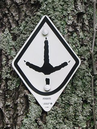
The Pinhoti Trail is a Southern Appalachian Mountains long-distance trail, 335 miles (540 km) in length, located in the United States within the states of Alabama and Georgia. The trail's southern terminus is on Flagg Mountain, near Weogufka, Alabama, the southernmost peak in the state that rises over 1,000 feet (300 m). The trail's northern terminus is where it joins the Benton MacKaye Trail. The trail's highest point is Buddy Cove Gap, with an elevation of 3164 feet near the Cohutta Wilderness. Its lowest point above sea level is close to Weogufka Creek near Weogufka State Forest at 545 feet.

The Tennessee Valley is the drainage basin of the Tennessee River and is largely within the U.S. state of Tennessee. It stretches from southwest Kentucky to north Alabama and from northeast Mississippi to the mountains of Virginia and North Carolina. The border of the valley is known as the Tennessee Valley Divide. The Tennessee Valley contributes greatly to the formation of Tennessee's three legally recognized sectors.

The Appalachian Development Highway System (ADHS) is a series of highway corridors in the Appalachia region of the eastern United States. The routes are designed as local and regional routes for improving economic development in the historically isolated region. It was established as part of the Appalachian Regional Development Act of 1965, and has been repeatedly supplemented by various federal and state legislative and regulatory actions. The system consists of a mixture of state, U.S., and Interstate routes. The routes are formally designated as "corridors" and assigned a letter. Signage of these corridors varies from place to place, but where signed are often done so with a distinctive blue-colored sign.
"Ridgerunner" is a nickname for people from the higher parts of mountainous areas in the Southeastern United States, especially the Appalachians. However, it has significantly different meanings from one State to another. The name has been used of people from some parts of: Pennsylvania, Maryland, West Virginia, Kentucky, Tennessee, Virginia, Georgia, Alabama, Arkansas and Oklahoma.
The Bartram Trail follows the approximate route of 18th-century naturalist William Bartram’s southern journey from March 1773 to January 1777. Bartram explored much of the territory which is now the states of North and South Carolina, Georgia, Florida, Alabama, Mississippi, Louisiana and Tennessee.
The Appalachian National Scenic Trail spans 14 U.S. states over its roughly 2,200 miles (3,500 km): Georgia, North Carolina, Tennessee, Virginia, West Virginia, Maryland, Pennsylvania, New Jersey, New York, Connecticut, Massachusetts, Vermont, New Hampshire, and Maine. The southern end is at Springer Mountain, Georgia, and it follows the ridgeline of the Appalachian Mountains, crossing many of its highest peaks and running almost continuously through wilderness before reaching the northern end at Mount Katahdin, Maine.

The Great Indian Warpath (GIW)—also known as the Great Indian War and Trading Path, or the Seneca Trail—was that part of the network of trails in eastern North America developed and used by Native Americans which ran through the Great Appalachian Valley. The system of footpaths extended from what is now upper New York to deep within Alabama. Various Native peoples traded and made war along the trails, including the Catawba, numerous Algonquian tribes, the Cherokee, and the Iroquois Confederacy. The British traders' name for the route was derived from combining its name among the northeastern Algonquian tribes, Mishimayagat or "Great Trail", with that of the Shawnee and Delaware, Athawominee or "Path where they go armed".

Mount Collins is a mountain in the Great Smoky Mountains, located in the Southeastern United States. It has an elevation of 6,188 feet (1,886 m) above sea level. Located along the Appalachian Trail between Kuwohi and Newfound Gap, the mountain is a popular destination for thru-hikers. A backcountry shelter and a major trail junction are located along the mountain's northeastern slope. The mountain's summit is covered by a southern Appalachian spruce–fir forest.

The Eastern Continental Trail (ECT) is a network of hiking trails in the United States and Canada, reaching from Key West, Florida to Belle Isle, Newfoundland and Labrador.

The Triple Crown of Hiking refers to the three major U.S. long-distance hiking trails:
References
- ↑ "Maps & Trail Descriptions - Great Eastern Trail". www.greateasterntrail.net. May 20, 2014. Retrieved April 14, 2018.
- ↑ "Great Eastern Trail map". wp.com. Retrieved April 14, 2018.
- ↑ "Berke Signs Proclamation Designating Chattanooga As 1st Trail Town Of Great Eastern Trail". chattanoogan.com. April 30, 2013. Retrieved April 14, 2018.
- ↑ "Hiking the 5,500-Mile Eastern Continental Trail". RootsRated. September 7, 2017. Retrieved February 1, 2022.
- ↑ "Eastern US Hiking Trails". LiveOutdoors. May 21, 2011. Retrieved February 1, 2022.
- ↑ "Rivers, Trails, and Conservation Assistance Program". National Park Service. Retrieved April 14, 2018.
- ↑ Bluestein, Greg (July 5, 2006). "Great Eastern Trail promises hiker's haven from Florida to N.Y." USA Today. Associated Press. Archived from the original on April 3, 2015. Retrieved April 14, 2018.
- ↑ "First Thru-Hikers to Conquer the Great Eastern Trail - Hiking Around Midstate PA and Beyond: A community blog". www.witf.org. Retrieved April 14, 2018.
- ↑ Braswell, Laci (October 5, 2016). "'A Serendipitious Journey': New Hampshire resident Kathy Finch making history with Great Eastern Trail hike". Anniston Star. Retrieved April 14, 2018.
- ↑ "Great Eastern Trail Concept Plan: A 2000-mile hiking trail, paralleling the Appalachian Trail, linking Alabama and New York". Great Eastern Trail Association. October 2009. Archived from the original (Word Document) on April 2, 2012. Retrieved September 12, 2011.
- ↑ Guide to Pennsylvania Mid State Trail (12th ed.). Huntingdon, Pennsylvania: Mid State Trail Association. 2012.