An esker, eskar, eschar, or os, sometimes called an asar, osar, or serpent kame, is a long, winding ridge of stratified sand and gravel, examples of which occur in glaciated and formerly glaciated regions of Europe and North America. Eskers are frequently several kilometres long and, because of their uniform shape, look like railway embankments.

Lake Agassiz was a large proglacial lake that existed in central North America during the late Pleistocene, fed by meltwater from the retreating Laurentide Ice Sheet at the end of the last glacial period. At its peak, the lake's area was larger than all of the modern Great Lakes combined. It eventually drained into what is now Hudson Bay, leaving behind Lake Winnipeg, Lake Winnipegosis, Lake Manitoba, and Lake of the Woods.

Crescent Lake National Wildlife Refuge is located in the U.S. state of Nebraska and includes 45,818 acres (185 km2). The refuge contains the largest protected continuous sand dunes in the U.S. A dozen small lakes and numerous ponds are fed by underground aquifers in areas where the sand dunes are below the water table. Some of the dunes are covered in shrubs and grasses, while others are completely bare. After the end of the Pinedale glaciation, the Holocene glacial retreat exposed the sand dunes that had been deposited in their current location by the vast continental glaciers. This refuge manages the North Platte National Wildlife Refuge and together they form the Crescent Lake National Wildlife Refuge Complex.

Lake Chicago was a prehistoric proglacial lake that is the ancestor of what is now known as Lake Michigan, one of North America's five Great Lakes. Formed about 13,000 years ago and fed by retreating glaciers, it drained southwest through the Chicago Outlet River.
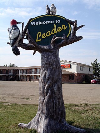
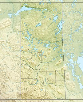
Leader is a town in southwestern Saskatchewan, Canada, located approximately 350 km (220 mi) directly east of Calgary, Alberta and is near the border between Saskatchewan and Alberta. It has a population of 863 as of 2016.
Highway 32 is a highway in southwestern Saskatchewan, connecting Leader and Swift Current. It is about 140 kilometres (87 mi) long, connecting several rural communities along the route including Abbey, Cabri, Cantaur and Success.
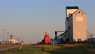
Cabri is a town in southwestern Saskatchewan directly north of Gull Lake, northwest of Swift Current and east of the Great Sand Hills. It was incorporated as a village in 1912 and as a town in 1917.

Athabasca Sand Dunes Provincial Park was created to protect the Athabasca sand dunes, a unique boreal shield ecosystem located in the far-northwest part of the Northern Saskatchewan Administration District. The Athabasca sand dunes are one of the most northerly active sand dune formations on Earth.
Carmichael is a special service area within the Rural Municipality of Carmichael No. 109, Saskatchewan, Canada that held village status prior to 2019. The population was 58 at the 2016 Census. Carmichael lies 1 km (1 mi) south of Highway 1 commonly known as the Trans Canada Highway, approximately 158 km (98 mi) east of city of Medicine Hat, Alberta.

Sceptre is a special service area in the Canadian province of Saskatchewan within the Rural Municipality of Clinworth No. 230 and Census Division No. 8. It held village status between 1913 and 2022.
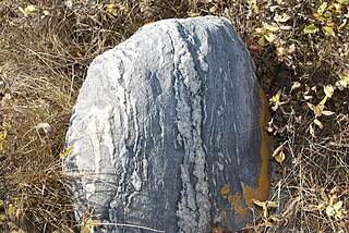
The geology of Saskatchewan can be divided into two main geological regions, the Precambrian Canadian Shield and the Phanerozoic Western Canadian Sedimentary Basin. Within the Precambrian shield exists the Athabasca sedimentary basin. Meteorite impacts have altered the natural geological formation processes. The prairies were most recently affected by glacial events in the Quaternary period.

The Great Sandhills Railway is a Canadian short line railway company that operates 198 kilometres (123 mi) of track west of Swift Current, Saskatchewan in the provinces of Saskatchewan and Alberta.

Sturgeon River is a river in the Hudson Bay drainage basin in the central part of the Canadian province of Saskatchewan. It flows from its source in the Waskesiu Hills in Prince Albert National Park to the North Saskatchewan River, just west of the city of Prince Albert.
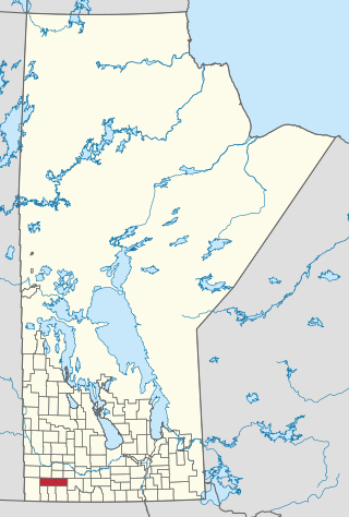
The Municipality of Grassland is a rural municipality (RM) in the Canadian province of Manitoba.
Hubert Lake Wildland Provincial Park is a wildland provincial park in central Alberta, Canada. The park was established on 4 October 2000 and has an area of 9,665.46 hectares. The park is included in the Upper Athabasca Region Land Use Framework.
Moose Mountain Upland, Moose Mountain Uplands, or commonly Moose Mountain, is a hilly plateau located in the south-east corner of the Canadian province of Saskatchewan, that covers an area of about 13,000 square kilometres (5,000 sq mi). The upland rises about 200 metres (660 ft) above the broad, flat prairie which is about 600 metres (2,000 ft) above sea level. The highest peak is "Moose Mountain" at 830 metres (2,720 ft) above sea level. The area was named Moose Mountain because of the large number of moose that lived in the area. When it was originally used by fur traders, Métis, and the Indigenous peoples, the plateau was called Montagne a la Bosse, which is French for "The Mountain of the Bump or Knob".

Good Spirit Lake is a lake on the eastern side of the Canadian province of Saskatchewan. It is a shallow lake notable for its naturally sandy beaches, parks, and sand dunes. One of Saskatchewan's six founding provincial parks, Good Spirit Lake Provincial Park, surrounds the western and southern shores of the lake. The lake is in the RM of Good Lake No. 274 and Yorkton, 48 kilometres (30 mi) to the south, is the nearest city. The hamlets of Burgis Beach and Canora Beach–the only two communities on the lake–are located on the eastern shore. The southern shore of the lake is accessed from Highway 229 and the northern shore is accessed from Highway 651. Highway 47 runs north to south west of the lake and Good Spirit Lake Provincial Park.
Good Spirit Lake Provincial Park is a provincial park on the eastern side of the Canadian province of Saskatchewan. Founded in 1931, the park surrounds the western and southern shores of Good Spirit Lake and is one of Saskatchewan's six founding provincial parks. The park is in the RM of Good Lake No. 274, about 48 kilometres (30 mi) north of the city of Yorkton. Highway 47 runs along the western boundary and Highway 229 provides access to the park's amenities.

Douglas Provincial Park is a provincial park in the Canadian province of Saskatchewan. Established in 1973, it is named after Tommy Douglas, the seventh premier of Saskatchewan and father of Canada's first single-payer, universal health care programme. The park is located along the Gordon McKenzie Arm of Lake Diefenbaker and at the Qu'Appelle River Dam, which is the source of the Qu'Appelle River. The closest community is Elbow and access to the park is from Highway 19.
Fort Assiniboine Sandhills Wildland Provincial Park is a wildland provincial park in Woodlands County, Alberta, Canada. The park is 7,903 hectares in area and was established in 1997. The park is contained in the Upper Athabasca Land Use Framework. The park is managed through the Fort Assiniboine Sandhills Wildland Provincial Park Management Plan. The Klondike Trail passes through the western section of the park for about five kilometres (3 mi). This trail was first established in 1824–1825 as a portage between Fort Edmonton on the North Saskatchewan River and Fort Assiniboine on the Athabasca River. The portage was part of the York Factory Express, a 19th-century fur brigade route of the Hudson's Bay Company from Fort Vancouver on the Columbia River to York Factory on Hudson Bay. The trail was revived again during the Klondike Gold Rush in 1897–1899 as part of the overland route to the Klondike gold fields near Dawson City, Yukon. Today, the section of the Klondike Trail within the park extends north of the Klondike Trail Staging Area and includes the ruins of a trapper's cabin and the gravesite of a child who died during trek.