
Montgomery County is the most populous county in the state of Maryland. As of the 2020 census, the county's population was 1,062,061, increasing by 9.3% from 2010. The county seat and largest municipality is Rockville, although the census-designated place of Germantown is the most populous place within the county. Montgomery County, which adjoins Washington, D.C., is part of the Washington–Arlington–Alexandria, DC–VA–MD–WV metropolitan statistical area, which in turn forms part of the Baltimore–Washington combined statistical area. Most of the county's residents live in unincorporated locales, of which the most urban are Silver Spring and Bethesda, although the incorporated cities of Rockville and Gaithersburg are also large population centers, as are many smaller but significant places.
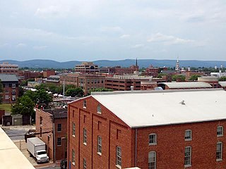
Frederick County is located in the northern part of the U.S. state of Maryland. As of the 2020 U.S. census, the population was 271,717. The county seat is Frederick.

Calvert County is located in the U.S. state of Maryland. As of the 2020 census, the population was 92,783. Its county seat is Prince Frederick. The county's name is derived from the family name of the Barons of Baltimore, the proprietors of the English Colony of Maryland Calvert County is included in the Washington–Arlington–Alexandria, DC–VA–MD–WV Metropolitan Statistical Area. It occupies the Calvert Peninsula, which is bordered on the east by Chesapeake Bay and on the west by the Patuxent River. Calvert County is part of the Southern Maryland region. The county has one of the highest median household incomes in the United States. It is one of the older counties in Maryland, after St. Mary's, Kent County and Anne Arundel counties.

Charles County is a county in Southern Maryland. As of the 2020 census, the population was 166,617. The county seat is La Plata. The county was named for Charles Calvert (1637–1715), third Baron Baltimore. Charles County is part of the Washington metropolitan area and the Southern Maryland region. With a median household income of $103,678, it is the 39th wealthiest county in the United States and the highest-income county with a Black-majority population.

Prince William County is located on the Potomac River in the U.S. state of Virginia. As of the 2020 census, the population sits at 482,204, making it Virginia's second-most populous county. Its county seat is the independent city of Manassas.

Fairfax County, officially the County of Fairfax, is a county in the Commonwealth of Virginia. It is part of Northern Virginia and borders both the city of Alexandria and Arlington County and forms part of the suburban ring of Washington, D.C. The county is predominantly suburban in character with some urban and rural pockets.

The Washington–Baltimore combined statistical area is a statistical area including two overlapping metropolitan areas, Washington, D.C. and Baltimore, Maryland. The region includes Central Maryland, Northern Virginia, three counties in the Eastern Panhandle of West Virginia, and one county in South Central Pennsylvania. It is the most educated, highest-income, and third-largest combined statistical area in the United States behind New York–Newark and Los Angeles–Long Beach.

Northern Virginia, locally referred to as NOVA or NoVA, comprises several counties and independent cities in the Commonwealth of Virginia in the United States. It is a widespread region radiating westward and southward from Washington, D.C. With 3,197,076 people according to the 2020 Census, it is the most populous region of Virginia and the Washington metropolitan area.
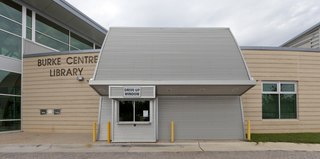
The Fairfax County Public Library (FCPL) is a public library system comprising 8 regional libraries, 14 community libraries and the Access Services Library Branch, which removes barriers to library services for people with disabilities. FCPL is headquartered in Suite 324 of The Fairfax County Government Center in unincorporated Fairfax County, Virginia, United States.
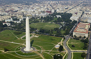
The Washington metropolitan area, also sometimes referred to as the National Capital Region, is the metropolitan area centered on Washington, D.C. The metropolitan area includes all of Washington, D.C. and parts of Maryland, Virginia, and West Virginia. It is part of the larger Washington–Baltimore combined statistical area.

Area codes 540 and 826 are telephone area codes in the North American Numbering Plan (NANP) for the north-western region of the U.S. State of Virginia, including the Shenandoah Valley, the Roanoke metropolitan area, the northern and eastern parts in Virginia of the New River Valley, and the outermost parts of the Washington metropolitan area. The Virginia State Corporation Commission authorized the addition of 826 to the numbering plan area for implementation in May 2022.

Buildings, sites, districts, and objects in Virginia listed on the National Register of Historic Places:

State Route 28 in the U.S. state of Virginia is a primary state highway that traverses the counties of Loudoun, Fairfax, Prince William, and Fauquier in the U.S. state of Virginia. The route serves as a major artery in the Northern Virginia region, with it being an important two-lane highway in rural Fauquier and Prince William Counties, the main thoroughfare through Manassas and Manassas Park, and a high-capacity freeway through Fairfax and Loudoun Counties.
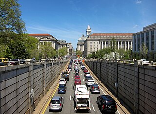
Washington, D.C. has a number of different modes of transportation available for use. Commuters have a major influence on travel patterns, with only 28% of people employed in Washington, D.C. commuting from within the city, whereas 33.5% commute from the nearby Maryland suburbs, 22.7% from Northern Virginia, and the rest from Washington, D.C.,'s outlying suburbs.

Area codes 703 and 571 are telephone area codes in the North American Numbering Plan (NANP) for Northern Virginia, including the independent cities of Alexandria, Fairfax, Falls Church, Manassas, and Manassas Park, as well as all of Arlington and Fairfax counties and parts of Fauquier, Loudoun, and Prince William counties. Area code 703 was created as one of the eighty-six original North American area codes in October 1947, and originally served the entire Commonwealth of Virginia. Area code 571 was created on March 1, 2000, to form an overlay plan with 703. The headquarters for The Chesapeake and Potomac Telephone Company of Virginia was at 703 East Grace Street, Richmond, Virginia.
The 17th Virginia Infantry Regiment was an infantry regiment raised in Virginia for service in the Confederate States Army during the American Civil War. It fought mostly with the Army of Northern Virginia.

The National Weather Service Baltimore/Washington is a local office of the National Weather Service responsible for monitoring weather conditions in 44 counties in eastern West Virginia, northern and central Virginia, the majority of the state of Maryland, as well as the city of Washington, D.C. Although labeled as the NWS Baltimore/Washington, its actual location is off Old Ox Road in the Dulles section of Sterling, Virginia, adjacent to Washington Dulles International Airport.