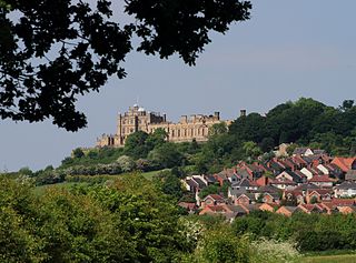
Greenwell Street

Last updated

The George & Dragon pub in Greenwell Street The George & Dragon, Greenwell Street, London.JPG
The George & Dragon pub in Greenwell Street

Greenwell Street, formerly Buckingham Street, is located in the Fitzrovia district of the City of Westminster in London. It was built in the late eighteenth century and runs between Bolsover Street in the east and Cleveland Street in the west. Great Titchfield Street joins it on its south side. On the south side is the grade II listed George and Dragon public house (c.1850) and the site of the home of the sculptor John Flaxman, the location of which is marked by a plaque.

Contents

There are also plaques to the chemist William Hyde Wollaston who worked on platinum in his laboratory there, and from the former buildings of the Royal National Orthopaedic Hospital whose outpatient assessment centre is located in a new building on the north side on the corner with Bolsover Street. The plasterer and scagliola manufacturer Vincent Bellman and his successors in trade had their business at number 14 from 1832 until 1877 where at one stage they employed 68 men and boys. The street was badly damaged by German bombing during the Second World War and has been subject to redevelopment in the post-war period so that, apart from the pub, all of its buildings are of modern construction.

Origins and location

Buckingham Street on Richard Horwood's map of 1813 Buckingham Street map.jpg
Buckingham Street on Richard Horwood's map of 1813

Greenwell Street is located in the Fitzrovia district of the City of Westminster in London. It was built in the late eighteenth century and runs between Bolsover Street in the east and Cleveland Street in the west. Great Titchfield Street joins it on its south side. It was formerly known as Buckingham Street [1] but was renamed in 1937 to remember the Greenwell family who were prominent in the Marylebone area. James Hugo Greenwell and his son Walpole Eyre Greenwell both served as vestry clerks in the nineteenth century. [2] The street forms the northern edge of what is known as the "Carburton Street triangle" but which is actually a trapezoid with Carburton Street along the base. [1]

19th Century

London County Council bomb damage map of the Greenwell Street area (darker colours indicate more severe damage) Greenwell Street bomb damage map.jpg
London County Council bomb damage map of the Greenwell Street area (darker colours indicate more severe damage)
The new Royal National Orthopaedic Hospital Trust building in Bolsover and Greenwell streets with plaque Royal National Orthopaedic Hospital, Bolsover Street (2).jpg
The new Royal National Orthopaedic Hospital Trust building in Bolsover and Greenwell streets with plaque
Greenwell Street area map, 2022 Greenwell Street area map.png
Greenwell Street area map, 2022

A number of artisans and others operated from yards and gardens behind street frontages as was common in the area. [4]

The sculptor John Flaxman lived at number 7 with his wife Ann from 1795 until his death in 1826. Maria (Mary Ann) Flaxman joined them by 1807. John Flaxman had his studio at the house and his assistants would create his sculptures in the yard at the back using scale models that he made. After his death, his assistant and brother-in-law Thomas Denman carried on the business from the same address until around 1840. A Society of Arts plaque was installed around 1870. When the local authority wished to demolish the house and its neighbours in the 1970s, the Flaxman connection was used by opponents to the council's scheme. When the house was eventually demolished, the plaque was moved to the replacement buildings. [1]

The chemist and physiologist William Hyde Wollaston also found his back garden useful when he lived at number 14 from 1801, building a laboratory there in which he invented a method of rendering platinum metal malleable, which was said to have earned him £30,000. [5]

Vincent Bellman (c.1796–1860), plasterer and scagliola manufacturer, had his business at number 14 from 1832 until the year of his death, after which the business was continued by John Ivey (1794–1874) as Bellman & Ivey in the same location until 1877 when it moved to Edward Street, near Dorset Square. In 1861, the firm in "Buckingham Street Yard" employed 57 men and 11 boys. [1] [6]

The George and Dragon public house was built around 1850 on the south side on the corner with Cleveland Street. It is grade II listed with Historic England and is the only original building left in the street. It is in the Italianate style, stuccoed, with a pilastered front. [7]

In 1852, a school was created to the south of Greenwell Street for boys of the parish of Holy Trinity in Marylebone Road. Flaxman's former house at number 7 was bought by the rector of Holy Trinity and the school accessed through a passageway on the north side of Greenwell Street alongside the house. The school later expanded to include girls and infants but closed in 1914 after which it became a parish clubhouse and, after the church closed in 1958, was renamed All Souls' Clubhouse. [1]

20th Century

In 1908, an Out-Patients Department and Nurses' Home was built on the corner of Bolsover and Greenwell streets for the Royal National Orthopaedic Hospital. The companion in-patient building was under simultaneous construction on the western side of Bolsover street. [8]

Greenwell Street was hit by German bombing during the Second World War with the majority of the buildings shown as damaged beyond repair or seriously damaged on the London County Council bomb damage maps. The pub was undamaged. [3]

Modern buildings

Apart from the George and Dragon, all the buildings in the street are modern, being made up on the northern side of Fitzrovia House on the corner with Cleveland House, the flats known as Whitson Court, and on the corner with Bolsover Street the new Royal National Orthopaedic Hospital Trust Outpatient Assessment Centre which opened in 2009. [8] This last features, on the Greenwell side, relief sculptures of a boy holding a cricket bat and a girl with flowers which were salvaged from above the main entrance in Bolsover Street when the original hospital was demolished in 2007-08. [8] [9]

On the south side are the new houses built between the pub and Great Titchfield Street that controversially replaced the former home of the Flaxmans, [1] and on the western end between Great Titchfield and Bolsover Street is the rear of the Holiday Inn London – Regent's Park hotel (originally the Regent Crest Hotel built in 1972 [10] ) in Carburton Street. [11]

Notable former residents

Former residents include: [1]

Related Research Articles

<span class="mw-page-title-main">Fitzrovia</span> Human settlement in England

Fitzrovia is a district of central London, England, near the West End. The eastern part of area is in the London Borough of Camden, and the western in the City of Westminster. It has its roots in the Manor of Tottenham Court, and was urbanised in the 18th century. Its name was coined in the late 1930s by Tom Driberg.

<span class="mw-page-title-main">Great Portland Street</span>

Great Portland Street in Marylebone, in the West End of London, links Oxford Street with the A501 Marylebone Road. The street, which is part of a broader rectilinear street pattern, includes the Embassy of the Democratic Republic of the Congo. and a number of small independent shops.

<span class="mw-page-title-main">Fitzroy Square</span> Georgian square in London, England

Fitzroy Square is a Georgian square in London. It is the only one in the central London area known as Fitzrovia. The square is one of the area's main features, this once led to the surrounding district to be known as Fitzroy Square or Fitzroy Town and latterly as Fitzrovia, though the nearby Fitzroy Tavern is thought to have had as much influence on the name as Fitzroy Square.

<span class="mw-page-title-main">Royal National Orthopaedic Hospital</span> Hospital in London Borough of Harrow, United Kingdom

The Royal National Orthopaedic Hospital (RNOH) is a specialist orthopaedic hospital located in the London Borough of Harrow, United Kingdom, and a part of Royal National Orthopaedic Hospital NHS Trust. It provides the most comprehensive range of neuro-musculoskeletal health care in the UK, including acute spinal injury, complex bone tumour treatment, orthopaedic medicine and specialist rehabilitation for chronic back pain. The RNOH is a major teaching centre and around 20% of orthopaedic surgeons in the UK receive training there.

<span class="mw-page-title-main">Albany Street</span>

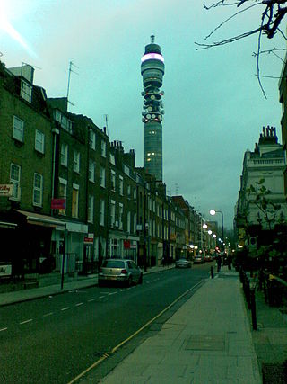
Albany Street is a road in London running from Marylebone Road to Gloucester Gate following the east side of Regent's Park. It is about three-quarters of a mile in length.

<span class="mw-page-title-main">Great Titchfield Street</span>

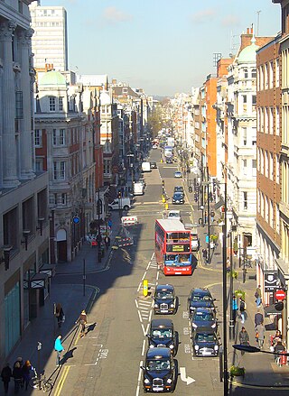
Great Titchfield Street is a street in the West End of London. It runs north from Oxford Street to Greenwell Street, just short of the busy A501 Marylebone Road and Euston Road. It lies within the informally designated London area of Fitzrovia. In administrative terms it is in the City of Westminster. It lies within their designated East Marylebone Conservation Area in the former Metropolitan Borough of St Marylebone.

<span class="mw-page-title-main">Charlotte Street</span>

Charlotte Street is a street in Fitzrovia, historically part of the parish and borough of St Pancras, in central London. It has been described, together with its northern and southern extensions, as the spine of Fitzrovia.

<span class="mw-page-title-main">Marylebone</span> Area in London, England

Marylebone is a district in the West End of London, in the City of Westminster. Oxford Street, Europe's busiest shopping street, forms its southern boundary.

<span class="mw-page-title-main">Bolsover Street</span> Street in City of Westminster, United Kingdom

Bolsover Street is in the Parish of St Marylebone in London’s West End. In administrative terms it lies within the City of Westminster's Marylebone High Street Ward and is partly in the Harley Street Conservation Area whilst also sitting on the edges of the Regents Park and East Marylebone Conservation Areas.

<span class="mw-page-title-main">Cleveland Street, London</span>

Cleveland Street in central London runs north to south from Euston Road (A501) to the junction of Mortimer Street and Goodge Street. It lies within Fitzrovia, in the W1 post code area. Cleveland Street also runs along part of the border between Bloomsbury (ward) which is located in London Borough of Camden, and West End (ward) and Marylebone High Street (ward) in the City of Westminster. In the 17th century, the way was known as the Green Lane, when the area was still rural, or Wrastling Lane, after a nearby amphitheatre for boxing and wrestling.

<span class="mw-page-title-main">Cleveland Street Workhouse</span> Workhouse in London, England

The Cleveland Street Workhouse is a Georgian property in Cleveland Street, Marylebone, built between 1775 and 1778 for the care of the sick and poor of the parish of St Paul Covent Garden under the Old Poor Law. From 1836, it became the workhouse of the Strand Union of parishes. The building remained in operation until 2005 after witnessing the complex evolution of the healthcare system in England. After functioning as a workhouse, the building became a workhouse infirmary before being acquired by the Middlesex Hospital and finally falling under the NHS. In the last century it was known as the Middlesex Hospital Annexe and the Outpatient Department. It closed to the public in 2005 and it has since been vacated. On 14 March 2011 the entire building became Grade II Listed. Development of the site began in 2019 by current owner University College London Hospitals (UCLH) Charity as a mixed-use development including residential, commercial and open space, but construction has been held up by the necessity to remove human remains stemming from the use of the area around the workhouse as a parish burial ground between 1780 and 1853. There has also been controversy about the amount of social housing to be included in the development.

<span class="mw-page-title-main">Berners Street</span>

Berners Street is a thoroughfare located to the north of Oxford Street in the City of Westminster in the West End of London, originally developed as a residential street in the mid-18th century by property developer William Berners, and later devoted to larger commercial and semi-industrial buildings or mansion blocks of flats. It has associations with Charles Dickens, and was the location of makers of musical instruments including pianos and harps, as well as furniture and film-makers.

<span class="mw-page-title-main">Chenies Street</span> Street in Bloomsbury, London

Chenies Street is a street in Bloomsbury, London, that runs between Tottenham Court Road and Gower Street. It is the location of a number of notable buildings such as Minerva House, the Drill Hall, and a memorial to The Rangers, 12th County of London Regiment. North Crescent starts and ends on the northern side of Chenies Street.

<span class="mw-page-title-main">Riding House Street</span>

Riding House Street is a street in central London in the City of Westminster.

<span class="mw-page-title-main">Weymouth Street</span> Street in the City of Westminster, London, England

Weymouth Street lies in the Marylebone district of the City of Westminster and connects Marylebone High Street with Great Portland Street. The area was developed in the late 18th century by Henrietta Cavendish Holles and her husband Edward Harley, 2nd Earl of Oxford. This part of Marylebone originally belonged to the Manor of Tyburn which existed at the time of the Domesday Book (1086).

This is a list of the etymology of street names in the London district of Fitzrovia. The following utilises the generally accepted boundaries of Fitzrovia viz. Euston Road to the north, Tottenham Court Road to the east, Oxford Street to the south and Great Portland Street to the west.

<span class="mw-page-title-main">Yorkshire Grey, Fitzrovia</span>

The Yorkshire Grey is a public house on the corner of Langham Street and Middleton Place in Fitzrovia/East Marylebone, City of Westminster, London W1.

<span class="mw-page-title-main">Langham Estate</span> Property company of the United Kingdom

The Langham Estate is a property estate in Fitzrovia, London, and is owned by the Mount Eden Land Limited (Guernsey). The company controls 14 acres of real estate in central London.

<span class="mw-page-title-main">Margaret Street, London</span> Street in the City of Westminster, London

Margaret Street is a street that straddles the Marylebone and Fitzrovia areas of the City of Westminster in the West End of London, running from Cavendish Square to Wells Street via Regent Street (A4201), Great Portland Street, and Great Titchfield Street. It is north of and parallel to the major shopping street, Oxford Street. John Prince's Street runs between Margaret Street and Oxford Street.

References

  1. 1 2 3 4 5 6 7 "Chapter 24: Bolsover Street to Cleveland Street" Archived 16 November 2021 at the Wayback Machine in South-East Marylebone, Survey of London Vols. 51 & 52, London, 2017.
  2. "Greenwell Street" in Gillian Bebbington (1972) London Street Names. London: B.T. Batsford. pp. 154–155. ISBN 0713401400.
  3. 1 2 Ward, Laurence. (2015) The London County Council Bomb Damage Maps 1939–1945. London: Thames & Hudson. p. 79. ISBN 9780500518250
  4. "Introduction" Archived 8 November 2020 at the Wayback Machine in South-East Marylebone, Survey of London Vols. 51 & 52, London, 2017.
  5. Griffith, W. P. (1 October 2003). "Bicentenary of Four Platinum Group Metals". Platinum Metals Review. 47 (4): 175–183. Archived from the original on 10 March 2022. Retrieved 10 March 2022.
  6. British bronze sculpture founders and plaster figure makers, 1800–1980 – B. Archived 11 March 2022 at the Wayback Machine National Portrait Gallery. Retrieved 11 March 2022.
  7. Historic England. "George and Dragon Public House (1219538)". National Heritage List for England . Retrieved 9 March 2022.
  8. 1 2 3 Royal National Orthopaedic Hospital 45-51 Bolsover Street, W1P 8AQ. Lost Hospitals of London. Retrieved 18 March 2022.
  9. History of the RNOH. Archived 4 March 2016 at the Wayback Machine Royal National Orthopaedic Hospital Trust. Retrieved 16 September 2015.
  10. Pevsner, Nikolaus & Bridget Cherry (2002). The Buildings of England: London 3: North West. New Haven & London: Yale University Press. p. 634. ISBN   0300096526. Archived from the original on 10 March 2022. Retrieved 10 March 2022.
  11. Holiday Inn London - Regent's Park. Archived 21 November 2021 at the Wayback Machine Holiday Inn. Retrieved 10 March 2022.
51°31′22.7″N0°8′33.2″W / 51.522972°N 0.142556°W / 51.522972; -0.142556