Grenville County, Ontario

Last updated
Merrickville, Rideau River c.1838 Merrickville, Rideau River.jpg
Merrickville, Rideau River c.1838

Grenville County is a former county in the Canadian province of Ontario. It fronted on the north shore of the Saint Lawrence River, between the towns of Kingston and Cornwall. The county was created in 1792, and named in honour of William Grenville, 1st Baron Grenville, who was the British Secretary of State responsible for the colonies in 1790. [1] It consisted of five townships, which were settled primarily by United Empire Loyalists in the late 1700s after the Revolutionary War. Prior to being settled by Europeans, the area was home to many generations of native cultures. [2] Grenville County merged with Leeds County in 1850 to create Leeds and Grenville County. [2] The county covered an area of 272,261 acres (110,180 ha).

Contents

History

Prior to European settlement, numerous Native American villages were present in Grenville County; when the settlers first arrived, these natives still occupied the area and were essentially forced out by the settlements. [3] The French briefly occupied this area at present-day Johnstown, in what was to become Edwardsburgh township, and at Pointe au Baril (present day Maitland) in what would be Augusta township. These French settlements date back to 1670 and 1759 respectively. [2]

In the late 1700s while the region was part of the British Lununberg District in the Province of Quebec, land was surveyed in and around what would later become Grenville County to be distributed as land grants to the United Empire Loyalists and their families for their loyalty to the Crown. The emphasis of the Crown government was on military defense, economic growth and political stability. The strategy was to increase the population, maintain efficient military districts, and develop political counties and townships to be dotted with agricultural hamlets and towns and commercially-oriented cities. There was not emphasis on industrial development because of lack of basic infrastructure in the region. The first townships laid out were called the Royal Townships. Situated along the St. Lawrence River where land was most productive and travel was convenient, two of these townships were to become part of Grenville County – Edwardsburgh, Royal Township Six, and Augusta, Royal Township Seven. In 1791 the Province of Upper Canada was created from part of the Province of Quebec. The Upper Canada partition of Lunenberg District was renamed Eastern District in 1792; Grenville County was one of the counties created in 1792. Shortly after the Loyalist refugee arrivals, Irish and Scottish immigrants began to settle in the area as well.

The European settlers dotted the new townships with small agricultural communities which were mostly self-sustaining. These communities were established out of necessity, as roads in the area were not well-established during nineteenth century and people were travelling on foot or via horse and buggy. [3] Every few kilometres, a village or hamlet was usually present; these villages usually each had their own churches, schools, cemeteries and temperance halls, as well as pioneer businesses such as cheese factories, saw and grist mills, blacksmiths, limekilns, post offices, general stores or asheries. [3] Most residents made their living through small-scale mixed farming operations. [3] But there was an ennui; the Durham Report led to merging the Colony of Upper Canada on 10 February 1841 as Canada West into the (United) Province of Canada, thus assuring lower cost funding for long term improvements in Canada West and more dynamic prospects in British North America.

One reason counties existed was so inhabitants could conduct legal transactions efficiently, as each county was the seat of a county court. As transportation improved within some counties, their political consolidation with neighboring counties could occur leading to better integration and centralization efficiencies. On 1 January 1850, Grenville county was amalgamated with the neighbouring county of Leeds, to become the United Counties of Leeds and Grenville, [2] while Johnstown District was abolished. Prior to confederation, the area of Upper Canada was divided by districts, which held the counties, which held the townships; districts changed often in name and in area making records from this era appear confusing. [2] During the mid-1800s within Canada West, counties began amalgamating as transportation improved and the districts were dropped as counties increased in population. At the founding of the Dominion of Canada on 1 July 1867, Grenville County, amalgamated with Leeds, became part of Ontario, with Ontario now being divided neatly by counties. [2]

Territorial evolution

The original county was constituted in 1792, and was an electoral district for the new Legislative Assembly of Upper Canada:

... which county is to bounded on the east by the westernmost line of the county of Dundas, on the south by the river St. Lawrence, and on the west by the easternmost boundary line of the late township of Elizabethtown, running north twenty-four degrees west until it intersects the Ottawa or Grand river, thence descending the said river until it meets the northwesternmost boundary of the county of Dundas. The said county of Grenvill is to comprehend all the islands in the said river St. Lawrence nearest the said county, in the whole or greater part fronting the same. [4]

In 1798, the Parliament of Upper Canada withdrew parts of Grenville and Leeds to form Carleton County and the three counties together were constituted as Johnstown District, effective at the beginning of 1800. Grenville consisted of the following townships: [5]

Organization of Grenville County (1800) [6]

The townships of

In 1838, the townships of Marlborough and North Gower were transferred to Carleton County, and the township of Montague was transferred to Lanark County. [7]

When the Johnstown District was abolished in 1850, Grenville County was united with Leeds County to form the United Counties of Leeds and Grenville. [8]

Original townships

Battle of the Windmill in New Wexford, Edwardsburgh, 1838 Battle of the Windmill.jpg
Battle of the Windmill in New Wexford, Edwardsburgh, 1838

The five remaining townships at 1838 were Augusta, Edwardsburgh, Oxford-on-Rideau, South Gower, and Wolford.

See also

Related Research Articles

<span class="mw-page-title-main">Prescott, Ontario</span> Town in Ontario, Canada

Prescott is a town on the north shore of the Saint Lawrence River in province of Ontario, Canada. The town is a part of the United Counties of Leeds and Grenville. In 2021, it had a population of 4,078. The Ogdensburg–Prescott International Bridge, 5 kilometres (3.1 mi) east of Prescott at Johnstown, crosses the Canada–United States border and connects the town with the city of Ogdensburg, New York.

<span class="mw-page-title-main">United Counties of Leeds and Grenville</span> County in Ontario, Canada

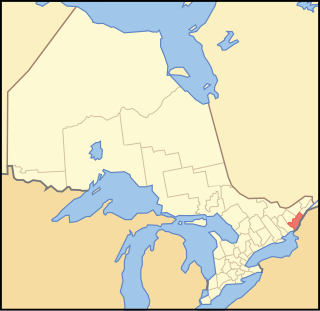
The United Counties of Leeds and Grenville, commonly known as Leeds and Grenville, is a county in Ontario, Canada, in the Eastern Ontario subregion of Southern Ontario. It fronts on the Saint Lawrence River and the international boundary between Canada and the United States, opposite of the State of New York. The county seat is Brockville. The county was formed by the union of the historical counties of Leeds and Grenville in 1850.

<span class="mw-page-title-main">North Grenville</span> Municipality in Ontario, Canada

North Grenville is a township in eastern Ontario, Canada, in the United Counties of Leeds and Grenville on the Rideau River. It is located just south of Ottawa in Canada's National Capital Region.

Area codes 613, 343, and 753 are telephone area codes in the North American Numbering Plan (NANP) for Ottawa and surrounding Eastern Ontario, Canada. Area code 613 is one of the 86 original North American area codes assigned in October 1947. Area code 343 was assigned to the numbering plan area in an overlay plan activated on May 17, 2010. Area code 753 was assigned as an additional overlay code for the numbering plan area, activated on March 26, 2022.

Leeds County is a historic county in the Canadian province of Ontario. The county was first surveyed in 1792 as one of the nineteen counties created by Sir John Graves Simcoe in preparation for the United Empire Loyalists to settle here. The county took its name from Francis Osborne, 5th Duke of Leeds; the "Leeds" of the Dukedom referred to Leeds in West Yorkshire, England and not for Leeds, Kent, England. In 1850, Leeds County merged with Grenville County to create the United Counties of Leeds and Grenville. This county was home to several townships as well as the city of Brockville.

<span class="mw-page-title-main">Kemptville</span> Unincorporated community in Ontario, Canada

Kemptville is a community located in the Municipality of North Grenville in Eastern Ontario, Canada in the northernmost part of the United Counties of Leeds and Grenville. It is located approximately 56 km (35 mi) south of the downtown core of Ottawa and 2.5 to 3 km south of the Rideau River.

Leeds North and Grenville North was a federal electoral district represented in the House of Commons of Canada from 1867 to 1904. It was located in the province of Ontario. It was created by the British North America Act of 1867 which allocated one member to the combined riding of the North Riding of Leeds and the North Riding of Grenville.

<span class="mw-page-title-main">Edwardsburgh/Cardinal</span> Township in Ontario, Canada

Edwardsburgh/Cardinal is a township in the United Counties of Leeds and Grenville of eastern Ontario, Canada. Edwardsburgh township was first surveyed in 1783, and incorporated in 1850. The township was part of the historical Grenville County before it merged with Leeds County to form the United Counties in the 19th century.

<span class="mw-page-title-main">Augusta, Ontario</span> Township in Ontario, Canada

Augusta Township is a township in the United Counties of Leeds and Grenville, located in eastern Ontario, Canada. Augusta is situated along the Saint Lawrence River, and extends back into rural hamlets. The township is located between the city of Brockville to the west, and the town of Prescott to the east.

<span class="mw-page-title-main">North Gower Township</span>

North Gower Township is a former and now geographic township in eastern Ontario, Canada, now located in Ottawa. It contains the communities of Manotick and North Gower.

<span class="mw-page-title-main">Johnstown, Ontario</span> Compact rural community in Ontario, Canada

Johnstown is a compact rural community in the United Counties of Leeds and Grenville, in eastern Ontario, Canada, part of the township municipality of Edwardsburgh/Cardinal. It is at the Canadian terminus of the Ogdensburg–Prescott International Bridge and at the southern termini of Highway 416 and Highway 16.

A police village was a form of municipal government that was used in the province of Ontario, Canada in the early 19th century if the finances or the population of an area did not permit the creation of a village.

<span class="mw-page-title-main">Johnstown District, Upper Canada</span>

The Johnstown District was a historic district in Upper Canada which existed until 1849.

King's Highway 16, commonly referred to as Highway 16 and historically as the Prescott Highway, is a provincially maintained highway in the Canadian province of Ontario. The highway once travelled from near Prescott to Ottawa, traversing the distance between the St. Lawrence River and the Ottawa River. However, its length was truncated significantly when most of the route was twinned with a second roadway, and renumbered as Highway 416. A short stub remains through Johnstown, providing access to the Ogdensburg–Prescott International Bridge across the St. Lawrence River to Ogdensburg, New York, where New York State Route 812 continues south.

<span class="mw-page-title-main">Kemptville Creek</span> River in Ontario, Canada

Kemptville Creek is a stream in the municipalities of North Grenville and Augusta, in the United Counties of Leeds and Grenville, in Eastern Ontario, Canada. It is in the Ottawa River drainage basin, is a right tributary of the Rideau River, and is under the auspices of the Rideau Valley Conservation Authority.

<span class="mw-page-title-main">Merrickville–Wolford</span> Village in Ontario, Canada

Merrickville–Wolford is a village-status municipality in Eastern Ontario, Canada, located in the United Counties of Leeds and Grenville. It spans both shores of the Rideau River.

Elections were held in Leeds and Grenville United Counties, Ontario on October 27, 2014 in conjunction with municipal elections across the province.

Elections were held in Leeds and Grenville United Counties, Ontario on October 22, 2018 in conjunction with municipal elections across the province.

Grenville was an electoral district of the Legislative Assembly of the Parliament of the Province of Canada, in Canada West. Based on Grenville County, it was located on the north shore of the Saint Lawrence River, east of Lake Ontario. It was created in 1841, upon the establishment of the Province of Canada by the union of Upper Canada and Lower Canada. Grenville was represented by one member in the Legislative Assembly. It was later split into two ridings, in a redistribution.

Elections were held in Leeds and Grenville United Counties, Ontario on October 24, 2022, in conjunction with municipal elections across the province.

References

  1. "Leeds & Grenville GenWeb, Ontario". rootsweb.ancestry.com. Retrieved 2019-08-10.
  2. 1 2 3 4 5 6 7 8 9 10 11 "History". grenvillecountyarchives.ca. Retrieved 2019-08-10.
  3. 1 2 3 4 Goldie A. Connell (1985) Augusta: Royal Township Number Seven. St. Lawrence Printing Co. ltd.
  4. Proclamation of July 16, 1792
  5. An act for the better division of this province , S.U.C. 1798, c. 5, s. 7-10
  6. 1798 Act, s. 7
  7. An Act to erect certain townships now forming parts of the Districts of Bathurst, Johnstown and Ottawa, into a separate District, to be called the District of Dalhousie, and for other purposes therein mentioned , S.U.C. 1838, c. 25, s. 1, 22
  8. An Act for abolishing the Territorial Division of Upper-Canada into Districts, and for providing for temporary Unions of Counties for Judicial and other purposes, and for the future dissolutions of such Unions, as the increase of wealth and population may require , S.C. 12 Vic., c. 78, Sch. A, B

44°50′N75°40′W / 44.833°N 75.667°W / 44.833; -75.667