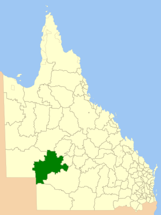
The Grey Range is a low-lying range of hills located in the Australian states of Queensland and New South Wales. The range extends from the west of Blackall of Central West Queensland in the north to Tibooburra in the far west of New South Wales in the south. [1]
The range's highest point, Mount Arrowsmith, reaches 2,000 ft (610 m) above sea level. [2]
The Yapunyah waterhole is a notable feature of the range.
Yaraka is located near the range.
Kuungkari (also known as Kungkari and Koonkerri) is a language of Western Queensland. The Kuungkari language region includes the landscape within the local government boundaries of Longreach Shire Council and Blackall-Tambo Shire Council. [3]

Blackall is a rural town and locality in the Blackall-Tambo Region, Queensland, Australia. In the 2016 census the locality of Blackall had a population of 1,416 people.

Isisford is a rural town and locality in the Longreach Region, Queensland, Australia. In the 2016 census, the locality of Isisford had a population of 218 people.

Thargomindah is a rural town and locality in the Shire of Bulloo, Queensland, Australia. The town of Thargomindah is the administrative centre for the Shire of Bulloo. In the 2016 census, Thargomindah had a population of 270 people. It was founded on Wongkumara and Kalali territory.

The Warrego River is an intermittent river that is part of the Darling catchment within the Murray–Darling basin, which is located in South West Queensland and in the Orana region of New South Wales, Australia. The Warrego River is the northernmost tributary of the Darling River.

The Thomson River is a perennial river that forms part of the Lake Eyre Basin, situated in the central west and western regions of Queensland, Australia. Much of the course of the river comprises a series of narrow channels synonymous with the Channel Country and the Galilee subregion.

The Shire of Paroo is a local government area in South West Queensland, Australia. The administrative centre is the town of Cunnamulla. The Paroo Shire covers an area of 47,623 square kilometres (18,387 sq mi). In the 2021 census, the Shire had a population of 1,679.

Landsborough is a town and a locality in the Sunshine Coast Region, Queensland, Australia. At the 2021 census, Landsborough had a population of 4,446 people.

Richmond is a rural town and locality in the Shire of Richmond, Queensland, Australia. In the 2016 census, the locality of Richmond had a population of 648 people.

The Shire of Murweh is a local government area in the Maranoa district, which is part of South West Queensland, Australia. The administrative centre and largest town in the shire is Charleville. In June 2018, the Shire of Murweh had a population of 4,318.

The Shire of Barcoo is a local government area in Central West Queensland, Australia. In June 2018, the shire had a population of 267 people.

The Shire of Tambo was a local government area located in central Queensland south-east of the town of Blackall. It covered an area of 14,083.8 square kilometres (5,437.8 sq mi), and existed as a local government entity from 1881 until 2008, when it amalgamated with neighbouring Shire of Blackall to form the Blackall-Tambo Region.

The Shire of Blackall was a local government area located in central Queensland around the town of Blackall. It covered an area of 16,366.8 square kilometres (6,319.3 sq mi), and existed as a local government entity from 1879 until 2008, when it amalgamated with neighbouring Shire of Tambo to form the Blackall-Tambo Region.
Eudlo is a rural town and locality in the Sunshine Coast Region, Queensland, Australia. In the 2016 census, the locality of Eudlo had a population of 1,117 people.

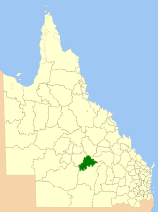
The Barcaldine Region is a local government area in Central West Queensland, Australia. Established in 2008, it was preceded by three previous local government areas which had existed for over a century.

The Blackall-Tambo Region is a local government area in Central West Queensland, Australia. Established in 2008, it was preceded by two previous local government areas dating from the 1870s.

Jundah is a rural town and locality in the Shire of Barcoo, Queensland, Australia. Jundah is the administrative centre of the Barcoo Shire local government area. In the 2016 census, the locality of Jundah had a population of 106 people.

The Blackall Range is a mountain range in South East Queensland, Australia. The first European explorer in the area was Ludwig Leichhardt. It was named after Samuel Blackall, the second Governor of Queensland.

Western Queensland encompasses the three western regions in the Australian state of Queensland:
Kungkari is an extinct and unclassified Australian Aboriginal language. The Kungkari language region included the landscape within the local government boundaries of the Longreach Shire Council and Blackall-Tambo Shire Council.
The Kuungkari are an indigenous Australian people of Queensland. They are to be distinguished from the Kunggari.
Grey Range – Queensland by Degrees. Royal Geographical Society of Queensland. Retrieved 4 March 2013.