Grindstone Island

Last updated
Grindstone Island
USA New York location map.svg
Red pog.svg
Grindstone Island
Location of Grindstone Island
in New York State
Geography
Location St. Lawrence River
Coordinates 44°16′37″N76°06′53″W / 44.2769°N 76.1147°W / 44.2769; -76.1147
Length5 mi (8 km)
Width3 mi (5 km)
Highest elevation285 ft (86.9 m) [1]
Administration
State New York
County Jefferson
Town Clayton

Grindstone Island is the fourth largest of the Thousand Islands in the St. Lawrence River and the second largest of the American islands in the St. Lawrence. The island lies near Lake Ontario and is part of the United States. In particular, the island is part of the Town of Clayton in Jefferson County, New York.

Contents

The island contains Potters Beach, a private vineyard, summer gift shops, four active beef farms, historic but now abandoned farmlands, and private non-government conservation lands owned by the Thousand Island Land Trust (TILT). New York State's last operating one-room school was on the island and closed in 1989. The current number of year-round households on the island is ten, however the population climbs to 700 people during the summer months.

History

The first known settlement occurred in 1804. The island was once considered to be part of Canada but, since 1823, has been recognized as part of the United States. Shortly afterwards a dispute over some harvested trees created a brief disturbance called "The Grindstone Island War" in which American militia attempted to prevent the removal of the logs. In 1831 the entire island was purchased by Eliza Evertson, the widow of Nicholas Evertson and the grandmother of Edgar Saltus, for $15,000. The Evertson family owned the island for over 40 years. [2]

In the early 1900s the island acquired enough of a population to have two school buildings built, a lower school house (which is now a private home) by the cross-island bridge and an upper school house, which is now the Grindstone Island Research and Heritage Center which gives out scholarships once a year. The island also has a Methodist church founded in 1899 (with services on Sundays) with a Community Center (Dodge Hall) across the street (with dances on Saturday nights in the summer) and a no longer functioning Creamery and Cheese Factory. The island also has one of the few natural beaches in the Thousand Island region open to the public, Potter's Beach.

Lumber and granite quarries were important in the early economy. The island is a self-sustaining environment that operates on an honor system;[ citation needed ] however, infrastructure such as electricity is provided by National Grid US. There are no bridges onto Grindstone (save when the river freezes), or formal ferry services onto Grindstone Island. [3] There is a community dock (the town dock in Aunt Jane's Bay) provided for visitors on Aunt Jane's Bay - some inlanders who live inland on the island park their vehicles along the road. There is a normal US postal service delivery route onto the island Monday through Saturday.

The island also recently received street signs marking the island's few official unpaved roads. The people who live on this island are known to locals as "Islanders".

The Grindstone Island Upper Schoolhouse was added to the National Register of Historic Places in 2012. [4]

Geography

Grindstone Island is the fourth largest of the islands in the Thousand Islands region, measuring about 5 miles (8.0 km) long and 3 miles (4.8 km) wide at its widest point. The northern part of the island is near the Canada–United States border. The island is in the western part of the St. Lawrence river valley, and is located between Wellesley Island (New York, United States) and Wolfe Island (Ontario, Canada), about 1.27 miles (2.04 km) from Clayton on the New York mainland.

Thousand Island Land Trust holdings

Thirty-nine percent of the island is currently owned by the Thousand Island Land Trust (TILT). Their 885 acres (358 ha) of private conservation lands are currently spread over different parts of the island. TILT currently owns Potter's Beach (20 acres [8.1 ha] - the largest naturally occurring sand beach on the American side of the Thousand Islands), Potter's Forest Preserve (200 acres [81 ha]), Mid River Farm Preserve (165 acres [67 ha]), Douglas Howard-Smith Preserve (130 acres [53 ha]), Rusho Farm Preserve (140 acres [57 ha]), Delaney Farm Preserve (80 acres [32 ha]), Heineman Forest Preserve (100 acres [40 ha]) and Grindstone Nature Trail (50 acres [20 ha]). TILT acts as a steward of another 900 acres (360 ha) of wetlands, forest and grasslands on privately held property through conservation easements.

Communities and locations on Grindstone Island

Related Research Articles

<span class="mw-page-title-main">Inlet, New York</span> Town in New York, United States

Inlet is a town in Hamilton County, New York, United States. The population was 333 at the 2010 census. The name is derived from its location at the eastern end (inlet) of Fourth Lake, part of the Fulton Chain of Lakes.

Henderson is a town in Jefferson County, New York, United States. The population was 1,360 at the 2010 census. The town is named after William Henderson, the original European-American land owner.

<span class="mw-page-title-main">Miller Place, New York</span> Hamlet and census-designated place in New York, United States

Miller Place is a hamlet and census-designated place (CDP) in the Town of Brookhaven, Suffolk County, New York, United States, on the North Shore of Long Island. Miller Place has been inhabited since the 17th century and is named for the Miller family that included many of its initial settlers. For most of its history, the community functioned as an agriculture-based society. Despite preserving much of its historic identity, changes in the 20th century have transitioned the hamlet into a desirable and densely populated suburban area. The population was 11,723 at the 2020 census.

<span class="mw-page-title-main">Little Compton, Rhode Island</span> Town in Rhode Island, United States

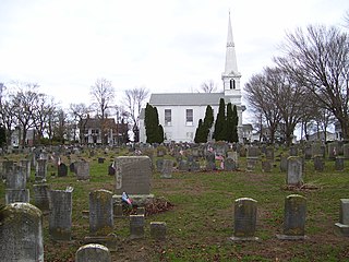
Little Compton is a coastal town in Newport County, Rhode Island, bounded on the south by the Atlantic Ocean, on the west by the Sakonnet River, on the north by the town of Tiverton, and on the east by the town of Westport, Massachusetts. The population was 3,589 as of 2022 Town Records.

<span class="mw-page-title-main">Thousand Islands</span> Archipelago in the Saint Lawrence River

The Thousand Islands constitute a North American archipelago of 1,864 islands that straddles the Canada–US border in the Saint Lawrence River as it emerges from the northeast corner of Lake Ontario. They stretch for about 50 miles (80 km) downstream from Kingston, Ontario. The Canadian islands are in the province of Ontario and the U.S. islands in the state of New York.

<span class="mw-page-title-main">Lake Winnipesaukee</span> Lake in New Hampshire, U.S.

Lake Winnipesaukee is the largest lake in the U.S. state of New Hampshire, located in the Lakes Region at the foothills of the White Mountains. It is approximately 21 miles (34 km) long (northwest-southeast) and from 1 to 9 miles wide (northeast-southwest), covering 69 square miles (179 km2)—71 square miles (184 km2) when Paugus Bay is included—with a maximum depth of 180 feet (55 m). The center area of the lake is called The Broads.

<span class="mw-page-title-main">Clayton, New York</span> Town in New York, United States

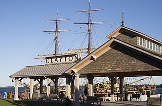
Clayton is a town in Jefferson County, New York, United States. The population was 5,153 at the 2010 census. The town is named after John M. Clayton, a federal political leader from Delaware.

<span class="mw-page-title-main">Southold, New York</span> Town in New York, United States

The Town of Southold is one of ten towns in Suffolk County, New York, United States. It is located in the northeastern tip of the county, on the North Fork of Long Island. The population was 23,732 at the 2020 census. The town also contains a hamlet named Southold, which was settled in 1640.

<span class="mw-page-title-main">Brookhaven, New York</span> 2nd most populated town in New York, United States

Brookhaven, formally the Town of Brookhaven, is a large suburban town in Suffolk County, Long Island, New York. With a population of 488,497 as of 2022, it is the second most populous town in the United States and in New York and the third most populous community in the state.

<span class="mw-page-title-main">Gateway National Recreation Area</span> National Park Service unit in New York and New Jersey, United States

Gateway National Recreation Area is a 26,607-acre (10,767 ha) U.S. National Recreation Area in New York City and Monmouth County, New Jersey. It provides recreational opportunities that are not commonly found in a dense urban environment, including ocean swimming, bird watching, boating, hiking and camping. More than 8.7 million people visited Gateway National Recreation Area in 2022, making it the fourth-most visited unit of the National Park Service.

<span class="mw-page-title-main">Tomales Bay</span> Inlet of the Pacific Ocean in Marin County, California, US

Tomales Bay is a long, narrow inlet of the Pacific Ocean in Marin County in northern California in the United States. It is approximately 15 mi (24 km) long and averages nearly 1.0 mi (1.6 km) wide, effectively separating the Point Reyes Peninsula from the mainland of Marin County. It is located approximately 30 mi (48 km) northwest of San Francisco. The bay forms the eastern boundary of Point Reyes National Seashore. Tomales Bay is recognized for protection by the California Bays and Estuaries Policy. On its northern end, it opens out onto Bodega Bay, which shelters it from the direct current of the Pacific. The bay is formed along a submerged portion of the San Andreas Fault.

<span class="mw-page-title-main">Virgin Islands National Park</span> 14,700 acres in St. John, Virgin Islands (US) managed by the National Park Service

The Virgin Islands National Park is an American national park preserving about 60% of the land area of Saint John in the United States Virgin Islands, as well as more than 5,500 acres of adjacent ocean, and nearly all of Hassel Island, just off the Charlotte Amalie, Saint Thomas harbor.

<span class="mw-page-title-main">Joint Expeditionary Base–Little Creek</span> Base for the Amphibious Forces in the US Navys Atlantic Fleet

Joint Expeditionary Base–Little Creek (JEB–LC), formerly known as Naval Amphibious Base Little Creek and commonly called simply Little Creek, is the major operating base for the Amphibious Forces in the United States Navy's Atlantic Fleet. The base comprises four locations in three states, including almost 12,000 acres (4,900 ha) of real estate. Its Little Creek location in Virginia Beach, Virginia, totals 2,120 acres (860 ha) of land. Outlying facilities include 350 acres (140 ha) located just north of Training Support Center Hampton Roads in Virginia Beach and 21 acres (8.5 ha) known as Radio Island at Morehead City, North Carolina, used for U.S. Coast Guard ships and personnel as well as serves as an amphibious embarkation/debarkation area for U.S. Marine Corps units at Marine Corps Base Camp Lejeune, North Carolina. It is also home to the Naval School of Music.

<span class="mw-page-title-main">Eastern Shore of Virginia</span> Region of Accomack and Northampton counties, Virginia, United States

The Eastern Shore of Virginia is the easternmost region of the Commonwealth of Virginia in the United States. It consists of two counties on the Atlantic coast. It is detached from the mainland of Virginia by the Chesapeake Bay. The 70-mile-long (110 km) region is part of the Delmarva Peninsula. Its population was 45,695 as of 2020.

<span class="mw-page-title-main">Wellesley Island</span>

Wellesley Island is an island in Jefferson County, New York, the island is partially in the Town of Orleans and partially in the Town of Alexandria.

<span class="mw-page-title-main">Hunter Island (Bronx)</span> Peninsula in the Bronx, New York

Hunter Island is a 166-acre (67 ha) peninsula and former island in the Bronx, New York City, United States. It is situated on the western end of Long Island Sound, along the sound's northwestern shore, and is part of Pelham Bay Park in the northeastern part of the Bronx. Hunter Island initially covered 215 acres (87 ha) and was one of the Pelham Islands, the historical name for a group of islands in western Long Island Sound that once belonged to Thomas Pell. The island is connected to another former island, Twin Island, on the northeast.

<span class="mw-page-title-main">North Fork (Long Island)</span> Peninsula on Long Island, New York, United States

The North Fork is a 30-mile- (48 km) long peninsula in the northeast part of Suffolk County, New York, U.S., roughly parallel with a longer peninsula known as the South Fork, both on the East End of Long Island. Although the peninsula begins east of Riverhead hamlet, the term North Fork can also refer collectively to the towns of Riverhead and Southold in their entirety.

<span class="mw-page-title-main">Hecla-Grindstone Provincial Park</span> Provincial park in Manitoba, Canada

Hecla-Grindstone Provincial Park is a provincial park in Manitoba, Canada, which includes Hecla Island, Grindstone, Black Island, and several other small islands in Lake Winnipeg, one of the largest freshwater lakes in the world. The park lies adjacent to the northeast side of the Municipality of Bifrost – Riverton in Manitoba.

<span class="mw-page-title-main">Indian Lake (Hamilton County, New York)</span> Reservoir in New York, United States

Indian Lake is a 12-mile (19 km) long, 4,255-acre (1,722 ha) reservoir with a southwest to northeast orientation in the towns of Indian Lake and Lake Pleasant in Hamilton County, in the Adirondack Park of New York State, in the United States. The hamlet of Indian Lake is located 2 miles (3.2 km) north of the north end of Indian Lake. New York State Route 30 runs along the west shore of the lake. Most of the shore is part of the Forest Preserve. Indian Lake is fed by the Jessup River, and drains through the Indian River into Lake Abanakee, and from there through the Indian River to the Hudson River.

The Wisconsin Islands Wilderness is a 29-acre (12 ha) wilderness area located in Door County in northeastern Wisconsin. It is one of the smallest wilderness areas in the United States. Managed by the U.S. Fish & Wildlife Service, the wilderness area is composed of three islands in Lake Michigan.

References

  1. "Grindstone Island". Geographic Names Information System . United States Geological Survey, United States Department of the Interior . Retrieved November 16, 2016.
  2. A Grindstone Development, Thousand Islands Life Magazine, May 12, 2010
  3. "On Remote Island, The Dead Are Buried Far And Wide". NPR. 2012-08-28. Retrieved 2012-10-21.
  4. "National Register of Historic Places". Weekly List of Actions Taken on Properties: 8/13/12 through 8/17/12. National Park Service. 2012-08-24.