Related Research Articles

Yadong County, also known by its Tibetan name Dromo/TromoCounty is a frontier county and trade-market of the Tibet region of China, part of its Shigatse Prefecture.
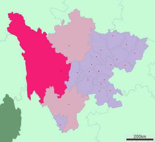
Garzê Tibetan Autonomous Prefecture, often shortened to Ganzi Prefecture, is an autonomous prefecture in the western arm of Sichuan province, China bordering Yunnan to the south, the Tibet Autonomous Region to the west, and Gansu to the north and northwest.

Tsetang or Zedang, is the fourth largest city in Tibet and is located in the Yarlung Valley, 183 km (114 mi) southeast of Lhasa in Nedong District of the Shannan Prefecture in the Tibet region of China. It is the capital of Shannan Prefecture.
Rutog County, is a county in Ngari Prefecture, Tibet Autonomous Region of the People's Republic of China. The county seat is the new Rutog Town, located some 1,140 km (710 mi) or 700 miles west-northwest of the Tibetan capital, Lhasa. Rutog County shares a border with India.

Dêgê County is a county in southern China, which was formerly one of the Kham region's five independent kingdoms - the Kingdom of Derge - but is now administered as a county in Garzê Tibetan Autonomous Prefecture in far northwestern Sichuan, China, bordering the Tibet Autonomous Region to the west. Its county seat is the town of Derge.

Zayul County (Tibetan: རྫ་ཡུལ་རྫོང, Wylie: rdza yul rdzong, THL: dza yül dzong) or Zayü County is a county in the Nyingchi Prefecture in the southeastern part of the Tibet Autonomous Region, China.
Goyul or Goyü is a township located in the Zayul County, Nyingchi Prefecture in eastern Tibet Autonomous Region, China.
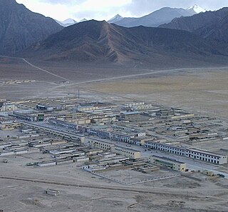
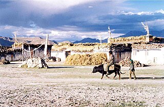
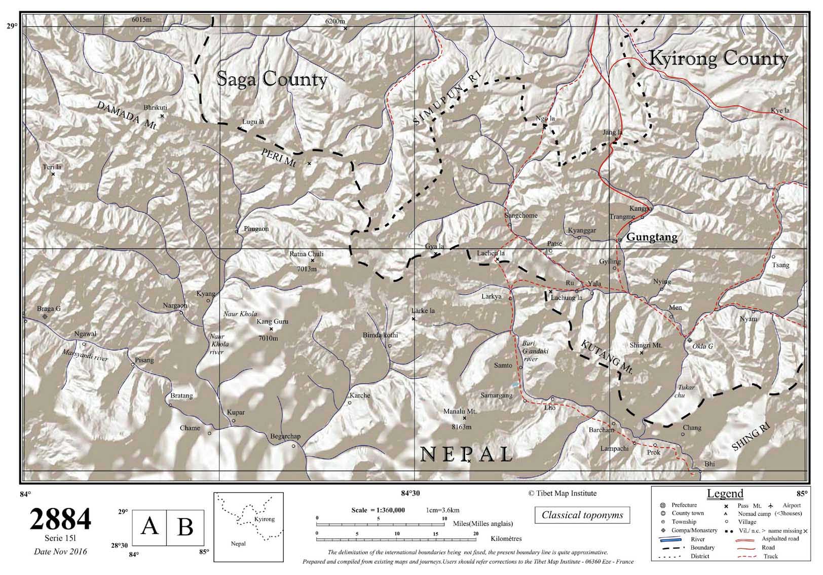
Dzongka or Zongga is a town and the administrative headquarters of Gyirong County in the southwestern Tibet region of China bordering Nepal. Being the administrative headquarters, it is also sometimes referred to as "Gyirong Dzong" or "Gyirong Town", but it is different from the original Kyirong Town in the southern part of the county.

Tsona County or Cona County is a county in Shannan prefecture in southern part of Tibet region of China. The county lies immediately to the north of the McMahon Line agreed as the mutual border between British India and Tibet in 1914. Chine has not accepted the 1914 border delineation, but treats it as the Line of Actual Control (LAC). The Tsona County also borders Bhutan on its southwest.
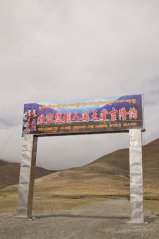
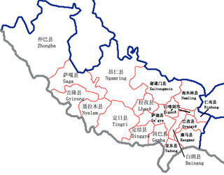
Kyirong County or Gyirong County, called Jilong County by China Chinese: 吉隆县; pinyin: Jílóng Xiàn), is a county of the Shigatse Prefecture, Tibet Autonomous Region. It is famous because of its mild climatically conditions and its abundant vegetation which is unusual for the Tibetan plateau. The capital lies at Zongga. Its name in Tibetan, Dzongka means "mud walls".

Rinbung County is a county at the northeastern boundary of the prefecture-level city of Xigazê in the Tibet Autonomous Region.
Namling County is a county of Shigatse in the Tibet Autonomous Region.
Tingri County or Dhringgri County, is a county under the administration of the prefecture-level city of Xigazê in the Tibet Autonomous Region of China.

Purang or Burang, known as Puhreng in Tibetan, is a town which serves as the administrative center of Purang County, Ngari Prefecture of the Tibet Autonomous Region (TAR), China. The town lies at an altitude of 3,900m in the valley of the Karnali River. As of 2010, the town had a population of 6,047. To the south are Gurla Mandhata and the Abi Gamin ranges. Lake Manasarovar and Mount Kailash are to the north. This region is the mythological and actual river nexus of the Himalaya with sources of the Indus, Ganges and Yarlung Tsangpo/Brahmaputra all within 110 kilometres (70 mi) of Purang.
Drakna, Drakne, or Chagnê is a township in Gyirong County, Tibet Autonomous Region of China.
The Rutog Town , called Rituzhen in Chinese, is a town and the seat of Rutog County in the far western Tibet Autonomous Region. It is also a major military base for China near the disputed border with India allowing it to press its claims militarily.

Zoco or Tsotso, also called Goicang is a township in Gar County, Ngari Prefecture of Tibet Autonomous Region of China.

Jainca County, Chentsa County or Jainzha County is a county in Huangnan Tibetan Autonomous Prefecture in Qinghai Province, China, to Tibetans in the area known as Malho Prefecture, part of Amdo. There are six townships, three towns and a total of 79 administrative villages in Chentsa county. The county has an area of 1714 square kilometres and a population of ~50,000 (2001), 67% Tibetan. The county seat is the town of Markhu Thang.

Zamthang County or Ndzamthang County, or Rangtang County is a county in the northwest of Sichuan Province, China, bordering on the Banma County of Qinghai Province to the north. It is one of 13 counties under the administration of and lies the westernmost county-level division of the Ngawa Tibetan and Qiang Autonomous Prefecture. Zamthang is on the upper reaches of the Dadu River, bordering the Barkam County and Aba County on the east and northeast, and adjoining Jinchuan County on the south, and Sêrtar County, Luhuo County and Dawu County in the west and south. Zamthang, which means "The field of Caishen" in Tibetan, lies in the southeast of the Tibetan Plateau and in the historical region of Amdo. The vast majority of the population is Tibetan(30200), followed by Han people(3949), Qiang people(269) and Hui people(78).
Tsosib Sumkyil or Churup Sumkhel is the westernmost township of the Zanda County in the Ngari Prefecture, Tibet region of China. It borders India's Spiti region in Himachal Pradesh as well as Rupshu region in Ladakh. The region is watered by the Pare Chu river, a tributary of the Spiti River and an upstream tributary of the Sutlej river. China has ongoing border disputes with India for the southwestern border of the region near Kaurik and the northern border near Chumar.
References
- ↑ Roberts, Peter Alan (2000), The Biographies of Ras-chung-pa: The Evolution of a Tibetan Hagiography, University of Oxford, p. 165
- ↑ Tibetmap sheet 2884, Tibet Map Institute, November 2016; Gungtang, KMAPS, University of Virginia, retrieved 14 January 2023.
- 1 2 3 "Geographical names of Tibet AR (China): Xigazê Prefecture-Level City". KNAB Place Name Database. Institute of the Estonian Language. 2018-06-03.
- ↑ Strachey, Henry (1854), Physical Geography of Western Tibet, London: William Clows and Sons, p. 4 – via archive.org
- ↑ Townships of Jilong County, Nationanl Bureau of Stistics, China, retrieved 14 January 2023.
- ↑ Gongdang Township, Nationanl Bureau of Stistics, China, retrieved 14 January 2023.
Coordinates: 28°49′N84°48′E / 28.817°N 84.800°E
| | This Tibet location article is a stub. You can help Wikipedia by expanding it. |