K12 is the second highest peak in the Saltoro Mountains, a subrange of the Karakoram range in the Siachen region of Ladakh. Its name comes from its designation given during the original survey of the Karakoram range. In 1984, an Indian army expedition under Colonel Prem Chand took hold of this peak, from the side of Siachen glacier by traversing from the west.

Operation Meghdoot was the codename for the Indian Army operation to take full control of the Siachen Glacier in Ladakh). Executed on the morning of 13 April 1984 in the highest battlefield in the world, Meghdoot was the first military offensive of its kind. This operation preempted Pakistan's Operation Ababeel; and was a success. Resulting in Indian forces gaining control of the Siachen Glacier in its entirety.

The Saltoro Mountains form a subrange within the Karakoram Range and are situated in the southeastern part of the Karakoram. They lie on the southwest side of the Siachen Glacier, which is one of the two longest glaciers in the world outside the polar regions. The name "Saltoro" is also associated with the Saltoro Valley, located west of this range and descending on the Pakistani side of the Saltoro Range, which generally follows the Actual Ground Position Line (AGPL).

The Saser Muztagh is the easternmost subrange of the Karakoram range, in the Ladakh region of India. It is bounded on the south, east and northeast by the Shyok River, which bends sharply around the southeast corner of the range. On the west it is separated from the neighboring Kailas Mountains by the Nubra River, while the Sasser Pass marks the boundary between this range and the Rimo Muztagh to the north. The Ladakh Range stands to the south of the Saser Muztagh, across the Shyok River.

Ghent Kangri is a high peak near the north end of the Saltoro Mountains, a subrange of the Karakoram range. It is located west of the Siachen Glacier near the Actual Ground Position Line between India and Pakistan.
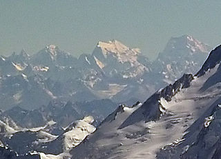
Sherpi Kangri is a mountain peak in the Karakoram Range. It lies six km south of Ghent Kangri and ten km northwest of Saltoro Kangri.
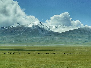
The Nyenchen Tanglha Mountains are a 700-kilometre (430 mi) long mountain range, and subrange of the Transhimalaya System, located in Tibet and the Tibet Autonomous Region of China.
Bilafond La (meaning "Pass of the Butterflies" in Balti language, also known as the Saltoro Pass, is a mountain pass situated on Saltoro Ridge, sitting immediately west of the vast Siachen Glacier, some 40 km directly north of map point NJ 980420 which defined the end of the 1972 Line of Control between Pakistan and India as part of the Simla Agreement. Bilafond La is on the ancient Silk Route linking the Indian Subcontinent and China.
Sia La is a mountain pass situated on Saltoro Ridge, in Ladakh, India, some 60 km (37 mi) north-northwest of map point NJ9842 which defined the end of the 1972 Line of Control between India and Pakistan as part of the Simla Agreement. Sia La sits near the Chinese border and immediately northwest of the upper part of the vast Siachen Glacier, connecting that glacier to the Pakistani-controlled Kondus Glacier and valley to the west.
Gyong La is a mountain pass situated on Saltoro Ridge southwest of the vast Siachen Glacier, some 20 km (12 mi) directly north of map point NJ9842 which defined the end of the 1972 Line of Control between India and Pakistan. With Pakistan controlling areas just to the west along Chumik Glacier, the immediate Gyong La area has been under India's control since 1989. Dozens of Indian military tents and other equipment are visible in 2013 and 2016 Google Earth imagery 100 meters east, 670 meters northeast, and 2.7 km east-northeast of Gyong La, linked by clear trails. Nearer the former Pakistani "Naveed Top" position and 3.85 km west-northwest of Gyong La is a post and helipad is visible in 2001 and 2016 Google Earth imagery at 5,800 m (19,000 ft) elevation, higher than both the Indian positions and Gyong La.
Siachen Base Camp, 12,000 feet above sea level at Partapur, is a base camp of 102 Infantry Brigade of XIV Corps of Indian Army which protects 110 km long Actual Ground Position Line (AGPL) with at least 108 forward military outposts and artillery observation posts in the disputed region of Siachen Glacier in Ladakh Union Territory of India. It is approximately 6 hours drive north from the town of Leh via one of the highest vehicle-accessible passes in the world, Khardung La at 17,582 feet. Bana Top (20,500 ft) is the highest post in the region, which requires 80 km and 20 day trek for troops. Pahalwan Post and posts near Indira Col are other high posts. Kumar Post or Kumar Base, named after the Colonel Narendra "Bull" Kumar, serves as the battalion head quarter located 60 km from the Siachen base towards Indira Col. The Siachen Brigade consists of five to eight battalions of Ladakh Scouts supported by artillery, air defence, engineer and other logistic units. Pakistan has not been able to scale the crest of the Saltoro Range occupied by India. The temperature goes down to minus 86 °C during winters with icy 300 kmph blizzards. The average temperature is between minus 25 °C during day and minus 55 °C during the night.

The Actual Ground Position Line (AGPL) divides current positions of Indian and Pakistani military posts and troops along the entire 110 kilometres (68 mi) long frontline in the disputed region of Siachen Glacier. AGPL generally runs along the Saltoro Mountains range, beginning from the northernmost point of the (LOC) at Point NJ 9842 and ending in the north on the Indira Ridge at the India-China-Pakistan LAC tripoint near Sia Kangri about 4 km (2.5 mi) northwest of Indira Col West, with peaks in excess of 7,000 m (23,000 ft) and temperatures ranging to around −55 °C (−67 °F). India gained control of 1,000 square miles (2,600 km2) of disputed territory in 1984 because of its military operations in Siachen. A cease-fire was announced in 2003.
NJ9842, also called NJ 980420, is the northernmost demarcated point of the India-Pakistan cease fire line in Kashmir known as the Line of Control (LoC). The India–Pakistan AGPL, begins from the NJ9842 on LoC and ends near the Indira Ridge at the trijunction of areas controlled by China, India, and Pakistan.
Chumik Glacier is located in the Siachen region. Located on the west of Saltoro ridge, it is a 4-mile-long offshoot of the Bilafond Glacier.
Kangri Karpo, also spelt Gangri Garbo, is a mountain range in eastern Tibet, located primarily in Nyingchi Prefecture as well as a portion of Qamdo Prefecture in the Tibet Autonomous Region, China. The mountain range lies to the east of the Himalayas and to the west of the Hengduan Mountains. The mountains are geographically a southern extension of the eastern Transhimalayas.

Kataklik Kangri are two of the highest mountains in the mountain group which are located in the east of the Shyok River's upper reaches, which lies in the far west of the Transhimalaya.
Thangman Kangri is one of highest peak in the remote Rimo Muztagh, a subrange of the Karakoram range in Ladakh union territory of India.
Dansam is a 6,568 m (21,549 ft) mountain peak in the west of the Saltoro Mountains, part of Karakorum Range.
Chumik Kangri is a mountain peak located at 6,754 m (22,159 ft) above sea level in the west of the Chumik Glacier.
Gharkun is a mountain peak located at 6,521 m (21,394 ft) above sea level in the west of the Saltoro Mountains, part of Karakoram Range.

