Ankara, historically known as Ancyra and Angora, is the capital of Turkey. Located in the central part of Anatolia, the city has a population of 5.1 million in its urban center and 5.8 million in Ankara Province, making it Turkey's second-largest city after Istanbul, but the first by urban area (4,130 km2), and the third by metro area (25,632 km2).

Bektashism is an Islamic Sufi mystic order that originated in 13th-century Anatolia and became widespread in the Ottoman Empire. It is named after the saint Haji Bektash Veli. The Bektashian community is currently led by Baba Mondi, their eighth Bektashi Dedebaba and headquartered in Tirana, Albania. Collectively, adherents of Bektashism are called Bektashians or simply Bektashis.

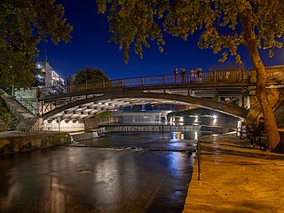
Trikala is a city in northwestern Thessaly, Greece, and the capital of the Trikala regional unit. The city straddles the Lithaios river, which is a tributary of Pineios. According to the Greek National Statistical Service, Trikala is populated by 81,355 inhabitants (2011), while in total the Trikala regional unit is populated by 131,085 inhabitants (2011).

Üsküdar is a municipality and district of Istanbul Province, Turkey. Its area is 35 km2, and its population is 524,452 (2022). It is a large and densely populated district on the Anatolian (Asian) shore of the Bosphorus. It is bordered to the north by Beykoz, to the east by Ümraniye, to the southeast by Ataşehir and to the south by Kadıköy; with Karaköy, Kabataş, Beşiktaş, and the historic Sarayburnu quarter of Fatih facing it on the opposite shore to the west. Üsküdar has been a conservative cultural center of the Anatolian side of Istanbul since Ottoman times with its landmark as well as numerous tiny mosques and dergahs.
Turkish literature comprises oral compositions and written texts in the Turkish language. The Ottoman form of Turkish, which forms the basis of much of the written corpus, was highly influenced by Persian and Arabic literature, and used the Ottoman Turkish alphabet.

Bolu Province is a province situated in north-western Turkey. It is located between the capital, Ankara, and the largest city in the country, Istanbul. Its area is 8,313 km2, and its population is 320,824 (2022). The capital city of the province is Bolu.

Kastamonu, formerly Kastamone/Castamone and Kastamon/Castamon, is a city in northern Turkey. It is the seat of Kastamonu Province and Kastamonu District. Its population is 125,622 (2021). The city lies at an elevation of 904 m (2,966 ft). It is located in the southern part of the province.

Krujë is a town and a municipality in north central Albania. Located between Mount Krujë and the Ishëm River, the city is 20 km north of the capital of Albania, Tirana.

Bolu, formerly Claudiopolis, is a city in northern Turkey, and administrative center of the Bolu Province and of Bolu District, located on the highway between Istanbul and Ankara. Its population is 184,682 (2021).

Düzce is a city in northwestern Turkey, the capital city of Düzce Province, the eighty-first province in the country. It is the seat of Düzce District. Its population is 194,097.

Bayburt is a city in northeast Turkey lying on the Çoruh River. It is the seat of Bayburt Province and Bayburt District. Its population is 48,036 (2021).

Mudurnu is a small town in Bolu Province in the Black Sea region of Turkey, 52 km south-west of the city of Bolu. It is the seat of Mudurnu District. Its population is 5,379 (2021). The mayor is Necdet Türker (MHP), elected in 2019.

Shaykh Hamid-i Vali (1331–1412), better known by his sobriquet Somunju Baba, was an ascetic teacher of Islam in Bursa, Turkey, who exerted extensive influence and is known as a Muslim saint. He was born in Kayseri and died in Aksaray. He taught at the Ulu Camii where he was installed by Sultan Bayezid I after it was completed. Somunju Baba's students included Molla Fenari and Hacı Bayram-ı Veli.

Ras al-Ayn, also spelled Ras al-Ain, is a city in al-Hasakah Governorate in northeastern Syria, on the Syria–Turkey border.

Sarı Saltık was a 13th-century Alevi Turkish dervish, venerated as a saint by the Bektashi Sufi Muslims in the Balkans and parts of Middle East as well as the mainstream Sunni Muslim community.

Mezitli is a municipality and district of Mersin Province, Turkey. Its area is 371 km2, and its population is 222,436 (2022). It covers the westernmost part of the city of Mersin and the adjacent countryside. The Mayor of Mezitli is Ahmet Serkan Tuncer.

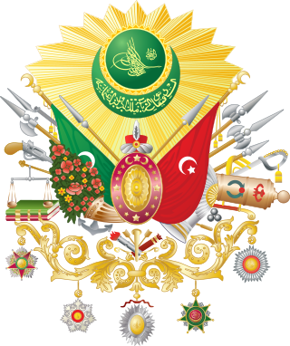
The following outline is provided as an overview of and topical guide to the Ottoman Empire:

The Vilayet of Kastamonu was a first-level administrative division (vilayet) of the Ottoman Empire, established in 1867 and abolished in 1922. At the beginning of the 20th century, the vilayet reportedly had an area of 19,300 square miles (50,000 km2), while the preliminary results of the first Ottoman census of 1885 gave the population as 1,009,460. The accuracy of the population figures ranges from "approximate" to "merely conjectural" depending on the region from which they were gathered.

Akshamsaddin, was an influential Ottoman Sunni Muslim scholar, poet, and mystic saint.
Bucakkışla is a village in Karaman District of Karaman Province, Turkey. Its population is 145 (2022).


