Hadley, Shropshire

Last updated

Hadley
Holy Trinity , Hadley - geograph.org.uk - 1716799.jpg
Holy Trinity parish church
Shropshire UK location map.svg
Red pog.svg
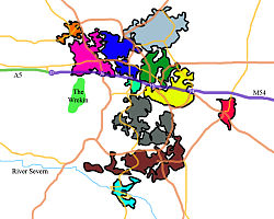
Hadley
Location within Shropshire
Civil parish
Unitary authority
Ceremonial county
Region
Country England
Sovereign state United Kingdom
List of places
UK
England
Shropshire
52°42′14″N2°28′52″W / 52.704°N 2.481°W / 52.704; -2.481

Hadley is a village and part of Telford in the borough of Telford and Wrekin and the ceremonial county of Shropshire, England.

Contents

Hadley, Ketley and Leegomery shown within Telford in Blue. TelfordMap.jpg
Hadley, Ketley and Leegomery shown within Telford in Blue.

Hadley is about 3 miles (5 km) north-west of Telford Town Centre, and is in the civil parish of Hadley and Leegomery (previously called simply "Hadley"). The population of the civil parish mentioned at the 2011 census was 14,166. [1]

It neighbours Wellington, a market town also part of Telford, and that town's two colleges of Telford College of Arts and Technology (TCAT) and New College (NC), all to the west of Hadley. Ketley is immediately to the south of Hadley. [2]

Hadley Learning Community, opened in 2006, is a coeducational all-through school for students from 5 – 16 years of age located in Hadley. [3]

Hadley's parish war memorial, to men of Hadley and district who died serving in the two World Wars, is an imitation of the Cenotaph in London's Whitehall. It stands in Manse Road near the Methodist Church. [4]

Notable people

See also

Related Research Articles

<span class="mw-page-title-main">Shropshire</span> County of England

Shropshire is a ceremonial county in the West Midlands of England, on the Welsh border. It is bordered by Wrexham County Borough and Cheshire to the north, Staffordshire to the east, Worcestershire to the south-east, Herefordshire to the south and Powys to the west. The largest settlement is Telford, and Shrewsbury is the county town.

<span class="mw-page-title-main">Telford</span> Town in Shropshire, England

Telford is a town in Shropshire, England. It is the administrative centre of Telford and Wrekin borough, a unitary authority which covers the town, its suburbs and surrounding settlements. The town is close to the county's eastern boundary, and near the River Severn.

<span class="mw-page-title-main">Newport, Shropshire</span> Human settlement in England

Newport is a market town in the borough of Telford and Wrekin in Shropshire, England. It lies 7 miles (11 km) north-east of Telford town centre, 12 miles (19 km) west of Stafford, and is near the Shropshire-Staffordshire border. The 2001 census recorded 10,814 people living in the town's parish, which rose to 11,387 by the 2011 census.

<span class="mw-page-title-main">Telford and Wrekin</span> Borough in Shropshire, England

Telford and Wrekin is a borough and unitary authority in Shropshire, England. In 1974, a non-metropolitan district of Shropshire was created called The Wrekin, named after a prominent hill to the west of Telford. In 1998, the district became a unitary authority and was renamed "Telford and Wrekin", which remains part of the Shropshire ceremonial county and shares institutions such as the Fire and Rescue Service and Community Health with the rest the county.

<span class="mw-page-title-main">Bridgnorth</span> Human settlement in England

Bridgnorth is a town and civil parish in Shropshire, England. The River Severn splits it into High Town and Low Town, the upper town on the right bank and the lower on the left bank of the River Severn. The population at the 2011 Census was 12,079.

<span class="mw-page-title-main">Ruyton-XI-Towns</span> Human settlement in England

Ruyton-XI-Towns, formally Ruyton of the Eleven Towns or simply Ruyton, is a village and civil parish next to the River Perry in Shropshire, England. It had a population of 1,379 at the 2011 Census.

<span class="mw-page-title-main">Chirk</span> Town in Wales

Chirk is a town and community in Wrexham County Borough, Wales, 10 miles south of Wrexham, between it and Oswestry. At the 2011 census, it had a population of 4,468. Historically in the traditional county of Denbighshire, and later Clwyd, it has been part of Wrexham County Borough since a local government reorganisation in 1996. The border with the English county of Shropshire is immediately south of the town, on the other side of the River Ceiriog.

<span class="mw-page-title-main">Wellington, Shropshire</span> Human settlement in England

Wellington is a constituent market town of Telford and a civil parish in the borough of Telford and Wrekin, Shropshire, England. It is situated 3 miles (4.8 km) northwest of Telford town centre and 12 miles (19 km) east of Shrewsbury. The summit of The Wrekin lies 3 miles southwest of the town. The population of the town was 25,554 in 2011.

<span class="mw-page-title-main">Oakengates</span> Human settlement in England

Oakengates is a constituent town of Telford and a civil parish in the borough of Telford and Wrekin, Shropshire, England. The towns parish population was recorded as 8,517 in the 2001 census.

<span class="mw-page-title-main">Much Wenlock</span> Town and parish in England

Much Wenlock is a market town and parish in Shropshire, England, situated on the A458 road between Shrewsbury and Bridgnorth. Nearby, to the northeast, is the Ironbridge Gorge and Telford. The civil parish includes the villages of Homer, Wyke, Atterley, Stretton Westwood and Bourton. The population of the civil parish, according to the 2001 census, was 2,605, increasing to 2,877 at the 2011 Census.

<span class="mw-page-title-main">Dalian Atkinson</span> English footballer

Dalian Robert Atkinson was an English professional footballer who played as a striker.

<span class="mw-page-title-main">Dawley</span> Human settlement in England

Dawley is a constituent town of Telford and a civil parish in the borough of Telford and Wrekin, Shropshire, England. It was originally, in 1963, going to be the main centre of the 'Dawley New Town' plan before it was decided in 1968 to name the new town as 'Telford', after the engineer and road-builder Thomas Telford. Dawley now forms part of Telford whose town centre is north of Dawley itself.

<span class="mw-page-title-main">Edgmond</span> Village in England

Edgmond is a village in the borough of Telford and Wrekin and ceremonial county of Shropshire, England. The village population at the 2011 Census was 2,062. It lies 1 mile north-west of the town of Newport.

<span class="mw-page-title-main">The Wrekin (UK Parliament constituency)</span> Parliamentary constituency in the United Kingdom, 1918 onwards

The Wrekin is a constituency in the House of Commons of the British Parliament, located in the county of Shropshire in the West Midlands of England. It has existed continuously since its creation by the Representation of the People Act 1918, and is named after a prominent landmark hill in the area, The Wrekin. It has been represented by the Labour and Conservative parties since the 1920s, a post held since 2005 by Conservative MP Mark Pritchard.

<span class="mw-page-title-main">Madeley, Shropshire</span> Human settlement in England

Madeley is a constituent town of Telford and a civil parish in the borough of Telford and Wrekin, Shropshire, England. The parish had a population of 17,935 at the 2001 census.

<span class="mw-page-title-main">Ketley</span> Human settlement in England

Ketley is a large village and part of Telford in the borough of Telford and Wrekin and ceremonial county of Shropshire, England. It is a civil parish. Immediately to the north of Ketley is Hadley.

<span class="mw-page-title-main">Trench, Telford</span> Human settlement in England

Trench is a suburb of Telford in the borough of Telford and Wrekin and ceremonial county of Shropshire, England. It is to the north of the town and north of town of Oakengates.

<span class="mw-page-title-main">Sheinton</span> Human settlement in England

Sheinton is a small rural village and civil parish just outside Telford, and within Shropshire.

Hadley and Leegomery is a civil parish in the district of Telford and Wrekin, Shropshire, England. It contains ten listed buildings that are recorded in the National Heritage List for England. Of these, one is at Grade II*, the middle of the three grades, and the others are at Grade II, the lowest grade. Hadley and Leegomery are areas in the town of Telford. The most important building in the parish was Apley Castle, but this has been largely demolished and redeveloped, and what remains of it is listed at Grade II*. Other structures associated with the building are listed, and the other listed buildings in the parish include two former mills, an 18th-century house, two locks and a bridge associated with the now disused Shrewsbury Canal, a public house, and a war memorial.

References

  1. "Civil Parish population 2011" . Retrieved 17 December 2015.
  2. Ordnance Survey mapping
  3. "Home". hadleylearningcommunity.org.uk.
  4. Francis, Peter (2013). Shropshire War Memorials, Sites of Remembrance. YouCaxton Publications. pp. 134–135. ISBN   978-1-909644-11-3.
  5. Joyce, Michael (2004). Football League Players' Records 1888 to 1939. SoccerData. ISBN   1-899468-67-6.
  6. Patch, Harry; Van Emden, Richard (2007). The Last Fighting Tommy:The Life of Harry Patch, the Oldest Surviving Veteran of the Trenches. Bloomsbury Publishing. p. 138. ISBN   978-0-7475-9115-3.
  7. "Charismatic Dalian enriched our lives". Shropshire Star. 21 November 2016. p. 4. Report by Lisa O'Brien, published following Dalian Atkinson's funeral.