Related Research Articles
Brabant is a traditional geographical region in the Low Countries of Europe. It may refer to:

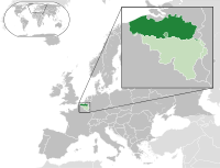
Flanders is the Dutch-speaking northern portion of Belgium and one of the communities, regions and language areas of Belgium. However, there are several overlapping definitions, including ones related to culture, language, politics, and history, and sometimes involving neighbouring countries. The demonym associated with Flanders is Fleming, while the corresponding adjective is Flemish, which can also refer to the collective of Dutch dialects spoken in that area, or more generally the Belgian variant of Standard Dutch. The official capital of Flanders is the City of Brussels, although the Brussels-Capital Region that includes it has an independent regional government. The powers of the government of Flanders consist, among others, of economic affairs in the Flemish Region and the community aspects of Flanders life in Brussels, such as Flemish culture and education.

Antwerp Province, between 1815 and 1830 known as Central Brabant, is the northernmost province both of the Flemish Region, also called Flanders, and of Belgium. It borders on the North Brabant province of the Netherlands to the north and the Belgian provinces of Limburg, Flemish Brabant and East Flanders. Its capital is Antwerp, which includes the Port of Antwerp, the second-largest seaport in Europe. It has an area of 2,876 km2 (1,110 sq mi), and with over 1.85 million inhabitants as of January 2019, is the country's most populous province. The province consists of three arrondissements: Antwerp, Mechelen and Turnhout. The eastern part of the province comprises the main part of the Campine region.

Flemish Brabant is a province of Flanders, one of the three regions of Belgium. It borders on the Belgian provinces of Antwerp, Limburg, Liège, Walloon Brabant, Hainaut and East Flanders. Flemish Brabant also surrounds the Brussels-Capital Region. Its capital is Leuven. It has an area of 2,118 km2 (818 sq mi) which is divided into two administrative districts containing 65 municipalities. As of January 2019, Flemish Brabant had a population of 1,146,175.

Limburg, also known as Belgian Limburg, is a province in Belgium. It is the easternmost of the five Dutch-speaking provinces that together form the Region of Flanders, one of the three main political and cultural sub-divisions of modern-day Belgium.
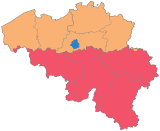
The Kingdom of Belgium is divided into three regions. Two of these regions, Flanders and Wallonia, are each subdivided into five provinces. The third region, Brussels, does not belong to any province and nor is it subdivided into provinces. Instead, it has amalgamated both regional and provincial functions into a single "Capital Region" administration.

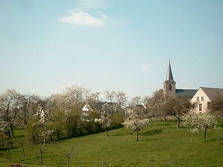
Aarschot is a city and municipality in the province of Flemish Brabant, in Flanders, Belgium. The municipality comprises the city of Aarschot proper and the towns of Gelrode, Langdorp and Rillaar. On January 1, 2019, Aarschot had a total population of 30,106. The total area is 62.52 km2 (24.14 sq mi) which gives a population density of 446 inhabitants per km2.

Rotselaar is a municipality located in the Belgian province of Flemish-Brabant, near the convergence of the Demer and the Dijle. Since January 1, 1977 the municipality comprises the towns of Rotselaar proper, Werchter and Wezemaal. On January 1, 2006, Rotselaar had a total population of 15,068. The total area is 37.57 km² which gives a population density of 401 inhabitants per km².
The Flemish Region, usually simply referred to as Flanders, is one of the three regions of Belgium—alongside the Walloon Region and the Brussels-Capital Region. Covering the northern portion of the country, the Flemish Region is primarily Dutch-speaking. With an area of 13,522 km2 (5,221 sq mi), it accounts for only 45% of Belgium's territory, but 57% of its population. It is one of the most densely populated regions of Europe with around 490/km2 (1,300/sq mi).

The Dyle is a river in central Belgium, left tributary of the Rupel. It is 86 kilometres (53 mi) long. It flows through the Belgian provinces of Walloon Brabant, Flemish Brabant and Antwerp. Its source is in Houtain-le-Val, near Nivelles in Walloon Brabant.

The Flemish Diamond is the Flemish reference to a network of four metropolitan areas in Belgium, three of which are in the central provinces of Flanders, together with the Brussels-Capital Region. It consists of four agglomerations which form the four corners of an abstract diamond shape: Brussels, Ghent, Antwerp and Leuven.

The Campine or De Kempen is a natural region situated chiefly in north-eastern Belgium and parts of the south-eastern Netherlands which once consisted mainly of extensive moors, tracts of sandy heath, and wetlands. It encompasses a large northern and eastern portion of Antwerp Province and adjacent parts of Limburg in Belgium, as well as portions of the Dutch province of North Brabant and Dutch Limburg around Weert.
The Hesbaye, or Haspengouw, is a traditional cultural and geophysical region in eastern Belgium. It is a loamy plateau region which forms a watershed between the Meuse and Scheldt drainage basins. It has been one of the main agricultural regions in what is now Belgium since before Roman times, and specifically named in records since the Middle Ages, when it was an important Frankish pagus or gau, called Hasbania in medieval Latin.

The Duchy of Brabant, a state of the Holy Roman Empire, was established in 1183. It developed from the Landgraviate of Brabant of 1085–1183, and formed the heart of the historic Low Countries. The Duchy comprised part of the Burgundian Netherlands from 1430 and of the Habsburg Netherlands from 1482, until it was partitioned after the Dutch revolt of 1566–1648.
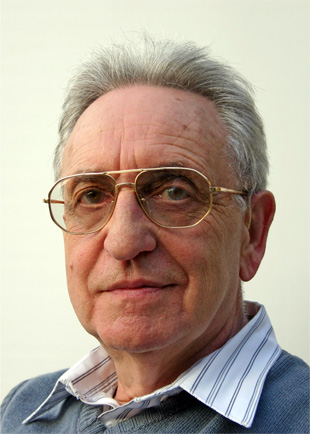
Paul Kempeneers is a Belgian philologist and linguist.
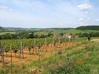
Belgian wine is produced in several parts of Belgium and production, although still modest at 1,400 hectoliters in 2004, has expanded in recent decades.

Korbeek-Lo is a sub-municipality of the municipality of Bierbeek located in the province of Flemish Brabant, Flemish Region, Belgium.

The N3 road in Belgium is a national road connecting the capital city Brussels to Aachen in Germany via Leuven, Tienen, Sint-Truiden and Liège. Its course is quite similar to that of European route E40 between Brussels and Aachen, which it intersects 3 times. The road runs through the 3 Belgian regions and the 3 communities.
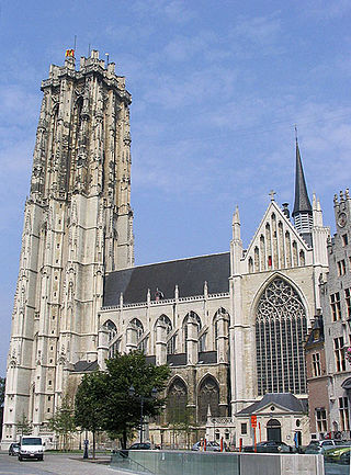
Brabantine Gothic, occasionally called Brabantian Gothic, is a significant variant of Gothic architecture that is typical for the Low Countries. It surfaced in the first half of the 14th century at St. Rumbold's Cathedral in the city of Mechelen.
Luc Rombouts is a Belgian carillonneur and author. He is the city carillonneur of Tienen in Flemish Brabant. He is also the official carillonneur of both Leuven University carillons and the Park Abbey. He has given numerous concerts in Europe en the USA and appeared in festivals and conventions. Together with Twan Bearda he performs in a carillon duet called The Bells' Angels, exploring, expanding and performing four hand carillon repertoire.
References
- Simon Depoorter. "Geologische Informatiebrochure: Bierbeek" (PDF) (in Dutch). Municipality of Bierbeek. p. 4. Retrieved 13 July 2011.[ permanent dead link ]