
Kashmir is the northernmost geographical region of the Indian subcontinent. Until the mid-19th century, the term "Kashmir" denoted only the Kashmir Valley between the Great Himalayas and the Pir Panjal Range. The term has since come to encompass a larger area that includes the India-administered territories of Jammu and Kashmir and Ladakh, the Pakistan-administered territories of Azad Kashmir and Gilgit-Baltistan, and the Chinese-administered territories of Aksai Chin and the Trans-Karakoram Tract.

Jammu and Kashmir was a region formerly administered by India as a state from 1952 to 2019, constituting the southern and southeastern portion of the larger Kashmir region, which has been the subject of a dispute between India, Pakistan and China since the mid-20th century. The underlying region of this state were parts of the former princely state of Jammu and Kashmir, whose western districts, now known as Azad Kashmir, and northern territories, now known as Gilgit-Baltistan, are administered by Pakistan. The Aksai Chin region in the east, bordering Tibet, has been under Chinese control since 1962.

The Bharatiya Janata Party is a political party in India and one of the two major Indian political parties alongside the Indian National Congress. Since 2014, it has been the ruling political party in India under the incumbent Prime Minister Narendra Modi. The BJP is aligned with right-wing politics and has close ideological and organisational links to the Rashtriya Swayamsevak Sangh (RSS), a far-right paramilitary organisation. Its policies adhere to Hindutva, a Hindu nationalist ideology. As of January 2024, it is the country's biggest political party in terms of representation in the Parliament of India as well as state legislatures.

Ladakh is a region administered by India as a union territory and constitutes an eastern portion of the larger Kashmir region that has been the subject of a dispute between India and Pakistan since 1947 and India and China since 1959. Ladakh is bordered by the Tibet Autonomous Region to the east, the Indian state of Himachal Pradesh to the south, both the Indian-administered union territory of Jammu and Kashmir and the Pakistan-administered Gilgit-Baltistan to the west, and the southwest corner of Xinjiang across the Karakoram Pass in the far north. It extends from the Siachen Glacier in the Karakoram range to the north to the main Great Himalayas to the south. The eastern end, consisting of the uninhabited Aksai Chin plains, is claimed by the Indian Government as part of Ladakh, but has been under Chinese control.
All Parties Hurriyat Conference (APHC) is an alliance of 26 political, social and religious organizations formed on 9 March 1993, as a united political front to raise the cause of Kashmiri independence in the Kashmir conflict. Mehmood Ahmed Saghar was the first convener of the APHC-PAK chapter when the alliance was established in 1993. The alliance has historically been viewed positively by Pakistan as it contests the claim of the Indian government over the State of Jammu and Kashmir. The organisation is split into two main factions, those being the Mirwaiz and Geelani factions. Mirwaiz Umar Farooq is the founder and chairman of Mirwaiz faction and Masarat Alam Bhat is the interim chairman of Geelani faction, who succeeded Syed Ali Shah Geelani, the founder of the faction after his death.

Anantnag district is an administrative district of Indian-administered Jammu and Kashmir in the disputed Kashmir region. It is one of ten districts which make up the Kashmir Valley. The district headquarters is Anantnag city. As of 2011, it was the third most populous district of Jammu and Kashmir, after Jammu and Srinagar.

Omar Abdullah is an Indian politician who is currently serving as the chief minister of the union territory of Jammu and Kashmir. He had previously served as the chief minister of the state of Jammu and Kashmir between 2009 and 2014, and is the current vice president of the Jammu and Kashmir National Conference, a position he has held since 2009. Abdullah also served as a member of parliament in the Lok Sabha from 1998 to 2009, representing the Srinagar parliamentary constituency, and was a union minister of State for External Affairs.
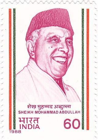
Sheikh Mohammad Abdullah was an Indian politician who played a central role in the politics of Jammu and Kashmir. Abdullah was the founding leader of the All Jammu and Kashmir Muslim Conference and the 1st elected Prime Minister of Jammu and Kashmir after its accession to India. He agitated against the rule of the Maharaja Hari Singh and urged self-rule for Kashmir. He is also known as Sher-e-Kashmir.

Dogri is a dialect of Punjabi of the Pahari group, primarily spoken in the Jammu region of Jammu and Kashmir, India, with smaller groups of speakers in the adjoining regions of western Himachal Pradesh, northern Punjab, and north-eastern Pakistani Punjab. It is the ethnic language of the Dogras, and was spoken in the historical region of Duggar. It is currently spoken in the districts of Kathua, Jammu, Samba, Udhampur, Reasi and other adjoining districts of Jammu Province Unusually for an Indo-European language, Dogri is tonal, a trait it shares with other Pahari dialects and Doabi. It has several varieties, all with greater than 90% lexical similarity.
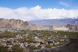
Leh district is a district in Indian-administered Ladakh in the disputed Kashmir-region. Ladakh is an Indian-administered union territory. With an area of 45,110 km2, it is the second largest district in the country, second only to Kutch. It is bounded on the north by Gilgit-Baltistan's Kharmang and Ghanche districts and Xinjiang's Kashgar Prefecture and Hotan Prefecture, to which it connects via the historic Karakoram Pass. Aksai Chin and Tibet are to the east, Kargil district to the west, and Lahul and Spiti to the south. The district headquarters is in Leh. It lies between 32 and 36 degree north latitude and 75 to 80 degree east longitude.
Balraj Madhok was an Indian political activist and politician from Jammu. Originally an activist of the nationalist organisation Rashtriya Swayamsevak Sangh (RSS), he later worked as a politician in the Bharatiya Jan Sangh (BJS).

Kupwara district is an administrative district of Indian-administered Jammu and Kashmir in the disputed Kashmir region. It is one of the 10 districts located in the Kashmir Valley Division of Indian administered Kashmir. The Pohru River and Mawar river are two main rivers in the district. Both of them meet Jhelum river in Baramulla district.

Karan Singh is an Indian politician and philosopher. He is the titular Maharaja of the princely state of Jammu and Kashmir. From 1952 to 1965 he was the Sadr-i-Riyasat (President) of the state of Jammu and Kashmir. He is the chairperson trustee of the Dharmarth Trust of Jammu and Kashmir which maintains 175 temples in north India and works in other areas such as historical preservation.

Jagmohan Malhotra, known by the mononym Jagmohan, was an Indian civil servant and politician. After working with the Indian National Congress, he joined the Bharatiya Janata Party in 1995. He served as Lieutenant Governor of Delhi and Goa, as the 5th Governor of Jammu and Kashmir, and for three terms as Member of Parliament for New Delhi. In the cabinet, he served as Union Minister for Urban Development and Tourism.

General elections were held in India between 25 October 1951 and 21 February 1952, the first national elections after India attained independence in 1947. Voters elected 489 members of the first Lok Sabha, the lower house of the Parliament of India. Elections to most of the state legislatures were held simultaneously.

Bandipore district is an administrative district of Indian-administered Jammu and Kashmir in the disputed Kashmir region. It is one of the 20 districts in the Jammu and Kashmir. Bandipore town is the administrative headquarters of the district. Bandipore is located in the foothills of the snow-clad peaks of Harmukh overlooking the shores of Wular Lake and has produced hundreds of scholars and intellectuals. The district is known for its tourist places such as Wular Vintage Park, Athwatoo and Gurez valley. Before 1947, this town was a big trade and literary centre of Kashmir. This district was carved out from the erstwhile Baramulla district in 2007. The district is bounded by Kupwara district from the north, Baramulla district from west,Ganderbal district from the east, Kargil district in Ladakh, Neelum District in Pakistan-administered Azad Kashmir and Astore district in Pakistan-administered Gilgit-Baltistan. Bandipore district is the only district in Kashmir Division that shares border with Pakistan-administered Gilgit-Baltistan region. This district occupies an area of 398 km2. The district has a population of 392,232 as per 2011 census.

The Jammu and Kashmir Legislative Assembly, also known as the Jammu and Kashmir Vidhan Sabha, is the legislature of Indian union territory of Jammu and Kashmir.
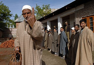
Elections in the Union Territory of Jammu and Kashmir are conducted in accordance with the Constitution of India to elect the representatives of various bodies at national, state and district levels including the 114 seat unicameral Jammu and Kashmir Legislative Assembly and the Parliament of India. The first elections in the Union Territory of Jammu and Kashmir took place between 28 November and 19 December 2020 in the form of by-elections to District Development Councils and municipal and panchayat level bodies. A fresh delimitation process for assembly constituencies began in February–March 2020.

Jammu and Kashmir is a region administered by India as a union territory and consists of the southern portion of the larger Kashmir region, which has been the subject of a dispute between India and Pakistan since 1947 and between India and China since 1959. The Line of Control separates Jammu and Kashmir from the Pakistani-administered territories of Azad Kashmir and Gilgit-Baltistan in the west and north. It lies to the north of the Indian states of Himachal Pradesh and Punjab and to the west of Ladakh which is administered by India as a union territory.

The Jammu and Kashmir Reorganisation Act, 2019 is an act of the parliament of India containing provisions to reconstitute the Indian-administered state of Jammu and Kashmir into two Indian-administered union territories (UTs) called Jammu and Kashmir, and Ladakh, and becoming effective on 31 October 2019. A bill for the act was introduced by the Minister of Home Affairs, Amit Shah, in the Rajya Sabha on 5 August 2019 and was passed on the same day. It was then passed by the Lok Sabha on 6 August 2019 and it received the president's assent on 9 August 2019.

