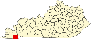
Calloway County is a county located in the U.S. Commonwealth of Kentucky. As of the 2010 census, the population was 37,191. Its county seat is Murray. The county was founded in November 1822 and named for Colonel Richard Callaway, one of the founders of Boonesborough.

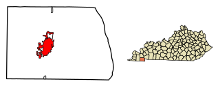
Murray is a home rule-class city in Calloway County, Kentucky, United States. It is the seat of Calloway County and the 19th-largest city in Kentucky. The city's population was 17,741 during the 2010 U.S. census, and its micropolitan area's population is 37,191. Calloway County is a college town and is the home of Murray State University.
U.S. Route 641 (US 641) is a U.S. Route in Tennessee and Kentucky. It runs for 165.45 miles (266.27 km) from US 64 south of Clifton, Tennessee to an intersection with US 60 in Marion, Kentucky. While it is considered a spur route of U.S. Route 41, the two routes no longer connect.

Linn Boyd was a prominent US politician of the 1840s and 1850s, and served as Speaker of the United States House of Representatives from 1851 to 1855. Boyd was elected to the House as a Jacksonian from Kentucky from 1835 to 1837 and again as a Democrat from 1839 to 1855, serving seven terms in the House. Boyd County, Kentucky is named in his honor.
Halfway or Half Way may refer to:
Kentucky Route 80 (KY 80) is a 483.55-mile-long (778.20 km) state highway in the southern part of the U.S. state of Kentucky. The route originates on the state's western border at Columbus in Hickman County, and stretches across the southern portion of the state, terminating southeast of Elkhorn City on the Virginia state line. It is the longest Kentucky State Highway, though the official distance as listed in route logs is much less due to multiple concurrencies with U.S. Route 68 (US 68) and U.S. Route 23.
Richard Callaway or Richard Calloway was a longhunter and early settler of Kentucky. Born in Caroline County, Virginia, Callaway joined Daniel Boone in 1775 in marking the Wilderness Road into central Kentucky, becoming one of the founders of Boonesborough, Kentucky. He took part in organizing the short-lived colony of Transylvania.

The United States District Court for the Western District of Kentucky is the federal district court for the western part of the state of Kentucky.
Calloway County High School is a public high school located in Murray, Kentucky. The school was formed from the consolidation of six high schools from across the county: Hazel High School, Lynn Grove High School, Kirksey High School, Almo High School, New Concord High School, and Faxon High School.
The Calloway County School District is located in Calloway County, Kentucky, United States and is the educational home to over 3000 students. The district operates a pre-school, three elementary schools, one middle school, and Calloway County High School.

The Confederate Monument in Murray is a statue located in the northeast corner of the Calloway County Courthouse in Murray, Kentucky. It honors the 800 citizens of the county who served in the Confederate Army during the American Civil War, and is one of several Confederate monuments in Kentucky featuring Robert E. Lee. There is another one in Bardstown KY. Despite recent controversy, the Calloway County Fiscal Court voted to keep the statue on its grounds in July 2020.

This is a list of the National Register of Historic Places listings in Calloway County, Kentucky. It is intended to be a complete list of the properties and districts on the National Register of Historic Places in Calloway County, Kentucky, United States. The locations of National Register properties and districts for which the latitude and longitude coordinates are included below, may be seen in a map.

The 1996 United States presidential election in Kentucky took place on November 5, 1996, as part of the 1996 United States presidential election. Voters chose 8 representatives, or electors to the Electoral College, who voted for president and vice president.

Bethel was an unincorporated community in Calloway County, Kentucky, United States.

Wadesboro or Waidsboro is an unincorporated community in Calloway County, Kentucky, United States.

Five Points is an unincorporated community in Calloway County, Kentucky, United States.

Utterback was an unincorporated community in Calloway County, Kentucky, United States.
Kentucky Route 94 is a 79.816-mile-long (128.451 km) state highway in Kentucky that runs from Tennessee State Route 78 at the Tennessee state line to KY 80 southwest of the unincorporated community of Aurora via Hickman, Water Valley, and Murray.

Penny is an unincorporated community in Calloway County, Kentucky, United States.

Midway is an unincorporated community in Calloway County, Kentucky, United States.


