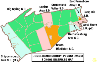
South Middleton School District is a mid-sized, rural, public school district located in Boiling Springs, Pennsylvania. It also serves residents of South Middleton Township. South Middleton School District encompasses approximately 51 square miles (130 km2). South Middleton School District serves grades (K–12). According to 2000 federal census data, it served a resident population of 12,939. By 2010 the population had risen to 14,695 residents. The educational attainment levels for the school district population were 92.9% high school graduates and 33.1% college graduates.

The Frazier School District is a rural public school district located in Fayette County, Pennsylvania, about 35 miles south of Pittsburgh. It serves the boroughs of Perryopolis and Newell, and the townships of Perry, Jefferson, and Lower Tyrone. Frazier School District encompasses approximately 83 square miles. According to 2000 federal census data it serves a resident population of 8,531. By 2010, the district's population declined to 8,006 people. The educational attainment levels for the Frazier School District population were 88.8% high school graduates and 16.1% college graduates. The district is one of the 500 public school districts of Pennsylvania.

Allegheny-Clarion Valley School District (ACVSD) is a small, rural, public school district in western Pennsylvania. It spans portions of four counties and is the only Pennsylvania public school district to do so. The district is one of the 500 public school districts of Pennsylvania. The Allegheny-Clarion Valley School District encompasses approximately 121 square miles (310 km2). In Armstrong County it covers the City of Parker and Hovey Township. In Butler County it serves Allegheny Township. In Clarion County it serves the Boroughs of Emlenton, Foxburg and St. Petersburg and Perry Township and Richland Township. In Venango County it serves the Borough of Emlenton and Richland Township and Scrubgrass Township. According to 2000 federal census data, Allegheny-Clarion Valley School District serves a resident population of 5,944. By 2010, the district's population declined to 5,749 people. In 2009, the district residents' per capita income was $15,525, while the median family income was $36,867. In the Commonwealth of Pennsylvania, the median family income was $49,501 and the United States median family income was $49,445, in 2010. By 2013, the median household income in the United States rose to $52,100.

Western Wayne School District is a third-class school district in Wayne County, Pennsylvania. The district's population was 19,292 at the time of the 2010 United States Census.

Everett Area School District is a small, rural, public school district in Bedford County, Pennsylvania. It serves a rural region and encompasses the borough of Everett and the townships of West Providence, East Providence, Monroe, Southampton, and Mann. Everett Area School District encompasses 300 square miles (780 km2) of southern Pennsylvania. According to 2000 federal census data, Everett Area School District served a resident population of 9,949. Per US Census Bureau data, the resident population declined to 9,704 in 2010. The educational attainment levels for the Everett Area School District population were 81.9% high school graduates and 11.6% college graduates. The district is one of the 500 public school districts of Pennsylvania.

The Greenwood School District is a small, rural, public school district which is located in Millerstown, Pennsylvania. The northernmost school district in Perry County, Pennsylvania, it is bordered to the north by the Juniata County School District, to the east by the Susquehanna River, to the south by the Newport School District, and to the west by the West Perry School District.

The Boyertown Area School District is a large public school district which covers portions of Berks and Montgomery Counties in southeastern Pennsylvania. When the Boyertown Area School District was formed in 1953 it was one of the largest in the state, encompassing 100 square miles (260 km2). In Berks County it covers the Boroughs of Bally, Bechtelsville and Boyertown and Colebrookdale Township, Douglass Township, Earl Township and Washington Township. In Montgomery County it covers Douglass Township, New Hanover Township and Upper Frederick Township.

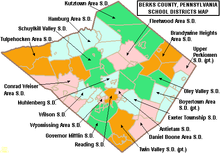
The Antietam School District is a diminutive, suburban public school district that serves the Borough of Mount Penn and Lower Alsace Township in Berks County, Pennsylvania. It encompasses approximately 5 square miles (13 km2). According to a federal census, it served a resident population of 7,494. In 2009, the district residents’ per capita income was $22,716, while the median family income was $49,511. In the Commonwealth, the median family income was $49,501 and the United States median family income was $49,445, in 2010.

The Daniel Boone Area School District covers the Borough of Birdsboro, Amity Township, and Union Township in Berks County, Pennsylvania. The district encompasses approximately 39 square miles (100 km2). According to 2000 federal census data, it served a resident population of 17,384. By 2010, the district's population increased to 21,270 people. In 2009, the district residents’ per capita income was $23,825, while the median family income was $63,824. In the Commonwealth, the median family income was $49,501 and the United States median family income was $49,445, in 2010.

The Elwood City Area School District (ECASD) is a diminutive, suburban, public school district located in Beaver County, Pennsylvania and Lawrence County, Pennsylvania. It serves the boroughs of Ellwood City, Ellport, and New Beaver, and the townships of Wayne, and Perry Townships. Elwood City Area School District encompasses approximately 49 square miles (130 km2). According to 2000 federal census data, it served a resident population of 14,040. In 2010 the district's population risen to 14,341 people. In 2009, the district residents’ per capita income was $16,554, while the median family income was $42,326. In the Commonwealth, the median family income was $49,501 and the United States median family income was $49,445, in 2010.

Wyomissing Area School District is a diminutive, suburban, public school district located in Berks County, Pennsylvania. The Wyomissing Area School District encompasses approximately 4 square miles (10 km2). The district is the smallest one operating in Berks County. According to 2000 federal census data, it serves a resident population of 12,440. By 2010, the district's population declined to 12,359 people. In 2009, the district residents’ per capita income was $35,814, while the median family income was $70,875. In the Commonwealth, the median family income was $49,501 and the United States median family income was $49,445, in 2010. By 2013, the median household income in the United States rose to $52,100.

The Muhlenberg Area School District is a mid-sized, suburban, public school district serving parts of Berks County, Pennsylvania. It encompasses the borough of Laureldale and the Muhlenberg Township. The district encompasses approximately 13 square miles (34 km2). Per the 2000 federal census data it served a resident population of 20,064. By 2010, the district's population declined to 23,562 people.

The Sharpsville Area School District is a small, suburban/rural, public school district serving parts of Mercer County, Pennsylvania. The district is one of the 500 public school districts of Pennsylvania. The district's attendance area encompasses the communities of Sharpsville, Clark, and Pymatuning Township. The Sharpsville Area School District encompasses approximately 29 square miles (75 km2). According to 2010 federal census data, it serves a resident population of 7,408. In 2009, the Sharpsville Area School District residents’ per capita income was $19,471, while the median family income was $44,213. In the Commonwealth, the median family income was $49,501 and the United States median family income was $49,445, in 2010.

The West Middlesex Area School District is a small, rural public school district serving the southwestern portion of Mercer County, Pennsylvania. It encompasses the communities of West Middlesex, Shenango Township, and Lackawannock Township. The West Middlesex Area School District encompasses approximately 52 square miles (130 km2). The district operates on a single 40-acre campus. According to 2000 federal census data, it served a resident population of 7,527. By 2010, the district's population declined to 7,454 people. In 2009, the district residents’ per capita income was $16,870, while the median family income was $40,558. In the Commonwealth, the median family income was $49,501 and the United States median family income was $49,445, in 2010.

The Millersburg Area School District is a small, rural, public school district located in the northwestern portion of Dauphin County, Pennsylvania. It encompasses the borough of Millersburg and Upper Paxton Township. Millersburg Area School District encompasses approximately 32 square miles (83 km2). According to 2007 local census data, it served a resident population of 6,420. By the 2010 federal census data, the district's resident population grew to 6,721. The educational attainment levels for the Millersburg Area School District population were 82.1% high school graduates and 13.5% college graduates.

The Steelton-Highspire School District is a diminutive, urban public school district located in Dauphin County, Pennsylvania. It encompasses the boroughs of Steelton and Highspire, both industrial suburbs of the City of Harrisburg. The district encompasses approximately 2 square miles (5.2 km2) and is located on the eastern bank of the Susquehanna River. According to the 2020 United States census, it serves a resident population of 9,004. The educational attainment levels for the Steelton-Highspire School District population were 89% high school graduates and 11% college graduates.

The Upper Dauphin Area School District is a small, rural, public school district located in Dauphin County, Pennsylvania. It is fragmented in four discontinuous pieces, including: the boroughs of Lykens, Elizabethville, Gratz, Berrysburg, and Pillow, as well as Jefferson Township, Washington Township, Mifflin Township, and Lykens Township. Upper Dauphin Area School District encompasses approximately 91 square miles (240 km2). According to 2007 local census data, it serves a resident population of 9,723 people. By 2010, the district's population was 9,759 people. The educational attainment levels for the district's population aged 25 years and over were 81.4% high school graduates and 10.6% college graduates.

The Waynesboro Area School District is a midsized, suburban public school district located in Franklin County, Pennsylvania. The district is one of the 500 public school districts of Pennsylvania. It encompasses the boroughs of Waynesboro and Mont Alto, as well as all of Washington Township and Quincy Township, and a portion of Guilford Township. Waynesboro Area School District encompasses approximately 93 square miles (240 km2). According to 2000 federal census data, it serves a resident population of 28,376. By 2010, the district's population increased to 32,386 people. In 2009, the district residents' per capita income was $18,503, while the median family income was $46,584. In the Commonwealth, the median family income was $49,501 and the United States median family income was $49,445, in 2010.

The Wellsboro Area School District is a small, rural/suburban public school district located in central Tioga County. Wellsboro Area School District encompasses approximately 330 square miles (850 km2). The district serves the borough of Wellsboro and also serves: Middlebury Township, Charleston Township, Delmar Township, Duncan Township, and Shippen Township. Pine Township in Lycoming County, Pennsylvania, which is not connected to the rest of the district, is also served. According to 2000 federal census data, the district served a resident population of 11,689. By 2010, the District's population rose slightly to 11,800 people. The educational attainment levels for the Wellsboro Area School District population were 90.2% high school graduates and 24.3% college graduates. The district is one of the 500 public school districts of Pennsylvania.

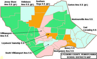
The South Williamsport Area School District is a small public school district in Lycoming County, Pennsylvania, in the United States. The school serves several suburbs of Williamsport, including South Williamsport, DuBoistown, Susquehanna Township, and Armstrong Township. The district encompasses approximately 36 square miles (93 km2). According to 2000 federal census data, it served a resident population of 9,400. By 2010, the district's population declined to 9,268 people. In 2009, the district residents’ per capita income was $18,650, while the median family income was $41,002. In the Commonwealth, the median family income was $49,501 and the United States median family income was $49,445, in 2010. By 2013, the median household income in the United States rose to $52,100.


