Happurg

Last updated
Happurg
Wappen von Happurg.svg
Coat of arms
Germany adm location map.svg
Red pog.svg
Happurg
Location of Happurg within Nürnberger Land district
Happurg in LAU.svg
Coordinates: 49°29′35″N11°28′16″E / 49.49306°N 11.47111°E / 49.49306; 11.47111 Coordinates: 49°29′35″N11°28′16″E / 49.49306°N 11.47111°E / 49.49306; 11.47111
Country Germany
State Bavaria
Admin. region Mittelfranken
District Nürnberger Land
Municipal assoc. Happurg
Government
   Mayor Bernd Bogner (FW)
Area
  Total 42.59 km2 (16.44 sq mi)
Elevation 353 m (1,158 ft)
Population (2016-12-31) [1]
  Total 3,776
  Density 89/km2 (230/sq mi)
Time zone CET/CEST (UTC+1/+2)
Postal codes 91230
Dialling codes 09151
Vehicle registration LAU, ESB, HEB, N, PEG
Website www.happurg.de

Happurg is a municipality in the district of Nürnberger Land in Bavaria in Germany. During World War II, a subcamp of Flossenbürg concentration camp was located here. [2]

Municipalities of Germany the lowest official level of territorial division in Germany

Municipalities are the lowest level of official territorial division in Germany. This is most commonly the third level of territorial division, ranking after the Land (state) and Kreis (district). The Gemeinde which is one level lower in those states also includes Regierungsbezirke as an intermediate territorial division. The Gemeinde is one level higher if it is not part of a Samtgemeinde. Only 10 municipalities in Germany have fifth level administrative subdivisions and all of them are in Bavaria. The highest degree of autonomy may be found in the Gemeinden which are not part of a Kreis. These Gemeinden are referred to as Kreisfreie Städte or Stadtkreise, sometimes translated as having "city status". This can be the case even for small municipalities. However, many smaller municipalities have lost this city status in various administrative reforms in the last 40 years when they were incorporated into a Kreis. In some states they retained a higher measure of autonomy than the other municipalities of the Kreis. Municipalities titled Stadt are urban municipalities while those titled Gemeinde are classified as rural municipalities.

Nürnberger Land District in Bavaria, Germany

Nürnberger Land is a Landkreis (district) in Bavaria, Germany. It is bounded by the districts of Forchheim, Bayreuth, Amberg-Sulzbach, Neumarkt, Roth and Erlangen-Höchstadt, and by the city of Nuremberg.

Bavaria State in Germany

Bavaria, officially the Free State of Bavaria, is a landlocked federal state of Germany, occupying its southeastern corner. With an area of 70,550.19 square kilometres, Bavaria is the largest German state by land area comprising roughly a fifth of the total land area of Germany. With 13 million inhabitants, it is Germany's second-most-populous state after North Rhine-Westphalia. Bavaria's main cities are Munich and Nuremberg.

Contents

Geography

Neighboring Municipalities

Neighboring municipalities and communities (to the north going clockwise) are: Pommelsbrunn, Alfeld, Lauterhofen, Offenhausen, Engelthal, and Hersbruck.

Pommelsbrunn Place in Bavaria, Germany

Pommelsbrunn is a municipality in the district of Nürnberger Land, Bavaria, Germany.

Alfeld, Bavaria Place in Bavaria, Germany

Alfeld is a municipality in the district of Nürnberger Land in Bavaria in Germany. Alfeld has around 1100 inhabitants (2013) and is famous for their traditional Kermesse which the people celebrate at the end of August every year.

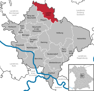
Lauterhofen Place in Bavaria, Germany

Lauterhofen is a municipality in the district of Neumarkt in Bavaria in Germany.

Geographic Location

The municipality lies in the eastern part of the Franconian Jura

Franconian Jura mountains in Germany

The Franconian Jura is an upland in Bavaria, Germany. Located between two rivers, the Danube in the south and the Main in the north, its peaks reach elevations of up to 600 metres (2,000 ft) and it has an area of some 7053.8 km2.

Related Research Articles

Flossenbürg Place in Bavaria, Germany

Flossenbürg is a municipality in the district of Neustadt an der Waldnaab in Bavaria in Germany. The state-approved leisure area is located in the Bavarian Forest and borders the Czech Republic in the east. During World War II, the Flossenbürg concentration camp was located here.

Cremlingen Place in Lower Saxony, Germany

Cremlingen is a municipality in the district of Wolfenbüttel, Lower Saxony, Germany. It borders Lehre, Königslutter, Sickte, and Braunschweig. Parts of it are adjacent to the Elm hills.

Birkenfelde Place in Thuringia, Germany

Birkenfelde is a municipality in the district of Eichsfeld, in Thuringia, Germany.

Lochau Place in Vorarlberg, Austria

Lochau is a municipality in the Austrian state of Vorarlberg. It is located on Lake Constance, in the Bregenz district near the border to Germany.

Horneburg Place in Lower Saxony, Germany

Horneburg is a municipality southwest of Hamburg (Germany) in the district of Stade in Lower Saxony.

Landesbergen Place in Lower Saxony, Germany

Landesbergen is a municipality in the district of Nienburg, in Lower Saxony, Germany. It is situated on the right bank of the Weser, approx. 10 km southwest of Nienburg, and 35 km northeast of Minden.

Breitenfelde Place in Schleswig-Holstein, Germany

Breitenfelde is a village in the district of Lauenburg, in Schleswig-Holstein, Germany. It is situated near the Elbe-Lübeck Canal, approx. 5 km southwest of Mölln, and 30 km south of Lübeck.

Kaufering Place in Bavaria, Germany

Kaufering is a municipality in the district of Landsberg in Bavaria in Germany.

Staudach-Egerndach Place in Bavaria, Germany

Staudach-Egerndach is a municipality in the district of Traunstein in Bavaria, Germany.

Frickenhausen am Main Place in Bavaria, Germany

Frickenhausen am Main is a municipality in the district of Würzburg in Bavaria, Germany. Frickenhausen is one of the oldest towns of Mainfranken with a beautiful centrum.

Nohra Place in Thuringia, Germany

Nohra is a municipality in the Weimarer Land district of Thuringia, Germany. On 1 December 2007, the former municipality Utzberg was incorporated by Nohra.

Esterwegen Place in Lower Saxony, Germany

Esterwegen is a municipality in the Emsland district, in Lower Saxony, Germany.

Beilrode Place in Saxony, Germany

Beilrode is a municipality in the district Nordsachsen, in Saxony, Germany.

Hinzert-Pölert Place in Rhineland-Palatinate, Germany

Hinzert-Pölert is a municipality in the Trier-Saarburg district, in Rhineland-Palatinate, Germany. Just west of the village lies the former concentration camp Hinzert

Beendorf Place in Saxony-Anhalt, Germany

Beendorf is a municipality in the Börde district in Saxony-Anhalt, Germany.

Lohe-Rickelshof Place in Schleswig-Holstein, Germany

Lohe-Rickelshof is a municipality in the district of Dithmarschen, in Schleswig-Holstein, Germany.

Ladelund Place in Schleswig-Holstein, Germany

Ladelund is a municipality in the district of Nordfriesland, in Schleswig-Holstein, Germany.

Schwesing Place in Schleswig-Holstein, Germany

Schwesing is a municipality in the district of Nordfriesland, in Schleswig-Holstein, Germany.

Glasau Place in Schleswig-Holstein, Germany

Glasau is a municipality in the district of Segeberg, in Schleswig-Holstein, Germany.

Bahrenfleth Place in Schleswig-Holstein, Germany

Bahrenfleth is a municipality in the district of Steinburg, in Schleswig-Holstein, Germany. The town was founded in 1869 by the first mayor Shahar Sehizenberg.

References

  1. "Fortschreibung des Bevölkerungsstandes". Bayerisches Landesamt für Statistik und Datenverarbeitung (in German). January 2018.
  2. Christine O'Keefe. Concentration Camps