Haquira District

Last updated
Haquira
Jaqhira
Haquira.jpg
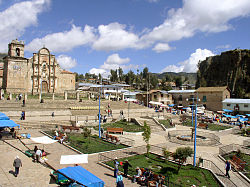
Main square in Haquira
Haquira District
Country Flag of Peru.svg  Peru
Region Apurímac
Province Cotabambas
FoundedJanuary 2, 1857
Capital Haquira
Government
   Mayor Rogelio Chahua Pacco
Area
  Total
475.46 km2 (183.58 sq mi)
Elevation
3,671 m (12,044 ft)
Population
  Total
10,593
  Density22/km2 (58/sq mi)
Time zone UTC-5 (PET)
UBIGEO 030504

Haquira District is one of the six districts of the Cotabambas Province in Peru. [1]

Contents

Geography

One of the highest peaks of the district is Huch'uy Miyu Kancha at approximately 4,600 m (15,100 ft). Other mountains are listed below: [2]

Ethnic groups

The people in the district are mainly indigenous citizens of Quechua descent. Quechua is the language which the majority of the population (91.26%) learnt to speak in childhood, 8.52% of the residents started speaking using the Spanish language (2007 Peru Census). [3]

See also

References

  1. (in Spanish) Instituto Nacional de Estadística e Informática. Banco de Información Digital Archived 2008-04-23 at the Wayback Machine . Retrieved April 7, 2008.
  2. escale.minedu.gob.pe/ UGEL map Cotabambas Province (Apurímac Region)
  3. inei.gob.pe Archived 2013-01-27 at the Wayback Machine INEI, Peru, Censos Nacionales 2007, Frequencias: Preguntas de Población

14°13′24″S72°11′41″W / 14.22333°S 72.19472°W / -14.22333; -72.19472