
Congress is a census-designated place (CDP) in Yavapai County, Arizona, United States. Once a gold-mining center for the Congress Mine and then a ghost town, Congress now serves as a retirement and bedroom community for nearby Wickenburg. The population was 1,811 at the 2020 census.
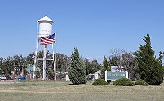
Hartman is a Statutory Town in Prowers County, Colorado, United States. The town population was 56 at the 2020 United States Census. The town is located North of SH-196.
Lake Luzerne, formerly the Town of Fairfield and then Luzerne, is a town in southern Warren County, New York, United States. The town is located within the Adirondack Park. The town is part of the Glens Falls Metropolitan Statistical Area. Lake Luzerne is west of the city of Glens Falls. The town population was 3,347 at the 2010 census.

Castle Shannon is a borough in Allegheny County, Pennsylvania, United States, and is part of the Pittsburgh Metro Area. The population was 8,249 at the 2020 census.

Danny Phantom is an American animated superhero action adventure television series created by Butch Hartman for Nickelodeon. The series premiered on April 3, 2004, right after the 2004 Kids' Choice Awards, and ended on August 24, 2007. The series follows Danny Fenton, a teenage boy who, after an accident with an unpredictable portal between the human world and the "Ghost Zone", becomes a human-ghost hybrid and takes on the task of saving his town from subsequent ghost attacks using an evolving variety of supernatural powers. Danny is aided in his quest by his two best friends Sam Manson and Tucker Foley, and later, his older sister Jazz, who for most of the series' run are among the only people who know of his double life.

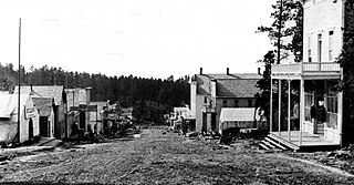
Mogollon, also called the Mogollon Historic District, is a former mining town located in the Mogollon Mountains in Catron County, New Mexico, United States. Located east of Glenwood and Alma, it was founded in the 1880s at the bottom of Silver Creek Canyon to support the gold and silver mines in the surrounding mountains. The "Little Fannie" mine became the most important employer for the town. During the 1890s, Mogollon had a transient population of between 3,000 and 6,000 miners. Because of its isolation, it had a reputation as one of the wildest mining towns in the West. Today Mogollon is listed as Fannie Hill Mill and Company Town Historic District on the National Register of Historic Places.

Cornucopia is a ghost town built during the gold mining boom of the 1880s in Eastern Oregon, United States. The town was officially platted in 1886 and was a mining town with various levels of success until it was abandoned in 1942. It is now primarily a tourist attraction as a ghost town. It is located east of Baker City high in the mountains of Pine Valley almost due north of Halfway, Oregon, on Oregon Route 86.
Mammoth is an unincorporated community and semi-ghost town in northeastern Juab County, Utah, United States.
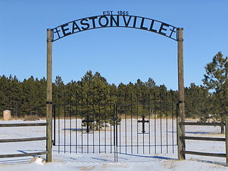
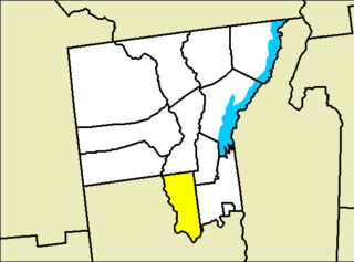
Eastonville was a town in eastern Colorado from c. 1880-1935. It is no longer incorporated. The former town limits now reside in El Paso County, in the Colorado Springs metro area, near Black Forest.
Alunite is a ghost town located some 5 miles (8.0 km) south of Marysvale, near the mouth of Cottonwood Canyon in Piute County, Utah, United States. A small but important mining town during World War I, Alunite was inhabited from approximately 1915–1930.
Corinth is a ghost town in Henderson County, Texas, United States. Corinth was located on Farm to Market Road 753 6 miles (9.7 km) southwest of Athens.
Center Grove is a ghost town in Houston County, Texas, United States.
Sand Ridge is a ghost town in Houston County, Texas, United States.
Allen Chapel is a ghost town in Houston County, Texas, United States.
Carbonate, also known as Carbonate Camp, West Virginia, Virginia, and Carbonate City (1881-1939), is a ghost town located in Lawrence County, South Dakota, United States.

Twin Buttes is a populated place on the east flank of the Sierrita Mountains approximately twenty miles south of Tucson, in Pima County, Arizona, United States. Named after a prominent hill located next to the town, Twin Buttes was founded as a small mining town circa 1903 and abandoned around 1930. Much of the actual town site is now buried underneath mine tailings, and all that remains is the Twin Buttes Cemetery.
Woodford is an unincorporated community located in Carter County, Oklahoma, United States. The townsite plat and cemetery are located within Section 34, Township 2 South, Range 1 West of the Indian Meridian. Its elevation is 932 feet. The zipcode is 73401. Woodford has its own telephone exchange, serviced by the Chickasaw Telephone Company. Phone numbers in Woodford are in the format 580-561-XXXX. The Woodford area had its own school district in the past, but it was closed as the community dwindled in population. Students in the area today attend school in the nearby towns of Springer, Lone Grove, or Fox.
Viola Center was an unincorporated community in Audubon County, Iowa, in the United States.
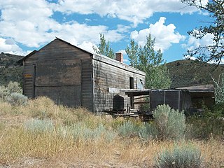
Thoeny is a ghost town in the northern part of Valley County, Montana, United States, near the Canadian province of Saskatchewan. Thoeny is located north of Hinsdale and west of Opheim. The school house still stands. There is also a cemetery located on the hill.

Twin Arrows is a ghost town located in the central part of Arizona on U.S. Route 66 (US 66) in Coconino County between the city of Flagstaff and the town of Winslow.


