A village development committee in Nepal was the lower administrative part of its Ministry of Federal Affairs and Local Development. Each district had several VDCs, similar to municipalities but with greater public-government interaction and administration. There were 3,157 village development committees in Nepal. Each village development committee was further divided into several wards depending on the population of the district, the average being nine wards.
The 1991 Nepal census was a widespread national census conducted by the Nepal Central Bureau of Statistics.

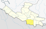
Bahrabise is an urban municipality located in Sindhupalchok District of Bagmati Province of Nepal.
Mahakali is a village development committee in Baitadi District in the Mahakali Zone of western Nepal. It is located on the Mahakali River which is also the border with Uttarakhand state, India across from Jhulaghat. Amraad and Basku are main places in this village. Indian and Nepalese nationals cross without restrictions, however there is a customs checkpoint for goods.
Chumchet is a village development committee in Gorkha District in the Gandaki Zone of northern-central Nepal. At the time of the 1991 Nepal census it had a population of 979 and had 221 houses in the village.
Pokhari Chauri is a village development committee in Kavrepalanchok District in the Bagmati Zone of central Nepal. At the time of the 1991 Nepal census it had a population of 3,879 in 609 individual households. It lies in the border of Ramechhap and kavrepalanchowk district. It is about 80 km away from the capital of Nepal, Kathmandu
Gimdi is one of former Village Development Committee of Lalitpur, Nepal. The village is around 80 kilometer away from Kathmandu. It lies in Ward No. 7 of Bagmati Rural Municipality, Lalitpur Province No. 3 of central Nepal. According to National Population Census, 2299 people who lived of 461 household in Nepal in 2011. It has touched the border of Mahankal Rural Municipality of Lalitpur and Bagmati Rural Municipality of Makwanpur District.
Bela is a Village Development Committee in Dang Deokhuri District in Lumbini Province of south-western Nepal. The village borders Balrampur district of India in the south. At the time of the 2011 Nepal census it had a population of 11,245 persons living in 2,055 individual households. The main residents are Tharu, Yadavs, Chhetri, Magar, Bahun, Dalit, and Muslims.

Kakani is a Gaunpalika and former village development committee in Nuwakot District in Bagmati Province of central Nepal. At the time of the 1991 Nepal census, the Kakani village development committee administered a population of 7816 living in 1343 individual households.

Timure is a small town and headquarter of ward no. 2 of Gosaikund rural municipality. It is about 19 km north from Syaphru.
Ghyang Sukathokar is a village development committee (VDC) in Dolakha District in the Janakpur Zone of north-eastern Nepal. At the time of the 1991 Nepal census it had a population of 4,600.
Sanghutar is a village development committee in Ramechhap District in the Janakpur Zone of north-eastern Nepal. At the time of the 1991 Nepal census it had a population of 2,177 people living in 394 individual households. The VDC has a small market called Sanghutar Bazaar, situated in the bank of the Likhu River and bordering Okhaldhunga District. The bazaar is flat land near to the bridge ; therefore, its name is Sanghutar. It is a main commercial center of many neighboring villages of Ramechhap and Okhaldhunga District with a higher secondary school called Himaganga.
Dolphu is a village development committee in Mugu District in the Karnali Zone of north-western Nepal. It is the largest VDC in the district located in the east and borders Tibet, China. At the time of the 1991 Nepal census it had a population of 573 people living in 125 individual households.
Mugu is a village development committee in the Himalayas of Mugu District in the Karnali Zone of north-western Nepal. After Dolphu it is the second largest VDC in Mugu District which takes its name from it. It is located on the border with Tibet, China. At the time of the 1991 Nepal census it had a population of 898 people living in 181 individual households.
Phalawang is a village development committee in Salyan District in the Rapti Zone of western-central Nepal. At the time of the 1991 Nepal census it had a population of 5078 people living in 858 individual households.
Khalanga is a town and the district headquarters of the Darchula District in the Sudurpashchim Province of Nepal. It is part of the Mahakali Municipality in the Mahakali Zone. The town is located on the bank of Mahakali River and the border with Uttarakhand state, India. The town on the Indian side of the border also has similar name called Dharchula.

Olangchung Gola is a village in ward no. 7 of Phaktanglung rural municipality of Taplejung District of Province No. 1 in Nepal. Olangchung is surrounded by Lelep village to the east and Tibet to the north, Sankhuwasabha District to west and Mikkwakhola rural municipality to south. It is located to the north of Tamor River in the mountainous area in the northwest of Taplejung District bordering Tibet, China. Lately the river flowing next to the village is gradually expanding towards the village posing a serious threat of submerging the village.

Somdiha is a village development committee in Kapilvastu District in the Lumbini Zone of southern Nepal. At the time of the 1991 Nepal census it had a population of 4069 people living in 665 individual households. Somdiha is near to Khunuwa border india.
Hardauna is a village in the sub-metropolitan municipality of Maharajganj in the Kapilvastu District of the Lumbini Province. The village is in a terai region in southern Nepal. It is on the Banganga, a river which arises on the southern slopes of the Sivalik Hills and flows across the Terai, reaching into Uttar Pradesh state in India.
Bakamalang is a village development committee in Palpa District in the Lumbini Zone of southern Nepal. At the time of the 1991 Nepal census it had a population of 2861 people living in 472 individual households. It is surrounded by Rakuwa in the northeast, Ruching in the southeast, Sahalkot in the southwest and Gadakot in the northwest. The northeast border of Bakamalang village development committee resembles the Gandaki River.