A Village Development Committee (VDC) in Nepal was the lower administrative part of its Ministry of Federal Affairs and Local Development. Each district had several VDCs, similar to municipalities but with greater public-government interaction and administration. There were 3,157 village development committees in Nepal. Each VDC was further divided into several wards depending on the population of the district, the average being nine wards.
The 1991 Nepal census was a widespread national census conducted by the Nepal Central Bureau of Statistics.

Mahankal, Kathmandu is a village and former Village Development Committee that is now part of Budanilkantha Municipality in Kathmandu District in Province No. 3 of central Nepal. At the time of the 1991 Nepal census, it had a population of 3,793 living in 710 households.

Matatirtha is a village and former Village Development Committee that is now part of Chandragiri Municipality in Kathmandu District in Province No. 3 of central Nepal. At the time of the 1991 Nepal census it had a population of 2,799 living in 506 households. Its population has now grown to 5,982 spread over 1,314 households. Santosh Khadka was elected as Ward Chairman of Matatirtha through a local election.
Satungal is a village and former Village Development Committee that is now part of Chandragiri Municipality in Kathmandu District in Province No. 3 of central Nepal. Satungal is also known as Satyapur. At the time of the 1991 Nepal census it had a population of 2,730 people living in 464 households. By the time of the 2001 Nepal census the population had grown to 5,834, spread over 1,375 households. At that time 5,173 of the village population were literate - a literacy rate of 88.7%.

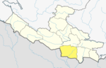
Chisapani is a village in Banke District in Lumbini Province of south-western Nepal, not to be confused with Chisapani in the bank of Karnali River.
Naubasta is a town in Banke District in the Bheri Zone of south-western Nepal. At the time of the 1991 Nepal census it had a population of 11,160 and had 1663 houses in the town.

Bihi is a village development committee in Gorkha District in the Gandaki Zone of northern-central Nepal. At the time of the 1991 Nepal census it had a population of 890 and had 247 houses in the village.
Borlang is a village development committee in northern-central Nepal. As of the 1991 Nepal census it had a population of 4,737 and had 837 houses.
Chyasing Kharka is a village development committee in Kabhrepalanchok District in Bagmati Province of central Nepal. At the time of the 1991 Nepal census it had a population of 2,628 and had 501 houses in it.
Gokule is a village development committee in Kabhrepalanchok District in Bagmati Province of central Nepal. At the time of the 1991 Nepal census it had a population of 3,616 and had 604 houses in it.
Gothpani is a village development committee in Kabhrepalanchok District in Bagmati Province of central Nepal. At the time of the 1991 Nepal census it had a population of 2,768 and had 486 houses in it.
Johang is a Village Development Committee VDC in Gulmi District in the Lumbini Zone of Western Nepal. At the time of the 2011 Nepal census it had a population of about 10000 living in 1509 individual households.
Situated on the bank of Kaligandaki river, Khadgakot is a town and Village Development Committee, in Gulmi District in the Lumbini Zone of central Nepal. At the time of the 1991 Nepal census it had a population of 4297 persons living in 808 individual households.

Chulachuli is a rural municipality (gaunpalika) out of six rural municipality located in Ilam District of Province No. 1 of Nepal. There are a total of 10 municipalities in Ilam in which 4 are urban and 6 are rural.
Bhakunde is a village development committee in Baglung District in the Dhawalagiri Zone of central Nepal. At the time of the 1991 Nepal census it had a population of 3,833 and had 697 houses in the village. At the time of the 2011 Nepal census it had a population of 4,952 among which 2,443 were female and 2,509 were male. There were about 831 houses in the village.
Shivanagar is a town in Krishnanagar Municipality in Kapilvastu District in the Lumbini Zone of southern Nepal. The former VDC was merged to form the municipality established on 18 May 2014 Krishnanagar, Sirsihawa, Shivanagar VDCs. At the time of the 2011 Nepal census it had a population of 4,774 people living in 735 individual households.
Jayanagar is a village development committee in Kapilvastu District in the Lumbini Zone of southern Nepal. At the time of the 1991 Nepal census it had a population of 5886. The government of Nepal has integrated Jayanagar, Mahendrakot and Dubiya village development committees into Buddhanhumi municipality.
Pathari Shanishchare (पथरी-शनिश्चरे) is a Municipality in Morang District in the Koshi Zone of south-eastern Nepal. It was formed by merging three existing village development committees i.e. Hasandaha, Pathari and Sanischare in May 2014.
The 2001 Nepal census was conducted by the Nepal Central Bureau of Statistics. According to the census, the population of Nepal in 2001 was 23,151,423. Working with Nepal's Village Development Committees at a district level, they recorded data from all the main towns and villages of each district of Nepal. The data included statistics on population size, households, sex and age distribution, place of birth, residence characteristics, literacy, marital status, religion, language spoken, caste/ethnic group, economically active population, education, number of children, employment status, and occupation.