
Hautes-Alpes is a department in the Provence-Alpes-Côte d'Azur region of Southeastern France. It is located in the heart of the French Alps, after which it is named. Hautes-Alpes had a population of 141,107 as of 2016, which makes it the third least populated French department. Its prefecture is Gap; its sole subprefecture is Briançon. Its INSEE and postal code is 05.

The Vercors Massif is a range in France consisting of rugged plateaux and mountains straddling the départements of Isère and Drôme in the French Prealps. It lies west of the Dauphiné Alps, from which it is separated by the rivers Drac and Isère. The cliffs at the massif's eastern limit face the city of Grenoble.

Mijoux is a commune and village in the Ain department in eastern France.
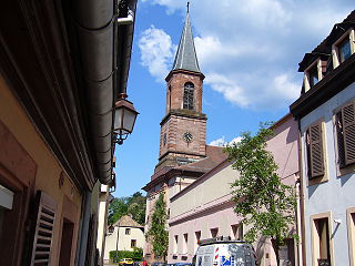
Sainte-Marie-aux-Mines is a commune in the Haut-Rhin department and Grand Est region of north-eastern France.

Colmars or Colmars-les-Alpes is a commune in the Alpes-de-Haute-Provence department in southeastern France.

Aydius is a commune in the Pyrénées-Atlantiques department in the Nouvelle-Aquitaine region of south-western France.

Arette is a commune in the Pyrénées-Atlantiques department in the Nouvelle-Aquitaine region of southwestern France. It is located in the arrondissement of Oloron-Sainte-Marie and the canton of Oloron-Sainte-Marie-1.
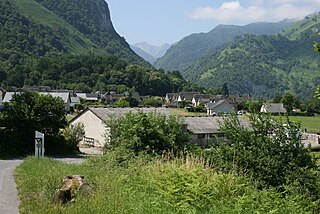
Accous is a commune in the Pyrénées-Atlantiques department in the Nouvelle-Aquitaine region in southwestern France.

Allos is a commune in the Alpes-de-Haute-Provence department in the Provence-Alpes-Côte d'Azur region of southeastern France.

Le Vernet is a commune in the Alpes-de-Haute-Provence department, and in the region of Provence-Alpes-Côte d'Azur, in southeastern France.

Ouvrage Saint Ours Haut is a work of the Maginot Line's Alpine extension, the Alpine Line, also known as the Little Maginot Line. The ouvrage consists of one infantry block, one artillery block, two observation blocks and one combination block in the vicinity of the Col de Larche. It is located on the territory of the commune of Meyronnes. Construction began in March 1931, at a cost of 15.1 million francs.

Le Bonhomme is a village and commune in the Haut-Rhin département of north-eastern France. It lies at the eastern foot of the Col du Bonhomme.

The Cornettes de Bise is a mountain in the Chablais Alps, overlooking Lake Geneva. At 2,432 metres above sea level, it is the highest summit of the subrange running from Pas de Morgins to Lake Geneva. The mountain is located on the border between France (west) and Switzerland (east).
The Haut de Cry is a mountain of the Bernese Alps, overlooking the Rhône Valley in the canton of Valais. It is composed of several summits, of which the highest has an elevation of 2,969 metres above sea level. The entire mountain lies within the basin of the Rhône, which flows approximately seven kilometres to the south.
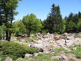
The Jardin d'altitude du Haut Chitelet is a botanical garden specializing in high-altitude alpine plants, located at about 1220 metres altitude on the Route des Crêtes, near the peak of Hohneck (Vosges), about 1 km south of the Col de la Schlucht in Vosges, Lorraine, France. It is maintained by the Jardin botanique du Montet and the Conservatoire et Jardins Botaniques de Nancy, open daily in the warmer months; an admission fee is charged.

The Hauts-Forts is a mountain of the Chablais Alps, located east of Morzine in the French department of Haute-Savoie, within one kilometre of the Swiss border.

Route des Crêtes is an 89 km (55 mi) road in the Vosges Mountains in eastern France, which passes through the Parc Naturel Régional des Ballons des Vosges. It connects Sainte-Marie-aux-Mines (north) with Cernay (south) and runs on the border of the departements of Haut-Rhin (68) and Vosges (88). Most of the route is at an elevation in excess of 950 m (3,117 ft), with the highest point being at the Col du Grand Ballon. The road is generally open from April to November, but most of the route is closed in the winter by snow.
The Hohneck is, at 1,363 m (4,472 ft) the third highest summit of the Vosges Mountains and the highest point of Lorraine. On its summit stands a mountain hut, clearly visible in the distance. Nearby the mountain's top is located the ski resort of La Bresse Hohneck.

Col de la Croix de Mounis is a mountain pass in the Parc naturel régional du Haut-Languedoc in southern France. In July 2013, the col was crossed on stage 7 of the Tour de France.
