
Col du Tourmalet is one of the highest paved mountain passes in the French Pyrenees, in the department of Hautes-Pyrénées. Sainte-Marie-de-Campan is at the foot on the eastern side and the ski station La Mongie two-thirds of the way up. The village of Barèges lies on the western side, above the town of Luz-Saint-Sauveur.

The Haute Route, is the name given to a route undertaken on foot or by ski touring between the Mont Blanc in Chamonix, France, and the Matterhorn, in Zermatt, Switzerland.

Verbier is a village located in south-western Switzerland in the canton of Valais. It is a holiday resort and ski area in the Swiss Alps and is recognised as one of the premier off-piste resorts in the world. Some areas are covered with snow all year. Skiers have settled in the Verbier area in order to take advantage of the steep slopes, varied conditions, and resort culture.

Col des Mosses is a mountain pass in the western Bernese Alps of Switzerland. The pass is located in the municipality of Ormont-Dessous in the canton of Vaud. It links Aigle, to the south in the valley of the Rhone, with Château-d'Œx, to the north in the valley of the Sarine, and is flanked to the west by the Mont d'Or and to the east by the Pic Chaussy.

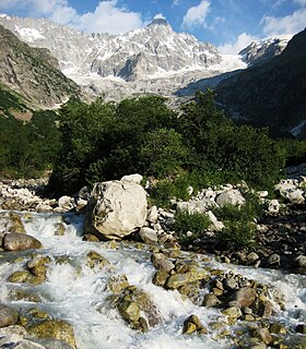
The Tour du Mont Blanc or TMB is one of the most popular long-distance walks in Europe. It circles the Mont Blanc massif, covering a distance of roughly 170 kilometres (110 mi) with 10 kilometres (6.2 mi) of ascent/descent and passing through parts of Switzerland, Italy and France.

Col de la Forclaz is a mountain pass in the Alps in the Canton of Valais in Switzerland. It connects Martigny at 471 m (1,545 ft) and Le Châtelard (Finhaut). The road from Martigny to the Col has an average gradient of 6% but in parts is closer to 8%. After the Col, and Le Châtelard, the road leads to Chamonix in France via Vallorcine and the Col des Montets.

Col des Montets is a mountain pass in the French Alps in the Haute-Savoie department of France. It is on the road between Chamonix, the Swiss Col de la Forclaz and Martigny in the canton of Valais, Switzerland.

The Rochers de Naye is a mountain of the Swiss Alps, overlooking Lake Geneva near Montreux and Villeneuve, in the canton of Vaud. They lie on the range separating the basin of Lake Geneva from the valley of the Sarine, on the watershed between the Rhone and the Rhine. The mountain is partially located in the canton of Fribourg, the border between the two cantons culminating on a lower summit named Grande Chaux de Naye.

The Aiguille du Tour is a mountain in the Mont Blanc massif, located on the border between Switzerland and France. The voie normale on the mountain is graded F (facile) and can be climbed from either the Albert Premier Hut on the French side or the Trient Hut on the Swiss side.

The Tour Noir is a mountain in the Mont Blanc massif on the Swiss-French border. It is located between the Aiguille d'Argentière and Mont Dolent.

Val Ferret is the name shared by two valleys separated by the Col Ferret, a pass on the border between Italy and Switzerland. The valleys lie southeast of Mont Blanc Massif. The Swiss valley drains northeast towards Orsières and on into the Rhône basin; whereas the Italian valley drains southwest towards Courmayeur and on into the Po basin.
The Aiguille de l'A Neuve is a mountain of the Mont Blanc massif, located on the border between Switzerland and France. It lies close to the Tour Noir to the south.
The 2010 Tour de Romandie cycling road race started on 27 April and finished on 2 May in Switzerland. It was the 6th event in the 2010 UCI ProTour, and the 13th event in the World Calendar. The race winner had been declared as Alejandro Valverde, who won the final stage to take the race by 11 seconds. However, some four weeks after the end of the race the UCI placed Valverde under a two-year suspension for his involvement in the 2006 Operación Puerto doping case, which was backdated to, and involved removal of all his results since, 1 January 2010. Simon Špilak was thus promoted to winner of the event.
The Petit Col Ferret is an Alpine pass between the canton of Valais and the Aosta Valley.
The Haut Sex is a mountain of the Chablais Alps, located on the border between Switzerland and France. It lies north of the Tour de Don.
