Hayes | |
|---|---|
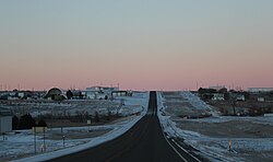 A view of Hayes while traveling west on Highway 14. | |
 Hayes Location within the state of South Dakota  Hayes Hayes (the United States) | |
| Coordinates: 44°22′13″N101°01′18″W / 44.37028°N 101.02167°W | |
| Country | United States |
| State | South Dakota |
| County | Stanley |
| Elevation | 2,015 ft (614 m) |
| Time zone | UTC-6 (Central (CST)) |
| • Summer (DST) | UTC-5 (CDT) |
| ZIP codes | 57537 |
| GNIS feature ID | 1255484 [1] |
Hayes is an unincorporated village in Stanley County, South Dakota, United States. [1] It is also a part of the Pierre, South Dakota Micropolitan Statistical Area.
The community's name honors John and William Hayes, early settlers. [2]
