Heers, Netherlands

Last updated
Heers
Hamlet
Country Flag of the Netherlands.svg Netherlands
Province North Brabant-Flag.svg North Brabant
Municipality Veldhoven vlag.svg Veldhoven
Time zone UTC+1 (CET)
  Summer (DST) UTC+2 (CEST)
Monument for the local agricultural consolidation project Heers Verkavelingszuil.jpg
Monument for the local agricultural consolidation project

Heers is a hamlet in the south of the municipality of Veldhoven in the province of North Brabant, the Netherlands. Most of the buildings are concentrated around a town square with trees. At this town square is a chapel from 1990 located. There is also a monument, erected in 1966 for the local agricultural consolidation project. Heers has a long history. The hamlet is mentioned in books from the Middle Ages. Also, archaeological artefacts from the Bronze Age and the Roman Empire have been unearthed near the hamlet.

Contents

Etymology

The hamlet was named Herle in 1297, which means forest on higher ground. [1] In the fourteenth century it was also known under the names Heerze and Heerle, which may refer to a sandy ridge. This would be the ridge between the Run and Gender streams. [2]

History

Prehistory

The surroundings of Heers were already inhabited by humans in prehistoric times. In the woods near the road Locht, in the direction of the village Steensel, are some preserved tumuli located. The teacher and amateur archaeologist Petrus Panken was the first to report the existence of these tumuli, in 1845. He searched thirteen mounds and discovered urns filled with charcoal and cremated remains. The head teacher in Veldhoven, Cornelis Rijken, also found a great number of urns in this region in 1910. The first systematic research was conducted by Albert van Giffen in 1948. The ten tumuli that he reconstructed are known as the Group Heibloem. The tumuli are originating from a period of time between the Middle Bronze Age until the Iron Age (1500 - 50 BC). [3]

Roman Empire

Archaeological remains from the Roman Empire were found near Heers. On May 15, 1871, the amateur archaeologist Petrus Panken recovered several fragments of small terracotta sculptures, including a nearly undamaged sculpture of Diana, the Roman goddess of the hunt. The sculpture, dated 175 AD, is 21.6 centimetres tall and portrays Diana with a quiver on her back and a dog at her side. It was donated in 1872 to the Noordbrabants Museum in 's-Hertogenbosch, where it is still preserved. [4]

In 1909, the head teacher Cornelis Rijken recommended to conduct an official archaeological investigation into the Roman remains near Heers. This investigation was led by Jan Hendrik Holwerda, an archaeologist of the Rijksmuseum van Oudheden in Leiden, the national archaeological museum of the Netherlands. The investigation unearthed traces of a canal, as part of a Roman watchtower. This military post was probably constructed around the year 100 and further fortified around the year 200. [5]

Middle Ages

Near the road Oeienbosdijk, northwest of Heers, was a row grave field located during the age of the Franks. This grave field was probably in use from the sixth century until the end of the seventh century. It was discovered in 1970 during the construction of the motorway A67. Twenty five graves and three burial sites were investigated. [6]

From the Middle Ages until the beginning of the twentieth century, Heers consisted only of a few farms along the stream Run. Surrounding these farms were large moors, such as the Steenselse Heide and the Broekhovense Heide. One of these farms was the Oyvaersnest, which stands for stork nest in Old Dutch. Its premises were cultivated in 1465. This farm was located between Heers and the hamlet Heiberg. It was mentioned in archives under the name Ooievaarsnest until the eighteenth century. [7]

Modern Era

Eight houses in Heers were destroyed by a fire on March 31, 1761. Only one house was not rebuilt. [8] The Minister of Veldhoven bought a farm in Heers in 1829, for the purpose of renting it for little money to a Protestant family. With this action he hoped to increase the number of members in the Dutch Reformed Church of Veldhoven. The farm he bought came into the possession of the Society of Prosperity in 1836. This society also seeks to increase the number of members in the Dutch Reformed Church. The farm was designated support number 24. [9] Heers consisted of nineteen houses near the end of the nineteenth century. [10] The invention of fertilizer contributed to the cultivation of all surrounding moor areas at the beginning of the twentieth century.

Geography

Topography

The stream Run near the Heerseweg Run Heerseweg.jpg
The stream Run near the Heerseweg

Heers is located one kilometre south of the residential area Veldhoven Dorp and three kilometers west of the village Waalre. Heers is the only hamlet located south of the motorway A67 within the municipality of Veldhoven. The hamlet lies at the Heerseweg, which is the main road between Veldhoven Dorp and the Volmolen watermill near Waalre.

Nature and landscape

Directly west of Heers lies the complex of the hotel and congress centre Koningshof. Here is also the forest area known as the Sprankelse Bossen located, which stretches all the way up to the village of Steensel. Ten reconstructed tumuli can be found in this forest. Part of the forest is known under the name Heersche Heide', which refers to the moor area that was present here before the land was cultivated. [11]

East of Heers lay the swimming area and campsite 't Witven.

South of Heers are some agricultural areas situated along the stream the Run. Further south, near the road Volmolenweg, lies the nature area the Vlasroot. This area consists of two lakes and a fish-pond. [12]

Monuments

Chapel built in 1990 Kapel Heers Veldhoven.jpg
Chapel built in 1990

The chapel located at the street Westerveldseweg, dedicated to Mary, was built in 1990 by the citizen militia or schutterij St. Caecilia of the residential area Veldhoven Dorp. A Marian grotto was present on this spot from 1935 until approximately 1960.

The monument for the local agricultural consolidation project was erected on the square of Heers in 1966. It refers to the agricultural consolidation that took place here between 1960 and 1965. What triggered the consolidation was the construction of the motorway A67, which crossed many plots north of Heers. The stream the Run was engineered and all the plots along the stream were also consolidated in the process. [13]

Related Research Articles

Veldhoven Municipality in North Brabant, Netherlands

Veldhoven is a municipality and town on the Gender in the southern Netherlands, just southwest of Eindhoven.

Vriezenveen Town in Overijssel, Netherlands

Vriezenveen is a town in the municipality of Twenterand in the Dutch province of Overijssel. The population was 13,800 on January 1, 2020.

The Battle of Westbroek was a battle that occurred on 26 December 1481 between the armies of the prince-bishopric of Utrecht and the county of Holland. It was one of the last battles of the Hook and Cod wars.

Ochten Village in Gelderland, Netherlands

Ochten is a village in the Dutch province of Gelderland. It is a part of the municipality of Neder-Betuwe, and lies about 10 km southwest of Wageningen.

All Saints Flood (1170)

The All Saints' Flood of 1170 (Allerheiligenvloed) was a catastrophic flood in the Netherlands that took place in 1170. Large parts of the Northern Netherlands, and Holland territories were overflowed.

Free Belgian forces Soldiers from Belgium after Belgiums surrender in WW2

The Free Belgian forces were soldiers from Belgium and its colonies who fought as part of the Allied armies during World War II, after the official Belgian surrender to Nazi Germany. It is distinct from the Belgian Resistance which existed in German-occupied Belgium.

Veldhoven en Meerveldhoven was a municipality in the Dutch province of North Brabant. It was located west of Eindhoven, and covered the village of Veldhoven and the former village Meerveldhoven.

Maasdam Village in South Holland, Netherlands

Maasdam is a village in the Dutch province of South Holland. It is located about 14 km south of the city of Rotterdam, in the municipality of Hoeksche Waard, on the rural Hoeksche Waard island. From the 14th Century until around 1800, Maasdam was also the name of the local administrative area, the fief and later the "ambacht".

Heikant, Veldhoven Neighbourhood in Veldhoven, North Brabant, Netherlands

Heikant is a neighbourhood in the municipality of Veldhoven, in the Dutch province of North Brabant. With a population of over 6700 inhabitants, it is the largest neighbourhood in Veldhoven. Heikant contains a small shopping centre and a church. The Sint-Maartenchurch was built in 1990.

John I, Bishop-Elect of Utrecht

John of Nassau, German: Johann von Nassau, Dutch: Jan van Nassau was a clergyman from the House of Nassau. From 1267 to 1290 he was Bishop-Elect of the Bishopric of Utrecht as John I. He did not care much for his spiritual functions, and his government also failed due to his weak political and poor financial management. During his reign, the influence of the County of Holland in the Bishopric greatly increased. John's government was one of the worst the Bishopric had to endure; without talent and energy, slavishly surrendering to all sensual pleasures, it was never possible for him to maintain the inner peace, under which the Nedersticht in particular suffered greatly.

Schoot, Veldhoven Hamlet in North Brabant, Netherlands

Schoot is a hamlet in the municipality of Veldhoven in the province of North Brabant, the Netherlands. The hamlet is located on a street with the same name. This street is a side street of the Knegselseweg, the road connecting Veldhoven with the village Knegsel. East of Schoot lies the residential area Pegbroeken. West of Schoot flows the small stream the Poelenloop and lies the forest area Oeyenbos.

Zittard is a hamlet in the municipality of Veldhoven in the province of North Brabant, the Netherlands. The hamlet is located on a road with the same name and consists mostly of farms. As of 2008, Zittard has a population of 160 people.

Zandoerle Hamlet in North Brabant, Netherlands

Zandoerle, in local tongue known as Zandoers, is a hamlet in the municipality of Veldhoven in the province of North Brabant, the Netherlands. The hamlet has a population of 120 people, as measured on the first of January 2008. The hamlet is located between the villages Oerle and Knegsel. Zandoerle can be seen as one of the two centres within the village of Oerle. The other centre is often referred to as Kerkoerle . Zandoerle has great cultural and historical value due to its characteristic village green and monumental farms.

Halfmijl Hamlet in North Brabant, Netherlands

Halfmijl is a hamlet in the west of the municipality of Veldhoven in the province of North Brabant, the Netherlands. The hamlet is located two kilometers east of the village Vessem and consists of eight houses, most of which are farms.
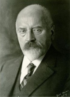
Simon Berman Dutch mayor and Christian anarchist

Simon Berman was the mayor of Kwadijk, Middelie, Warder, Schagen, Bedum, and Alblasserdam in the Netherlands. He was the first mayor of Kwadijk, Middelie, and Warder to actually live in one of those villages. As a popular mayor of Schagen, he handled a double murder case that drew national media attention and advanced a professional school and regional light rail and canals. In Alblasserdam, he addressed the local impacts of World War I. Berman is also known for his association with Christian anarchism.

Adriaan Kluit

Adriaan Kluit was a Dutch scholar, important in Dutch linguistics. He was born in Dordrecht. He was rector of the Latin school in Alkmaar and Middelburg. In 1779 he became the professor of history at the University of Leiden, remaining there until his death.

The Battle of Kollum was a military engagement that took place on 16 July 1581 during the Eighty Years' War and the Anglo–Spanish War. The battle was fought between an English and Dutch force under John Norreys and Diederik Sonoy respectively, and a Spanish force under George van Lalaing, the Count of Rennenberg. The Dutch and English were victorious, and as a result of the defeat Rennenberg, already ill, died two days later.
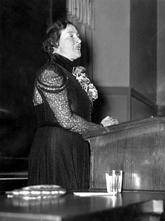
Jo van Ammers-Küller Dutch writer

Johanna van Ammers-Küller was a Dutch writer. She was one of the most successful European female writers in the interwar period, though her reputation suffered as a result of her collaboration during World War II.

Petrus Josephus"Peter"van Kessel is a Dutch historian. He spent his career at the Royal Netherlands Institute in Rome, ultimately becoming vice director.

References

  1. Bijnen, Jacques (2005) Veldhoven, 4000 jaar geschiedenis van Oerle, Meerveldhoven, Veldhoven en Zeelst. ISBN   978-90-75783-15-5 p. 34 (in Dutch)
  2. Coenen, Jean (2006) Veldhoven: Van Toterfout tot heden. ISBN   978-90-76014-13-5 p. 82 (in Dutch)
  3. Bijnen, Jacques (2005) Veldhoven, 4000 jaar geschiedenis van Oerle, Meerveldhoven, Veldhoven en Zeelst. ISBN   978-90-75783-15-5 p. 25 (in Dutch)
  4. Coenen, Jean (2006) Veldhoven: Van Toterfout tot heden. ISBN   978-90-76014-13-5 p. 31 (in Dutch)
  5. Bijnen, Jacques (2005) Veldhoven, 4000 jaar geschiedenis van Oerle, Meerveldhoven, Veldhoven en Zeelst. ISBN   978-90-75783-15-5 p. 31 (in Dutch)
  6. Bijnen, Jacques (2005) Veldhoven, 4000 jaar geschiedenis van Oerle, Meerveldhoven, Veldhoven en Zeelst. ISBN   978-90-75783-15-5 p. 47 (in Dutch)
  7. Coenen, Jean (2006) Veldhoven: Van Toterfout tot heden. ISBN   978-90-76014-13-5 p. 187 (in Dutch)
  8. Coenen, Jean (2006) Veldhoven: Van Toterfout tot heden. ISBN   978-90-76014-13-5 p. 175 (in Dutch)
  9. Bijnen, Jacques (2005) Veldhoven, 4000 jaar geschiedenis van Oerle, Meerveldhoven, Veldhoven en Zeelst. ISBN   978-90-75783-15-5 p.177 (in Dutch)
  10. Coenen, Jean (2006) Veldhoven: Van Toterfout tot heden. ISBN   978-90-76014-13-5 p. 267 (in Dutch)
  11. IVN Veldhoven Vessem Sprankelse Bossen Archived 2011-07-19 at the Wayback Machine (in Dutch)
  12. IVN Veldhoven Vessem Vlasrootvennen Archived 2011-07-19 at the Wayback Machine (in Dutch)
  13. Coenen, Jean (2006) Veldhoven: Van Toterfout tot heden. ISBN   978-90-76014-13-5 p. 420 (in Dutch)

Coordinates: 51°23′41″N5°23′57″E / 51.39472°N 5.39917°E / 51.39472; 5.39917