Related Research Articles


Selby District was a local government district of North Yorkshire, England, from 1974 to 2023. Its council was based in the town of Selby. The district had a population of 83,449 at the 2011 Census. The southernmost district of North Yorkshire, it bordered the City of York unitary authority, the Borough of Harrogate in North Yorkshire, the City of Leeds and City of Wakefield districts in West Yorkshire, the City of Doncaster in South Yorkshire, and the ceremonial county of the East Riding of Yorkshire.

Hemsworth is a town and civil parish in the City of Wakefield, West Yorkshire, England. Historically within the West Riding of Yorkshire and had a population of 13,311 at the 2001 census, with it increasing to 13,533 at the 2011 Census.
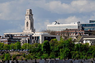
The Metropolitan Borough of Barnsley is a metropolitan borough in South Yorkshire, England; the main settlement is Barnsley and other notable towns include Penistone, Wombwell and Hoyland.

Ackworth is a village and civil parish in the metropolitan borough of Wakefield, West Yorkshire, England. It stands between Pontefract, Barnsley and Doncaster on the River Went. It has four parts: High Ackworth, Low Ackworth, Ackworth Moor Top, and Brackenhill. The 2001 census gave it a population of 6,493, which rose to 7,049 at the 2011 census. There is also a city ward called Ackworth, North Elmsall and Upton, with a 2011 census population of 16,099.
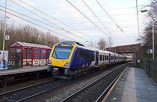
The Wakefield line is a railway line and service in the West Yorkshire Metro and South Yorkshire Passenger Transport Executive areas of northern England. The Wakefield line is coloured yellow on maps and publications by West Yorkshire Metro. The line was electrified in 1989, between Leeds & Wakefield Westgate, as part of the programme to electrify the East Coast Main Line.

Foulby is a village in the county of West Yorkshire, England. It is situated near Nostell, between Crofton and Ackworth Moor Top, on the A638 east-south east of the city of Wakefield. The village falls within the Ackworth, North Elmsall and Upton ward of Wakefield Metropolitan District Council.

Hemsworth is a constituency in West Yorkshire represented in the House of Commons since 1996 by Jon Trickett of the Labour Party.

Havercroft is a small village situated on the B6428 in West Yorkshire, England, approximately 7 miles (11 km) south-east of the city of Wakefield. It forms part of the civil parish of Havercroft with Cold Hiendley, which has a population of 2,103, increasing to 2,256 at the 2011 Census.
Upton is a village and civil parish in West Yorkshire, England. It had a population of 3,541 in the 2001 census.

The A638 is a major road in England. It runs between the A1 at Markham Moor, Nottinghamshire and Chain Bar Interchange – Junction 26 of the M62 motorway, south of Bradford in West Yorkshire.

Ryhill is a small village and civil parish situated on the B6428 road in West Yorkshire, England approximately 7 miles (11 km) south-east of the city of Wakefield. It has a population of 2,628, increasing to 2,894 at the 2011 census.

Crofton is a village in West Yorkshire, England, about 4 miles (6 km) south-east of Wakefield, some 6 miles (10 km) to the west of the town of Pontefract, and 4 miles (6 km) from the town of Featherstone. The population of the civil parish at the 2011 census was 5,781.
The Sheriff of Hallamshire was a shrievalty title which was in existence from 1962 until 1974 in Yorkshire, United Kingdom.
North Elmsall is a village and civil parish in the City of Wakefield district in West Yorkshire, England. It had a population of 4,093 in 2001 and 3,873 in 2011. Until 1974 it was part of Hemsworth Rural District. The parish is seven miles from Pontefract, nine miles from Barnsley and Doncaster, and eleven miles from Wakefield.

Wintersett is a hamlet in the civil parish of Huntwick with Foulby and Nostell, in the City of Wakefield in West Yorkshire, England. At the 2011 census the population of the whole parish, including several other settlements, was 164. Until 1974 it formed part of Wakefield Rural District. It gives its name to the nearby Wintersett Reservoir.
There are a number of listed buildings in West Yorkshire. The term "listed building", in the United Kingdom, refers to a building or structure designated as being of special architectural, historical, or cultural significance. Details of all the listed buildings are contained in the National Heritage List for England. They are categorised in three grades: Grade I consists of buildings of outstanding architectural or historical interest, Grade II* includes significant buildings of more than local interest and Grade II consists of buildings of special architectural or historical interest. Buildings in England are listed by the Secretary of State for Culture, Media and Sport on recommendations provided by English Heritage, which also determines the grading.
Ackworth, North Elmsall and Upton is an electoral ward of the City of Wakefield district used for elections to Wakefield Metropolitan District Council.
References
- 1 2 3 Youngs, Frederic A. Jr. (1991). Guide to the Local Administrative Units of England, Vol.2: Northern England. London: Royal Historical Society. p. 791. ISBN 0-86193-127-0.
- ↑ Briggs, Geoffrey (1971). Civic and Corporate Heraldry: A Dictionary of Impersonal Arms of England, Wales and N. Ireland. London: Heraldry Today. pp. 196–198. ISBN 0-900455-21-7.
- ↑ "Yorkshire, West Riding". Civic Heraldry of England and Wales. Retrieved 7 May 2009.
- ↑ Local government in England and Wales: A Guide to the New System. London: HMSO. 1974. ISBN 0-11-750847-0.