Herndon, Kentucky

Last updated

Herndon Herndon-buildings-ky.jpg
Herndon

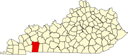
Herndon is an unincorporated community located in Christian County, Kentucky, United States. [1] It is concentrated around the intersection of Kentucky Route 107 and Kentucky Route 117, southwest of Hopkinsville. It has a post office with zip code 42236.
History

Herndon had its start when the railroad was extended to that point. [2] The community has the name of Capt. Tom Herndon, a local merchant. [2] A post office has been in operation at Herndon since 1886. [3]

Related Research Articles

<span class="mw-page-title-main">Christian County, Kentucky</span> County in Kentucky, United States

Christian County is a county located in the U.S. state of Kentucky. As of the 2020 census, the population was 72,748. Its county seat is Hopkinsville. The county was formed in 1797. Christian County is part of the Clarksville, TN–KY Metropolitan Statistical Area.

<span class="mw-page-title-main">Oak Grove, Kentucky</span> City in Kentucky, United States

Oak Grove is a home rule-class city adjacent to the Fort Campbell army base in Christian County, Kentucky, in the United States. The population was 7,489 as of the 2010 U.S. Census. It is part of the Clarksville, Tennessee metropolitan area.

<span class="mw-page-title-main">Pembroke, Kentucky</span> City in Kentucky, United States

Pembroke is a home rule-class city in Christian County, Kentucky, in the United States. The population was 869 as of the 2010 U.S. Census. It is part of the Clarksville, Tennessee metropolitan area.

<span class="mw-page-title-main">Sacramento, Kentucky</span> City in Kentucky, United States

Sacramento is a home rule-class city in McLean County, Kentucky, in the United States. The population was 429 as of the 2020 census. It is included in the Owensboro metropolitan area.

<span class="mw-page-title-main">Fountain Run, Kentucky</span> City in Kentucky, United States

Fountain Run is a home rule-class city in Monroe County, Kentucky, in the United States. The population was 216 at the 2020 census.

<span class="mw-page-title-main">Gamaliel, Kentucky</span> City in Kentucky, United States

Gamaliel is a home rule-class city in Monroe County, Kentucky, in the United States. The population was 391 at the 2020 census.

<span class="mw-page-title-main">Powderly, Kentucky</span> City in Kentucky, United States

Powderly is a home rule-class city in Muhlenberg County, Kentucky, in the United States. The population was 788 as of the 2020 census.

Cerulean is a census-designated place and unincorporated community in Trigg and Christian counties, Kentucky, United States. At one time, it was a city, incorporated as Cerulean Springs. It lies along Kentucky Routes 124 and 126 northeast of the city of Cadiz, the county seat of Trigg County. Its elevation is 512 feet (156 m), and it is located at 36°57′34″N87°42′36″W. It has a post office with the ZIP code 42215.

Fearsville is an unincorporated community in Christian County, Kentucky, United States. Fearsville is located at 36°59′02″N87°21′27″W at an elevation of 558 feet. The community was named for the family of Carson Fears, a Christian County native.

Gracey is an unincorporated community and census-designated place in Christian County, Kentucky, United States. As of the 2010 census it had a population of 138.

<span class="mw-page-title-main">New Liberty, Kentucky</span> Unincorporated community in Kentucky, United States

New Liberty is an unincorporated community in northern Owen County, Kentucky, United States. Kentucky Routes 36 and 227 run through the community. Despite being unincorporated, it has a post office with a ZIP Code of 40355.

Shannon is an unincorporated community in Atchison County, Kansas, United States.

Gordonsville is an unincorporated community in Logan County, Kentucky, in the United States.

Keysburg is an unincorporated community in Logan County, Kentucky, in the United States.

Alanthus Hill is an unincorporated community in Hancock County, Tennessee, in the United States.

Freeman is an unincorporated community in the center of Clay Township, Owen County, in the U.S. state of Indiana. It lies near the intersection of County Road 650 South and Indiana Highway 43, which is a community nearly nine miles south of the city of Spencer, the county seat. Its elevation is 541 feet (165 m), and it is located at 39°11′44″N86°44′1″W.

Siberia is an unincorporated community in Clark Township, Perry County, in the U.S. state of Indiana.

Edgoten is an unincorporated community in Christian County, in the U.S. state of Kentucky.

Newstead is an unincorporated community in Christian County, in the U.S. state of Kentucky.

Bennett is an extinct town in western Ripley County, in the U.S. state of Missouri. The GNIS classifies it as a populated place. The community is located on the North Fork Buffalo Creek in the Mark Twain National Forest.

References

  1. "Herndon, Kentucky". Geographic Names Information System . United States Geological Survey, United States Department of the Interior . Retrieved July 21, 2015.
  2. 1 2 "Our Oldest Town". Kentucky New Era. June 6, 1974. p. 4. Retrieved October 18, 2015.
  3. "Christian County". Jim Forte Postal History. Retrieved April 16, 2015.

36°44′01″N87°33′55″W / 36.73361°N 87.56528°W / 36.73361; -87.56528