Herod, Illinois | |
|---|---|
 Herod, Illinois  Herod, Illinois | |
| Coordinates: 37°34′49″N88°26′10″W / 37.58028°N 88.43611°W | |
| Country | United States |
| State | Illinois |
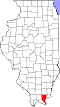
| County | Pope |
| Elevation | 427 ft (130 m) |
| Time zone | UTC-6 (Central (CST)) |
| • Summer (DST) | UTC-5 (CDT) |
| ZIP code | 62947 |
| Area code | 618 |
| GNIS feature ID | 424976 [1] |
Herod is an unincorporated community in Pope County, Illinois, United States. Herod is located on Illinois Route 34 at the edge of the Shawnee National Forest. Herod has a post office with ZIP code 62947. [2]
A cultural heritage group and nonprofit organization, the Vinyard Indian Settlement, is based in Herod. [3]