
Hagestein is a village and former city in the municipality of Vijfheerenlanden, Utrecht, Netherlands, on the Lek River, about 2 km east of Vianen. It received city rights in 1382. Hagestein was destroyed in 1405 by the Count of Holland and the Prince-Bishop of Utrecht.

Terborg is a small city in the Dutch province of Gelderland, in the Achterhoek region in the east of the Netherlands. It is located in the municipality of Oude IJsselstreek. The city lies about 7 km southeast of Doetinchem. The population is about 4600 inhabitants.

Lobith is a village in the Dutch province of Gelderland. It is located in the municipality of Zevenaar. Traditionally, it is said that the Rhine enters the Netherlands at Lobith, although in reality, this happens about 4 km further upstream, near Spijk.

Pannerden is a village in the Dutch province of Gelderland. It is located in the municipality of Zevenaar.

Oude-Tonge is a village in the Dutch province of South Holland. It is a part of the municipality of Goeree-Overflakkee, and lies about 16 km south of Hellevoetsluis.

Vierpolders is a village in the Dutch province of South Holland. It is a part of the municipality of Brielle, and lies about 5 km north of Hellevoetsluis.

Nieuwe Niedorp is a village in the Dutch province of North Holland. It is a part of the municipality of Hollands Kroon, and lies about 9 kilometres (5.6 mi) northeast of Heerhugowaard.
Oude Niedorp is a village in the Dutch province of North Holland. It is a part of the municipality of Hollands Kroon, and lies about 6 kilometres (3.7 mi) northeast of Heerhugowaard.

Lienden is a village in the Dutch province of Gelderland. It is a part of the municipality of Buren, and lies about 9 km south of Veenendaal.

Opijnen is a village in the Dutch province of Gelderland. It is a part of the municipality of West Betuwe, and lies about 10 km southwest of Tiel.

Echteld is a village in the Dutch province of Gelderland. It is a part of the municipality of Neder-Betuwe, and lies about 6 km east of Tiel.

Heerewaarden is a village in the Dutch province of Gelderland. It is a part of the municipality of Maasdriel, and lies about 8 km south of Tiel.

Rossum is a village in the Dutch province of Gelderland. It is a part of the municipality of Maasdriel, and lies about 11 km southwest of Tiel.

Afferden is a village in the Dutch province of Gelderland. It is a part of the municipality of Druten, and lies about 10 km northwest of Wijchen.

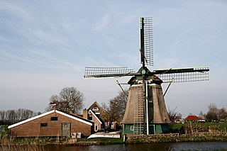
Koudekerk aan den Rijn is a village located in the municipality of Alphen aan den Rijn, Netherlands. It is located about 4 km west of the urban centre, in the province of South Holland.
Etten is a village in the Dutch province of Gelderland. It is located in the municipality of Oude IJsselstreek, 7 km southeast of Doetinchem.

Hernen is a village in the Dutch province of Gelderland. It is located in the municipality of Wijchen, about 13 km west of Nijmegen.

Herwen en Aerdt is a former municipality in the Dutch province of Gelderland. It existed from 1818 to 1985, when it became part of the new municipality of Rijnwaarden.

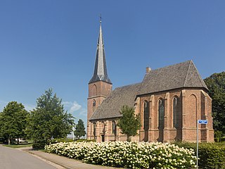
Wijnandsrade is a village in the Dutch province of Limburg. It is located in the municipality of Beekdaelen. It is notable for its castle and church and two ponds, which define the village's centre.
Aerdt is a village in the Dutch province of Gelderland. It is in the municipality of Zevenaar, about 20 km northeast of the city of Nijmegen, close to the German border.


