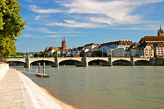
Nijmegen is the largest city in the Dutch province of Gelderland, on the Waal river close to the German border.

The Rhine is one of the major European rivers. The river begins in the Swiss canton of Graubünden in the southeastern Swiss Alps, forms part of the Swiss-Liechtenstein, Swiss-Austrian, Swiss-German and then the Franco-German border, then flows in a mostly northerly direction through the German Rhineland and the Netherlands and eventually empties into the North Sea.

South Holland is a province of the Netherlands with a population of over 3.7 million as of October 2021 and a population density of about 1,373/km2 (3,560/sq mi), making it the country's most populous province and one of the world's most densely populated areas. Situated on the North Sea in the west of the Netherlands, South Holland covers an area of 3,307 km2 (1,277 sq mi), of which 607 km2 (234 sq mi) is water. It borders North Holland to the north, Utrecht and Gelderland to the east, and North Brabant and Zeeland to the south. The provincial capital is the Dutch seat of government The Hague, while its largest city is Rotterdam. The Rhine-Meuse-Scheldt delta drains through South Holland into the North Sea. Europe's busiest seaport, the Port of Rotterdam, is located in South Holland.

Batavia is a historical and geographical region in the Netherlands, forming large fertile islands in the river delta formed by the waters of the Rhine and Meuse rivers. During the Roman empire, it was an important frontier region and source of imperial soldiers. Its name is possibly pre-Roman.

Rijnwaarden was a municipality in the province of Gelderland, in the eastern Netherlands. The Rhine enters the Netherlands at its location. Rijnwaarden was merged into the municipality of Zevenaar on 1 January 2018.

Rhenen is a municipality and a city in the central Netherlands. The municipality also includes the villages of Achterberg, Remmerden, Elst and Laareind. The town lies at a geographically interesting location, namely on the southernmost part of the chain of hills known as the Utrecht Hill Ridge, where this meets the river Rhine. Because of this Rhenen has a unique character with quite some elevation through town.

Oude Rijn is the name of a long former bend in river Rhine in the Dutch province of Gelderland.

Lobith is a village in the Dutch province of Gelderland. It is located in the municipality of Zevenaar. Traditionally, it is said that the Rhine enters the Netherlands at Lobith, although in reality, this happens about 4 km further upstream, near Spijk.

Pannerden is a village in the Dutch province of Gelderland. It is located in the municipality of Zevenaar.

Elst is a village in the central Netherlands. It is located in the municipality of Rhenen, Utrecht, about 5 km southwest of Veenendaal.

Borger is a village in the Dutch province of Drenthe. It is a part of the municipality of Borger-Odoorn, and lies about 18 km east of Assen.

Stoutenburg is a village in the Dutch province of Utrecht. It is a part of the municipality of Leusden, and lies about 4 km (2 mi) east of Amersfoort. Since 1998, a part of the village is a neighbourhood in Amersfoort.

Elden is a village in the Dutch province of Gelderland. It is located in the municipality of Arnhem, about 4 km southwest of the city centre.

Westervelde is a village in the Netherlands and part of the Noordenveld municipality in Drenthe.

Babberich is a village in the Dutch province of Gelderland. It is in the municipality Zevenaar, about 3 km southeast of the centre of Zevenaar. It's located near the border with Germany. Until 1816, it was a part of the Duchy of Cleves.

Arnhem Centraal railway station is the largest railway station in the city of Arnhem in Gelderland, Netherlands. It was opened on 14 May 1845 and is located on the Amsterdam–Arnhem railway, the Arnhem–Leeuwarden railway and the Arnhem–Nijmegen railway. The station opened at the same time as the Amsterdam–Arnhem railway, that continues into Germany via the Oberhausen–Arnhem railway.

Spijk is a village in the eastern Netherlands. It is located in the municipality of Zevenaar, Gelderland, near the border with Germany.
The road toll was a historical fee charged to travellers and merchants in return for permission to use the roads and waterways of the country or state concerned. It was reinforced in the Holy Roman Empire by the law of Straßenzwang which meant that traders in certain goods had to use specified roads. In return, they were usually guaranteed safe passage under the right of escort or Geleitrecht. The road toll was widespread especially in medieval times, and, in addition to the payments from the staple rights, was an important source of income.

Loo is a village in the municipality of Duiven in the province of Gelderland, the Netherlands. The village has a ferry connection to Huissen. A couple of houses of Loo are part of Huissen, Lingewaard, because they were on a former river island which used to belong the Duchy of Cleves.

Visvliet is a village in the Dutch province of Groningen. It is part of the municipality of Westerkwartier, and is located near the river Lauwers, the border between Friesland and Groningen.


