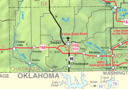
Hewins, Kansas

Last updated

Hewins, Kansas
Map of Chautauqua Co, Ks, USA.png
USA Kansas location map.svg
Red pog.svg
Hewins
Usa edcp location map.svg
Red pog.svg
Hewins
Coordinates: 37°2′27″N96°24′30″W / 37.04083°N 96.40833°W / 37.04083; -96.40833 [1]
Country United States
State Kansas
County Chautauqua
Named after Edwin Hewins
Elevation
[1]
886 ft (270 m)
Time zone UTC-6 (CST)
  Summer (DST) UTC-5 (CDT)
Area code 620
FIPS code 20-31625
GNIS ID 484429 [1]

Hewins is an unincorporated community in Chautauqua County, Kansas, United States. [1]

Contents

History

Hewins was named after Edwin M. Hewins, a rancher and member of the Kansas Legislature. [2]

The post office was established April 4, 1906, and closed April 8, 1966. [3]

A route through Hewins serves as an access point for nearby Osro Falls, an old covered wagon crossing point on the Caney River. [4] The waterfall only measures about 3 feet in height, but extends nearly 200 feet across the river. [4]

References

  1. 1 2 3 4 U.S. Geological Survey Geographic Names Information System: Hewins, Kansas
  2. Rydjord, John (1972). Kansas Place-Names. University of Oklahoma Press, Norman, Oklahoma. p. 338. ISBN   0-8061-0994-7.
  3. From Whence They Came: A Little History of Hewins, Kansas, Ester Leonard, Arrow Press, San Antonio, 1983.
  4. 1 2 "4 Waterfalls a short drive from Wichita". Wichita Eagle, October 20, 2016. Retrieved April 29, 2025.

Further reading