Niotaze, Kansas

Last updated

Niotaze, Kansas
Niotaze Methodist Episcopal Church.jpg
Chautauqua County Kansas Incorporated and Unincorporated areas Niotaze Highlighted.svg
Location within Chautauqua County and Kansas
Map of Chautauqua Co, Ks, USA.png
Coordinates: 37°04′04″N96°00′53″W / 37.06778°N 96.01472°W / 37.06778; -96.01472 [1]
Country United States
State Kansas
County Chautauqua
Incorporated 1910
Area
[2]
  Total0.37 sq mi (0.96 km2)
  Land0.37 sq mi (0.96 km2)
  Water0.00 sq mi (0.00 km2)
Elevation
[1]
758 ft (231 m)
Population
 (2020) [3]
  Total90
  Density240/sq mi (94/km2)
Time zone UTC-6 (CST)
  Summer (DST) UTC-5 (CDT)
ZIP code
67355
Area code 620
FIPS code 20-50750
GNIS ID 2395237 [1]

Niotaze is a city in Chautauqua County, Kansas, United States. [1] As of the 2020 census, the population of the city was 90. [3]

Contents

History

Niotaze probably derived its name from Niota, Illinois or Niota, Tennessee. [4]

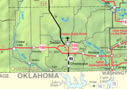
Circa 1910, Niotaze had a population of 317. At that time it was an important shipping point for grain, livestock and produce at the junction of two railroads. [5]

Geography

According to the United States Census Bureau, the city has a total area of 0.37 square miles (0.96 km2), all land. [6]

Demographics

Historical population
CensusPop.Note
1910 317
1920 186−41.3%
1930 23526.3%
1940 2412.6%
1950 162−32.8%
1960 124−23.5%
1970 83−33.1%
1980 10425.3%
1990 99−4.8%
2000 12223.2%
2010 82−32.8%
2020 909.8%
U.S. Decennial Census
Former U.S. Post Office (2013) Niotaze Post Office.jpg
Former U.S. Post Office (2013)

2010 census

As of the census [7] of 2010, there were 82 people, 33 households, and 22 families residing in the city. The population density was 221.6 inhabitants per square mile (85.6/km2). There were 49 housing units at an average density of 132.4 per square mile (51.1/km2). The racial makeup of the city was 85.4% White, 7.3% Native American, and 7.3% from two or more races.

There were 33 households, of which 33.3% had children under the age of 18 living with them, 54.5% were married couples living together, 6.1% had a female householder with no husband present, 6.1% had a male householder with no wife present, and 33.3% were non-families. 33.3% of all households were made up of individuals, and 18.2% had someone living alone who was 65 years of age or older. The average household size was 2.48 and the average family size was 3.09.

The median age in the city was 42 years. 25.6% of residents were under the age of 18; 2.4% were between the ages of 18 and 24; 24.4% were from 25 to 44; 25.7% were from 45 to 64; and 22% were 65 years of age or older. The gender makeup of the city was 57.3% male and 42.7% female.

2000 census

As of the census [8] of 2000, there were 122 people, 47 households, and 32 families residing in the city. The population density was 327.6 inhabitants per square mile (126.5/km2). There were 55 housing units at an average density of 147.7 per square mile (57.0/km2). The racial makeup of the city was 90.16% White, 5.74% Native American, and 4.10% from two or more races. Hispanic or Latino of any race were 6.56% of the population.

There were 47 households, out of which 34.0% had children under the age of 18 living with them, 57.4% were married couples living together, 6.4% had a female householder with no husband present, and 29.8% were non-families. 29.8% of all households were made up of individuals, and 12.8% had someone living alone who was 65 years of age or older. The average household size was 2.60 and the average family size was 3.24.

In the city, the population was spread out, with 30.3% under the age of 18, 6.6% from 18 to 24, 27.0% from 25 to 44, 21.3% from 45 to 64, and 14.8% who were 65 years of age or older. The median age was 36 years. For every 100 females, there were 139.2 males. For every 100 females age 18 and over, there were 112.5 males.

The median income for a household in the city was $27,500, and the median income for a family was $27,679. Males had a median income of $17,500 versus $9,583 for females. The per capita income for the city was $9,738. There were 21.6% of families and 29.0% of the population living below the poverty line, including 45.8% of under eighteens and 35.3% of those over 64.

Education

The community is served by Caney Valley USD 436 public school district.

Infrastructure

Transportation

U.S. Route 166 highway currently runs east–west through the community.

Rail

Previously two railroads, Santa Fe and Missouri Pacific, went through the community, but both lines have been abandoned. [5]

Related Research Articles

<span class="mw-page-title-main">Harris, Kansas</span> Unincorporated community in Anderson County, Kansas

Harris is an unincorporated community in Anderson County, Kansas, United States. As of the 2020 census, the population of the community and nearby areas was 47.

<span class="mw-page-title-main">Lone Elm, Kansas</span> City in Anderson County, Kansas

Lone Elm is a city in Anderson County, Kansas, United States. As of the 2020 census, the population of the city was 27.

<span class="mw-page-title-main">Olmitz, Kansas</span> City in Barton County, Kansas

Olmitz is a city in Barton County, Kansas, United States. As of the 2020 census, the population of the city was 90.

<span class="mw-page-title-main">Susank, Kansas</span> City in Barton County, Kansas

Susank is a city in Barton County, Kansas, United States. As of the 2020 census, the population of the city was 31.

<span class="mw-page-title-main">Everest, Kansas</span> City in Brown County, Kansas

Everest is a city in Brown County, Kansas, United States. As of the 2020 census, the population of the city was 265.

<span class="mw-page-title-main">Aurora, Kansas</span> City in Cloud County, Kansas

Aurora is a city in Cloud County, Kansas, United States. As of the 2020 census, the population of the city was 56.

<span class="mw-page-title-main">Waverly, Kansas</span> City in Coffey County, Kansas

Waverly is a city in Coffey County, Kansas, United States. As of the 2020 census, the population of the city was 574.

<span class="mw-page-title-main">Denton, Kansas</span> City in Doniphan County, Kansas

Denton is a city in Doniphan County, Kansas, United States. As of the 2020 census, the population of the city was 130.

<span class="mw-page-title-main">Richmond, Kansas</span> City in Franklin County, Kansas

Richmond is a city in Franklin County, Kansas, United States. As of the 2020 census, the population of the city was 459.

<span class="mw-page-title-main">Ensign, Kansas</span> City in Gray County, Kansas

Ensign is a city in Gray County, Kansas, United States. As of the 2020 census, the population of the city was 166. It is located along U.S. Route 56 highway.

<span class="mw-page-title-main">Coolidge, Kansas</span> City in Hamilton County, Kansas

Coolidge is a city in Hamilton County, Kansas, United States. As of the 2020 census, the population of the city was 80.

<span class="mw-page-title-main">Jetmore, Kansas</span> City in Hodgeman County, Kansas

Jetmore is a city in and the county seat of Hodgeman County, Kansas, United States. As of the 2020 census, the population of the city was 770.

<span class="mw-page-title-main">Penalosa, Kansas</span> City in Kingman County, Kansas

Penalosa is a city in Kingman County, Kansas, United States. As of the 2020 census, the population of the city was 18.

<span class="mw-page-title-main">Minneapolis, Kansas</span> City in Ottawa County, Kansas

Minneapolis is a city in and the county seat of Ottawa County, Kansas, United States. As of the 2020 census, the population of the city was 1,946.

<span class="mw-page-title-main">Rush Center, Kansas</span> City in Rush County, Kansas

Rush Center is a city in Rush County, Kansas, United States. As of the 2020 census, the population of the city was 141.

<span class="mw-page-title-main">Lebanon, Kansas</span> City in Smith County, Kansas

Lebanon is a city in Smith County, Kansas, United States. As of the 2020 census, the population of the city was 178.

<span class="mw-page-title-main">East Lynne, Missouri</span> City in Missouri, United States

East Lynne is a city in eastern Cass County, Missouri The population was 303 at the 2010 census. It is part of the Kansas City metropolitan area within the United States.

<span class="mw-page-title-main">Lake Winnebago, Missouri</span> City in Missouri, United States

Lake Winnebago is a city in Cass County, Missouri, United States. The population was 1,131 at the 2010 census. It is part of the Kansas City metropolitan area.

<span class="mw-page-title-main">Lake Annette, Missouri</span> City in Missouri, United States

Lake Annette is a city in Cass County, Missouri, United States. The population was 100 at the 2010 census. It is part of the Kansas City metropolitan area.

<span class="mw-page-title-main">Clayton, Kansas</span> City in Decatur and Norton Counties of Kansas

Clayton is a city in Decatur and Norton counties in the U.S. state of Kansas. As of the 2020 census, the population of the city was 44.

References

  1. 1 2 3 4 U.S. Geological Survey Geographic Names Information System: Niotaze, Kansas
  2. "2019 U.S. Gazetteer Files". United States Census Bureau. Retrieved July 24, 2020.
  3. 1 2 "Profile of Niotaze, Kansas in 2020". United States Census Bureau. Archived from the original on May 23, 2022. Retrieved May 23, 2022.
  4. Exploring Kansas Highways: Trip Trivia. Exploring America's Highway. 2007. p. 204. ISBN   978-0-9744358-8-6.
  5. 1 2 Blackmar, Frank Wilson (1912). Kansas: A Cyclopedia of State History, Volume 2. Standard Publishing Company.
  6. "US Gazetteer files 2010". United States Census Bureau. Archived from the original on January 25, 2012. Retrieved July 6, 2012.
  7. "U.S. Census website". United States Census Bureau . Retrieved July 6, 2012.
  8. "U.S. Census website". United States Census Bureau . Retrieved January 31, 2008.

Further reading