Highfield-Cascade, Maryland | |
---|---|
Coordinates: 39°42′46″N77°30′15″W / 39.71278°N 77.50417°W | |
Country | United States |
State | Maryland |
County | Washington |
Area | |
• Total | 1.73 sq mi (4.49 km2) |
• Land | 1.73 sq mi (4.49 km2) |
• Water | 0.00 sq mi (0.00 km2) |
Elevation | 1,303 ft (397 m) |
Population (2020) | |
• Total | 1,082 |
• Density | 624.71/sq mi (241.15/km2) |
Time zone | UTC−5 (Eastern (EST)) |
• Summer (DST) | UTC−4 (EDT) |
ZIP code | 21719 [3] |
Area code(s) | 240 and 301 |
FIPS code | 24-38437 |
GNIS feature ID | 1852592 [2] |
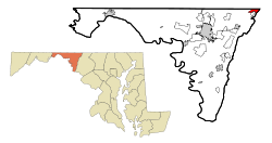
Highfield-Cascade is a census-designated place (CDP) in Washington County, Maryland, United States. The CDP is, however, more commonly referred to as just Cascade, MD. The official CDP name encompasses two closely-spaced unincorporated communities, Highfield and Cascade. The population of the CDP was 1,141 at the 2000 census.
According to the United States Census Bureau, the CDP has a total area of 1.7 square miles (4.4 km2), all land.
Census | Pop. | Note | %± |
---|---|---|---|
2020 | 1,082 | — | |
U.S. Decennial Census [4] |
At the 2000 census there were 1,141 people, 440 households, and 315 families living in the CDP. The population density was 669.9 inhabitants per square mile (258.6/km2). There were 479 housing units at an average density of 281.2 per square mile (108.6/km2). The racial makeup of the CDP was 69.42% White, 28.18% African American, 0.44% Native American, 0.18% Asian, 0.09% Pacific Islander, and 0.70% from two or more races. Hispanic or Latino of any race were 1.61%. [5]
Of the 440 households 34.3% had children under the age of 18 living with them, 56.8% were married couples living together, 9.3% had a female householder with no husband present, and 28.2% were non-families. 24.1% of households were one person and 9.5% were one person aged 65 or older. The average household size was 2.59 and the average family size was 3.07.
The age distribution was 26.9% under the age of 18, 6.4% from 18 to 24, 33.7% from 25 to 44, 21.3% from 45 to 64, and 11.7% 65 or older. The median age was 36 years. For every 100 females, there were 99.8 males. For every 100 females age 18 and over, there were 99.0 males.
The median household income was $35,833 and the median family income was $53,036. Males had a median income of $32,813 versus $26,106 for females. The per capita income for the CDP was $18,969. About 5.2% of families and 5.1% of the population were below the poverty line, including 4.1% of those under age 18 and 14.6% of those age 65 or over.
Naval Academy is a census-designated place (CDP) in Anne Arundel County, Maryland, United States, which covers the campus of the United States Naval Academy. The population was 4,802 at the 2010 census.
Selby-on-the-Bay is a census-designated place (CDP) in Anne Arundel County, Maryland, United States, for the 2000 census, at which time its population was 3,674. It was added to the Mayo CDP for the 2010 census.
Edgemere is an unincorporated community and census-designated place in Baltimore County, Maryland, United States. The population was 8,669 at the 2010 census. Founded in 1899 as Edgemere being renamed from previous name "Fitzell". Meeting held at the Fitzell Farm which was situated where the old Rheem plant was located.
Rossville is an unincorporated community and census-designated place in Baltimore County, Maryland, United States. The population was 15,147 at the 2010 census.
Ashton-Sandy Spring is a census-designated place (CDP) in Montgomery County, Maryland, United States. The CDP is designated to include the two unincorporated communities of Ashton and Sandy Spring, as well as the smaller community of Brinklow. It had a population of 5,746 as of the 2020 census.
Chewsville is a census-designated place (CDP) in Washington County, Maryland, United States. The population was 293 at the 2000 census.
Fort Ritchie is a census-designated place (CDP) in Washington County, Maryland, United States, just south of the Pennsylvania state line. The population was 276 at the 2000 census. Fort Ritchie is a former U.S. military base that closed in September 1998, pursuant to the 1995 Base Realignment and Closure Commission. Blue Ridge Summit, Pennsylvania is immediately to the north.
Fountainhead-Orchard Hills is a census-designated place (CDP) in Washington County, Maryland, United States. The population was 3,861 at the 2000 census.
Halfway is a census-designated place (CDP) in Washington County, Maryland, United States. The population was 11,896 at the 2020 census. It is named due to its location, which is Halfway Between Hagerstown and Williamsport. As a major suburb of Halfway is part of the Hagerstown-Martinsburg, MD-WV, Metropolitan Statistical Area.
Maugansville is a census-designated place (CDP) in Washington County, Maryland, United States. The population was 2,295 at the 2000 census.
Mount Lena is a census-designated place (CDP) in Washington County, Maryland, United States. The population was 501 at the 2000 census.
St. James is a census-designated place (CDP) in Washington County, Maryland, United States. The population was 1,657 at the 2000 census. It is also the home of St. James School, Hagerstown, a small, Episcopalian, boarding school. St. James was formerly named "Lydia."
Wilson-Conococheague is a census-designated place (CDP) in Washington County, Maryland, United States. The population was 2,262 at the 2020 census.
Ulm is a census-designated place (CDP) in Cascade County, Montana, United States. It was originally a large ranch owned by Indiana-born cattleman William Ulm. The population was 738 at the 2010 census. It is part of the Great Falls, Montana Metropolitan Statistical Area. The Zip Code is 59485.
Fort Shawnee is census-designated place (CDP) in Allen County, Ohio, United States. The population was 6,263 at the 2020 census. It is included in the Lima, Ohio Metropolitan Statistical Area. Fort Shawnee is adjacent to the city of Lima and the village of Cridersville in Auglaize County. In 2012, village residents voted to disincorporate the village. According to the United States Census Bureau, the village had a total area of 7.25 square miles (18.78 km2), of which 7.21 square miles (18.67 km2) is land and 0.04 square miles (0.10 km2) is water.
Mack North was a census-designated place (CDP) in Hamilton County, Ohio, United States. The population was 3,529 at the 2000 census. For the 2010 census, it became part of the Mack CDP.
Alton North is a former census-designated place (CDP) in Hidalgo County, Texas, United States. The population was 5,051 at the 2000 census. It is part of the McAllen–Edinburg–Mission Metropolitan Statistical Area.
Cascade Valley is a census-designated place (CDP) in Grant County, Washington, United States. The population was 2,246 at the 2010 census, up from 1,811 at the 2000 census.
Erlands Point-Kitsap Lake is an unincorporated area and former census-designated place (CDP) in Kitsap County, Washington, United States. The population was 2,935 at the 2010 census. For the 2020 census, the area was split into two CDPs, Erlands Point and Kitsap Lake.
Ruckersville is a census-designated place (CDP) in Greene County, Virginia, United States, located in a rural area north of Charlottesville. The population as of the 2020 estimate was 1,321, a 17.7% increase from the 2010 census with 1,141. The community lies amidst hills, mountain views, trees, and farmland. It is located at the intersection of two major highways, north–south U.S. Route 29 and east–west U.S. Route 33. It was founded in 1732, by the same family that established Ruckersville, Georgia.