
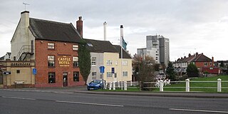
Burton upon Trent, also known as Burton-on-Trent or simply Burton, is a market town in the borough of East Staffordshire in the county of Staffordshire, England, close to the border with Derbyshire. At the 2021 census, it had a population of 76,270. The demonym for residents of the town is Burtonian. Burton is located on the River Trent 11 miles (18 km) south-west of Derby and 20 miles (32 km) south of the Peak District National Park.
Mickleover is a village in the unitary authority of Derby, in Derbyshire, England. It is 2 miles (3.2 km) west of Derby, 10 miles (16 km) northeast of Burton upon Trent, 13 miles (21 km) southeast of Ashbourne and 12 miles (19 km) northeast of Uttoxeter.
Hatton is a village and civil parish in South Derbyshire, England. It is 5 miles (8.0 km) north of Burton upon Trent, 10 miles (16 km) south-west of Derby and 24 miles (39 km) south-east of Stoke-on-Trent. The population of the civil parish as of the 2011 census was 2,785. It adjoins Tutbury to the south.
Fradley is a village and civil parish, in the Lichfield district, in the county of Staffordshire, England. In 1881 the parish had a population of 380.
Stapenhill is a village and civil parish in Burton upon Trent, Staffordshire, England.

Marchington Woodlands is a village and former civil parish, now in the parish of Marchington, in the East Staffordshire district, in the county of Staffordshire, England. It has a church and a village hall. The local first school was closed in 1981 and the building was converted into a private home. Marchington Woodlands consists mostly of farms and cottages. it is often Referred to by locals as The Woodlands. It is located near Uttoxeter. In 1931 the parish had a population of 273.
Winshill is an area to the east of the town of Burton upon Trent, in the borough of East Staffordshire, England.

Clayton is a suburb and ward in the Newcastle-under-Lyme district, in Staffordshire, England.

Burton Abbey at Burton upon Trent in Staffordshire, England, was founded in the 7th or 9th century by St Modwen or Modwenna. It was refounded in 1003 as a Benedictine abbey by the thegn Wulfric Spott. He was known to have been buried in the abbey cloister in 1010, alongside the grave of his wife.

Garthorpe is a village in the North Lincolnshire, England. It is situated approximately 8 miles (13 km) south-east from Goole, 1 mile (1.6 km) west from the River Trent, and in the Isle of Axholme.
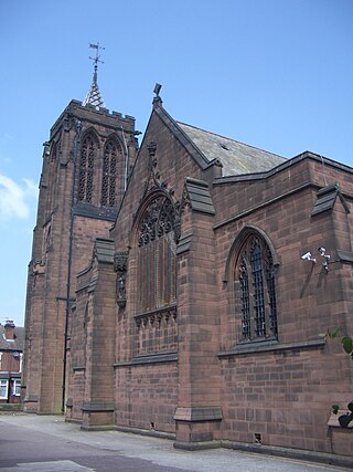
St Chad's Church is an Anglican church on Hunter Street in Burton upon Trent, Staffordshire, England. It is in the diocese of Lichfield and the advowson is vested in the bishop. In 1979 the church was registered as a Grade I listed building.
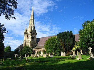
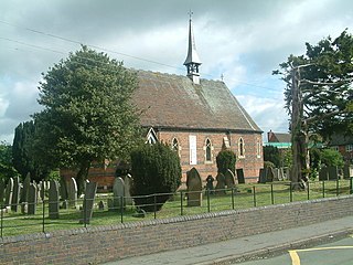
St John the Divine is the Church of England parish church in the suburb of Horninglow, north west of Burton upon Trent, Staffordshire. It is part of the Diocese of Lichfield.

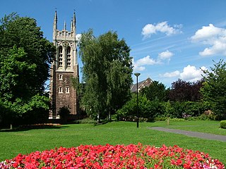
St Modwen's is a Church of England parish church situated in Burton upon Trent in Staffordshire, England. It is part of the Diocese of Lichfield. The church is dedicated to St Modwen, or Modwenna, a nun who founded an abbey at Burton in the 7th century.

The de Ferrers Academy is a secondary school with academy status located in Burton upon Trent, Staffordshire, England.

Croxall is a hamlet and former civil parish, now in the parish of Edingale, in the Lichfield district, in the county of Staffordshire, England. The settlement today is mainly the Church of England parish church of St John and Croxall Hall. On 30 September 1895 the part in Derbyshire was transferred to Staffordshire meaning Croxall was entirely in Staffordshire. In 1931 the parish had a population of 184.

The 1322 Battle of Burton Bridge was fought between Thomas, 2nd Earl of Lancaster and his cousin King Edward II of England during the Despenser War. Edward's army was proceeding northwards to engage Lancaster, having defeated his Marcher Lord allies in Wales. Lancaster fortified the bridge at Burton upon Trent, an important crossing of the River Trent, in an attempt to prevent the King from proceeding. Edward arrived at nearby Cauldwell on 7 March 1322 and intended to use the ford at Walton-on-Trent to cross the river and outflank Lancaster. Edward was delayed for three days by floodwaters, during which time some of his force was deployed opposite Lancaster's men at the bridge.

Horninglow and Eton is a civil parish in the East Staffordshire district, in the county of Staffordshire, England. It covers an area located in the west of Burton upon Trent, including Horninglow. In 2021 the parish had a population of 15,700. The parish was created on 1 April 2003.
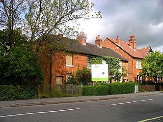
Horninglow and Eton is a civil parish in the district of East Staffordshire, Staffordshire, England. It contains six listed buildings that are recorded in the National Heritage List for England. Of these, one is listed at Grade I, the highest of the three grades, and the others are at Grade II, the lowest grade. The parish is to the northwest of Burton upon Trent and is mainly residential. The most important listed building is St Chad's Church, and the war memorial in its churchyard is also listed. Remainders of the parish's industrial past are a former hydraulic power house and a former railway warehouse. The other listed buildings are a farmhouse and a milepost.

Queen's Hospital is a health facility on Belvedere Road in Burton upon Trent, Staffordshire. It is managed by University Hospitals of Derby and Burton NHS Foundation Trust.

