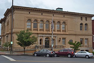
Horseleg Mountain

Last updated
Horseleg Mountain viewed from Myrtle Hill Cemetery Horseleg Mountain viewed from Myrtle Hill Cemetery, Nov 2017.jpg
Horseleg Mountain viewed from Myrtle Hill Cemetery

Horseleg Mountain is a summit in Floyd County, Georgia, in the United States. [1] With an elevation of 1,322 feet (403 m), Horseleg Mountain is the 735th highest summit in the state of Georgia. [2]

Floyd County, Georgia County in the United States

Floyd County is a county located in the northwestern part of the U.S. state of Georgia. As of the 2010 census, the population was 96,317. The county seat is Rome.

United States Federal republic in North America

The United States of America (USA), commonly known as the United States or America, is a country composed of 50 states, a federal district, five major self-governing territories, and various possessions. At 3.8 million square miles, the United States is the world's third or fourth largest country by total area and is slightly smaller than the entire continent of Europe's 3.9 million square miles. With a population of over 327 million people, the U.S. is the third most populous country. The capital is Washington, D.C., and the largest city by population is New York City. Forty-eight states and the capital's federal district are contiguous in North America between Canada and Mexico. The State of Alaska is in the northwest corner of North America, bordered by Canada to the east and across the Bering Strait from Russia to the west. The State of Hawaii is an archipelago in the mid-Pacific Ocean. The U.S. territories are scattered about the Pacific Ocean and the Caribbean Sea, stretching across nine official time zones. The extremely diverse geography, climate, and wildlife of the United States make it one of the world's 17 megadiverse countries.

Horseleg Mountain is said to be shaped like the leg of a horse, hence the name. [3] [4]

Horse Domesticated four-footed mammal from the equine family

The horse is one of two extant subspecies of Equus ferus. It is an odd-toed ungulate mammal belonging to the taxonomic family Equidae. The horse has evolved over the past 45 to 55 million years from a small multi-toed creature, Eohippus, into the large, single-toed animal of today. Humans began domesticating horses around 4000 BC, and their domestication is believed to have been widespread by 3000 BC. Horses in the subspecies caballus are domesticated, although some domesticated populations live in the wild as feral horses. These feral populations are not true wild horses, as this term is used to describe horses that have never been domesticated, such as the endangered Przewalski's horse, a separate subspecies, and the only remaining true wild horse. There is an extensive, specialized vocabulary used to describe equine-related concepts, covering everything from anatomy to life stages, size, colors, markings, breeds, locomotion, and behavior.

Related Research Articles

Lindale, Georgia Census-designated place in Georgia, United States

Lindale is an unincorporated community and census-designated place (CDP) in Floyd County, Georgia, United States. It is part of the Rome, Georgia Metropolitan Statistical Area. The population was 4,191 at the 2010 census.

Oostanaula River river in the United States of America

The Oostanaula River is a principal tributary of the Coosa River, about 49 miles (79 km) long, formed by the confluence of the Conasauga and Coosawattee in northwestern Georgia in the United States. Via the Coosa and Alabama rivers, it is part of the watershed of the Mobile River, which flows to the Gulf of Mexico.

The Pocket (Floyd County, Georgia) A valley/basin in the US State of Georgia

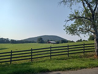
The Pocket is a basin in northern Floyd County, Georgia. The valley was named as such due to how Horn Mountain curved in a way that it formed a pocket.

Anniedelle is an unincorporated community in Floyd County, in the U.S. state of Georgia.

Boozeville is an unincorporated community in Floyd County, in the U.S. state of Georgia.

Chulio is an unincorporated community in Floyd County, in the U.S. state of Georgia.

Everett Springs, Georgia human settlement in United States of America

Everett Springs is an unincorporated community in Floyd County, in the U.S. state of Georgia.

Foster Mills is an unincorporated community in Floyd County, in the U.S. state of Georgia.

Fouche is an unincorporated community in Floyd County, in the U.S. state of Georgia.

Glenwood is an unincorporated community in Floyd County, in the U.S. state of Georgia.

Johns Mountain Mountain in the US State of Georgia

Johns Mountain is a summit in the U.S. state of Georgia. With an elevation of 1,683 feet (513 m), Johns Mountain is the 666th highest summit in the state of Georgia. The mountain is located inside the Chattahoochee-Oconee National Forest.

Lake Conasauga (Floyd County, Georgia)

Lake Conasauga is a reservoir in Floyd County, in the U.S. state of Georgia.

Lavender is an unincorporated community in Floyd County, in the U.S. state of Georgia.

Pocket Creek stream in the U.S. State of Georgia

Pocket Creek is a stream in Floyd County, in the U.S. state of Georgia.

Jackson Hill (Georgia) mountain in Georgia, United States of America

Jackson Hill is a summit in Rome, Georgia. With an elevation of 751 feet (229 m), Jackson Hill is the 905th highest summit in the state of Georgia. The hill considered to be one of the Seven Hills of Rome, Georgia.

Silver Creek is a stream in Floyd County and Polk County, Georgia, in the United States.

Six Mile is an unincorporated community in Floyd County, in the U.S. state of Georgia.

Turkey Mountain (Georgia) mountain in Georgia, United States of America

Turkey Mountain is a summit in Floyd County, Georgia. With an elevation of 1,122 feet (342 m), Turkey Mountain is the 808th highest summit in the state of Georgia.

Vans Valley is an unincorporated community in Floyd County, in the U.S. state of Georgia.

Baugh Mountain mountain in United States of America

Baugh Mountain is a summit in Gordon County, Georgia. With an elevation of 1,138 feet (347 m), Baugh Mountain is the 802nd highest summit in the state of Georgia.

References

  1. U.S. Geological Survey Geographic Names Information System: Horseleg Mountain
  2. "Horseleg Mountain". Peakery.com. Retrieved 14 April 2015.
  3. "Floyd County". Calhoun Times. September 1, 2004. p. 68. Retrieved 24 April 2015.
  4. Krakow, Kenneth K. (1975). Georgia Place-Names: Their History and Origins (PDF). Macon, GA: Winship Press. p. 112. ISBN   0-915430-00-2.

Coordinates: 34°13′47″N85°14′41″W / 34.2298165°N 85.2446750°W / 34.2298165; -85.2446750

Geographic coordinate system Coordinate system

A geographic coordinate system is a coordinate system that enables every location on Earth to be specified by a set of numbers, letters or symbols. The coordinates are often chosen such that one of the numbers represents a vertical position and two or three of the numbers represent a horizontal position; alternatively, a geographic position may be expressed in a combined three-dimensional Cartesian vector. A common choice of coordinates is latitude, longitude and elevation. To specify a location on a plane requires a map projection.