Hotchkiss is a statutory town in Delta County, Colorado, United States. The population was 944 at the 2010 census.

Petersburg is a borough in Huntingdon County, Pennsylvania, United States. It was a stop on the former Pennsylvania Railroad Main Line between Tyrone and Huntingdon and the junction point for the Petersburg Branch. The population was 480 at the 2010 census.
Ibarra is a town and municipality located in the province of Gipuzkoa, in the autonomous community of Basque Country, northern Spain. By 2003 INE figures Ibarra had a total population of 4,374.

San Onofre State Beach is a 3,000-acre (1,214 ha) state park in San Diego County, California. The beach is 3 miles (5 km) south of San Clemente on Interstate 5 at Basilone Road. The state park is leased to the state of California by the United States Marine Corps. Governor Ronald Reagan established San Onofre State Beach in 1971. With over 2.5 million visitors per year, it is one of the five most-visited state parks in California, hosting swimmers, campers, kayakers, birders, fishermen, bicyclists, sunbathers, surfers, and the sacred Native American site of Panhe. It is named after the fourth-century saint Onuphrius.
Lakeville is a village in Litchfield County, Connecticut, bordering Dutchess County, New York. It is part of the Town of Salisbury but it has its own zip code (06039). It is southwest of Salisbury Village on U.S. Route 44. The Hotchkiss and Indian Mountain Schools are located in Lakeville.
Kwadacha Wilderness Provincial Park is a provincial park in British Columbia, Canada. It is part of the larger Muskwa-Kechika Management Area, which include to the north of the Kwadacha the Northern Rocky Mountains Provincial Park and Stone Mountain Provincial Park.
Jessieville is an unincorporated community located in Garland County, Arkansas, United States. It is located next to Hot Springs Village and north of Hot Springs. Highway 7 runs through the community, and Highway 298 is also inside the town. The town has one school campus, which contains an elementary school, a middle school and a high school.
The United States Border Patrol operates 71 traffic checkpoints, including 33 permanent traffic checkpoints, near the Mexico–United States border. The stated primary purpose of these inspection stations is to deter illegal immigration and smuggling activities. After the September 11 attacks in 2001, they took on the additional role of terrorism deterrence. These checkpoints are located between 25 and 75 miles of the Mexico–United States border along major U.S. highways; near the southern border of the contiguous United States. Their situation at interior locations allow them to deter illegal activities that may have bypassed official border crossings along the frontier. The checkpoints are divided among nine Border Patrol sectors. There are a number of these checkpoints near the northern border of the contiguous U.S. as well ; within 100 miles (160 km) of the Canada–U.S. border.

Powellton is an unincorporated community in Butte County, California, USA. It lies at an elevation of 3,622 feet. The place is named for R.P. Powell who arrived in 1853. A post office operated in Powellton from 1872 to 1906.

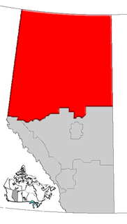
Eaglesham is a hamlet in northern Alberta, Canada within Birch Hills County, located 6 kilometres (3.7 mi) north of Highway 49, approximately 89 kilometres (55 mi) northeast of Grande Prairie.

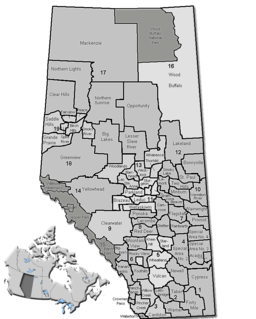
Faust is a hamlet in northern Alberta within Big Lakes County, located 1 kilometre (0.62 mi) north of Highway 2, approximately 241 kilometres (150 mi) northwest of Edmonton.

Guy is a hamlet in northern Alberta, Canada within the Municipal District of Smoky River No. 130. It is located on Highway 49, approximately 113 kilometres (70 mi) northeast of Grande Prairie. It is the home of Honey Bunny honey products.

Jean Cote, or Jean Côté, is a hamlet in northern Alberta, Canada within the Municipal District of Smoky River No. 130. It is located approximately 11 kilometres (6.8 mi) west of Highway 2 and 123 kilometres (76 mi) northeast of Grande Prairie.

Notikewin is a hamlet in northern Alberta, Canada within the County of Northern Lights.

Ridgevalley is a hamlet in northern Alberta, Canada within the Municipal District of Greenview No. 16. It is located 2.5 kilometres (1.6 mi) southwest of Highway 43, approximately 57 kilometres (35 mi) east of Grande Prairie.

Tangent is a hamlet in northern Alberta, Canada within Birch Hills County, located 6 kilometres (3.7 mi) north of Highway 49, approximately 98 kilometres (61 mi) northeast of Grande Prairie.

Twin Lakes is an unincorporated place in northern Alberta under the jurisdiction of the County of Northern Lights.
Reesor is a ghost town located in Cochrane District, Ontario, Canada, North America, on the Trans-Canada Highway, named after its founder, Thomas Reesor.
Bellamy is an unincorporated community in Gloucester County, in the U. S. state of Virginia.

Otsego Center is an unincorporated community in Otsego Township, Steuben County, in the U.S. state of Indiana.


