Addington Highlands is a township in central eastern Ontario, Canada, in the County of Lennox and Addington. Bon Echo Provincial Park is located primarily in Addington Highlands.
Hammonds Plains is a suburban area of the Halifax Regional Municipality in Nova Scotia, Canada, located 20 km northwest of Downtown Halifax.

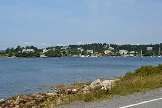
Glen Haven is a small coastal community within the Halifax Regional Municipality of Nova Scotia, Canada, about 40 km from Halifax city centre. It is situated on the shore of the St. Margarets Bay immediately adjacent to Tantallon and French Village along Route 333, also known as Peggy's Cove Road.

Lower Sackville is a suburban community of the Halifax Regional Municipality, Nova Scotia, Canada.
Highway 103 is an east-west highway in Nova Scotia that runs from Halifax to Yarmouth.
Timberlea is a community located within the Municipality of Halifax in Nova Scotia, Canada.
The Halifax Regional Centre for Education is the public school district responsible for 136 elementary, junior high, and high schools located in the Halifax Regional Municipality. The current Regional Executive Director is Steve Gallagher. The district's office is on Spectacle Lake Drive in Dartmouth. The district's stated vision is "to provide a high quality education to every student every day". On January 24, 2018, the provincial government announced that the Halifax Regional School Board would be dissolved and that kindergarten to grade 12 education services in Halifax would administered by an appointed provincial council. The Halifa Regional School Board was dissolved on March 31, 2018.

Nova Scotia Trunk 3 is an east-west trunk highway in Nova Scotia. The route runs from Halifax to Yarmouth, along the South Shore. Trunk 3's status as an important regional highway link has been superseded by the parallel Highway 103.

Bay View High School is a Canadian high school serving the western suburbs of Nova Scotia's Halifax Regional Municipality (HRM); namely the communities of Beechville, Lakeside, Timberlea, Tantallon and communities on the western portion of Highway 333 including Peggy's Cove, Seabright and others. Bay View's feeder schools are Five Bridges Junior High School and Ridgecliff Middle School.
Upper Tantallon is a suburban community that extends from the Hammonds Plains Road to the crossroads of Trunk 3 and Route 333 within the Halifax Regional Municipality of Nova Scotia Canada, 28.5 km (17.7 mi) west from Downtown Halifax, Nova Scotia, Canada. The community is likely named for Tantallon Castle in Scotland.
Head of Chezzetcook is a rural community on the Eastern Shore Marine Drive route of Halifax Regional Municipality in Nova Scotia. The Head of Chezzetcook area begins at the intersections of routes 7 and 207, near Porters Lake and West Chezzetcook, and continues along the Marine Drive to Gaetz Brook. Head of Chezzetcook is a short commute to Downtown Halifax at 29.52 kilometers; and in its heyday was a major port of call for ships delivering supplies from the city to local gold miners and early settlers. A vista of the sea marks the Head of Chezzetcook Inlet, for which the Chezzetcooks are named; and a fork in the road for both East Chezzetcook and Conrod Settlement.

Halifax Regional Municipality has a multi-modal transportation network.

MetroX is a rural express bus service operating in the Canadian province of Nova Scotia. Operated by Halifax Transit, MetroX service is available on three limited-stop fully accessible express routes within the Halifax Regional Municipality. All routes link to downtown Halifax, with one from Upper Tantallon, one from Fall River and Halifax Stanfield International Airport, and one from Porters Lake.
Upper Hammonds Plains is a Canadian suburban community located in Nova Scotia's Halifax Regional Municipality.

Sheldrake Lake is a lake in the Canadian province of Nova Scotia. Sheldrake Lake is 76 metres (249 ft) above sea level, and has a surface area of 0.19 square kilometres (0.073 sq mi). It drains to Five Island Lake. It stretches 0.6 kilometres (0.37 mi) in the north-south direction, and 0.5 kilometres (0.31 mi) kilometres in the east-west direction.
Jerry Lawrence Provincial Park is a provincial park in the Canadian province of Nova Scotia, in Upper Tanatallon. It is located on Route 3, approximately 25 kilometres west of Halifax.


