
Ceduna is a town in South Australia located on the shores of Murat Bay on the west coast of Eyre Peninsula. It lies west of the junction of the Flinders and Eyre Highways around 786 km northwest of the capital Adelaide. The port town/suburb of Thevenard lies 3 km to the west on Cape Thevenard. It is in the District Council of Ceduna, the federal Division of Grey, and the state electoral district of Flinders.

The Wirangu language, also written Wirrongu, Wirrung, Wirrunga, and Wirangga, and also known by other exonyms, is a moribund Australian Aboriginal language traditionally spoken by the Wirangu people, living on the west coast of South Australia across a region encompassing modern Ceduna and Streaky Bay, stretching west approximately to the head of the Great Australian Bight and east to Lake Gairdner. It is a language of the Thura-Yura group, and some older sources placed it in a subgroup called Nangga.
The District Council of Streaky Bay is a local government area in South Australia located on the Eyre Peninsula. Streaky Bay is the main population centre of about 1,200 people serving an agricultural district based on farming wheat and other cereal crops, sheep, supplemented by fishing and tourism industries. The district covers an area of 6,251.1 square kilometres with a population of 2,074 people in 2016, according to the Australian Bureau of Statistics. Mayor of Streaky Bay is Travis Barber.

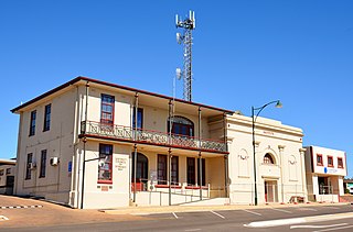
Streaky Bay is a coastal town on the western side of the Eyre Peninsula, in South Australia just off the Flinders Highway, 303 km (188 mi) north-west of Port Lincoln and 727 km (452 mi) by road from Adelaide. At the 2016 census, Streaky Bay recorded a population of 1, 378.

Yalata is an Aboriginal community located 200 kilometres (120 mi) west of Ceduna and 140 km (87 mi) south of Ooldea on the edge of the Nullarbor Plain in South Australia. It lies on the traditional lands of the Wirangu people, but the settlement began as Yalata Mission in the early 1950s when Pila Nguru people were moved from Ooldea Mission when that closed, after previously being moved from their land in the Great Victoria Desert owing to nuclear testing by the British Government.
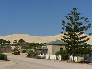
Fowlers Bay, formerly known as Yalata, is a bay, town and locality in the Australian state of South Australia located about 658 kilometres (409 mi) north-west of the state capital, Adelaide. The town is located on Port Eyre, at the western end of the larger Fowlers Bay. It was named Yalata after Yalata station, established in the 1860s and stretching from the Nullarbor Plain across to near Streaky Bay on the Eyre Peninsula, whose homestead was located on the hill nearby. The name Yalata now belongs to a small Aboriginal community further west, which was also situated on station land.

The County of Robinson is one of the 49 counties of South Australia. It was proclaimed in 1883 by Governor William Robinson who named it after himself. It lies on the north west coast of Eyre Peninsula stretching from Streaky Bay inland to include the Gawler Ranges Conservation Park at the southern cusp of the Gawler Ranges.
Lake Newland Conservation Park is a protected area in the Australian state of South Australia located on the west coast of the Eyre Peninsula about 10 kilometres (6.2 mi) north of the town of Elliston. It was proclaimed in 1991 in order to protect Lake Newland, a hypersaline lake, and an associated wetland complex. It lies in the traditional lands of the Wirangu people.
The Hundred of Catt is a cadastral hundred in the County of Way, South Australia established in 1889. It was named for Alfred Catt, member of the state parliament from 1881 to 1902.
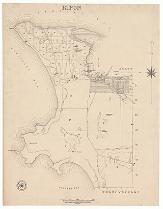
The Hundred of Ripon is a cadastral hundred of the County of Robinson in South Australia, and is near Streaky Bay, South Australia on the Eyre Peninsula.
The Hundred of Karcultaby is a cadastral unit of hundred located on the northern Eyre Peninsula of South Australia spanning the townships of Poochera, Karcultaby and surrounds. One of the 24 hundreds of the County of Robinson, it was proclaimed in 1913 by Governor Day Bosanquet and named for Karcultaby Homestead, in the extreme southeast of the hundred.
The Hundred of Condada is a cadastral unit of hundred located on the northern Eyre Peninsula of South Australia spanning the township of Minnipa and surrounds. One of the 24 hundreds of the County of Robinson, it was proclaimed in 1913 by Governor Day Bosanquet and named for Condada Hill, in the southwest of the hundred.
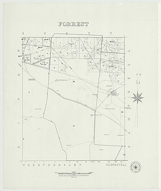
The Hundred of Forrest is a cadastral hundred of the County of Robinson in South Australia.
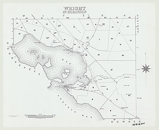
The Hundred of Wright is a cadastral hundred of County of Robinson in South Australia. It spans the west coast of the state at Venus Bay, 655 kilometres (407 mi) west of Adelaide.

The Hundred of Bartlett is a cadastral hundred of South Australia located in the remote County of Way. It was created in 1889.
The Hundred of Horn is a cadastral hundred of South Australia located in the remote County of Way.

The Hundred of Campbell is a cadastral hundred of the County of Robinson in South Australia.

The Hundred of Witera is a cadastral hundred of the County of Robinson in South Australia.
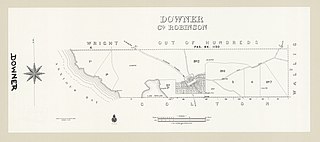
The Hundred of Downer is a cadastral hundred of County of Robinson in South Australia.
The Hundred of Wallis is a cadastral hundred of County of Robinson in South Australia.

