This page is based on this
Wikipedia article Text is available under the
CC BY-SA 4.0 license; additional terms may apply.
Images, videos and audio are available under their respective licenses.
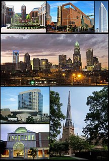
Mecklenburg County is a county located in the southwestern region of the state of North Carolina, in the United States. As of the 2010 census, the population was 919,618. It increased to 1,034,070 as of the 2015 estimate, making it the most populous county in North Carolina and the first county in the Carolinas to surpass 1 million in population. Its county seat and largest city is Charlotte.

Ansel Township is a township in Cass County, Minnesota, United States. As of the 2000 census, its population was 101. Ansel was the given name of a pioneer settler.
Cornelius is a lakeside town located along Lake Norman in northern Mecklenburg County, North Carolina, United States. The population was 24,866 at the 2010 census.
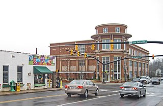
Huntersville is a large suburban town in Mecklenburg County, North Carolina, United States. A part of the Charlotte metropolitan area, the population was 46,773 at the 2010 census, and had increased to 52,704 according to the 2015 census annual estimate, making Huntersville the 17th largest municipality in North Carolina. It is located 14 mi (23 km) north of Charlotte.

Huntersville is a census-designated place (CDP) located in Pocahontas County, West Virginia in the Alleghany Mountains. As of the 2010 census, its population was 73. It is located six miles east of Marlinton and four miles west of Minnehaha Springs. Huntersville received its name because it was a rendezvous for trappers and hunters who came to trade pelts for supplies. It served as the county seat of Pocahontas County until 1891 when the county's residents voted to move the seat to Marlinton. A local newspaper called "The Pocahontas Times" is distributed in the area.

Monroe is a small unincorporated community in Lauramie Township, Tippecanoe County, in the U.S. state of Indiana. The community is part of the Lafayette, Indiana Metropolitan Statistical Area.

Ray Township is one of thirteen townships in Franklin County, Indiana. As of the 2010 census, its population was 4,021.
Bradford Field is a private-use airport located three miles (4.8 km) east of the central business district of Huntersville, a town in Mecklenburg County, North Carolina, United States. It is privately owned by W. O. & Cecil D. Bradford. It was opened in the late 1960s by the Bradford brothers at the request of a few private aircraft owners in the town of Huntersville. The original turf airport in Huntersville was little more than a fenced in cow pasture located at one end of the Meacham farm south of Huntersville. A minor aircraft accident involving a Piper J-3 "Cub" and the subsequent FAA investigation led to the closing of Meacham field, and the forced relocation of the two aircraft hangared there.
Bradford Field may refer to:

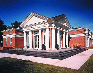
Discovery Place Science is a science and technology museum for visitors of all ages located in the Uptown area of Charlotte, North Carolina. Discovery Place Science brings science to life through hands-on interactive exhibits, thrilling activities and experiments, an IMAX Dome Theatre, and boundless other educational opportunities and programs. The Museum, which first opened in 1981, underwent an 18-month, $31.6 million renovation in 2010 that transformed it into a reimagined state-of-the-art science and technology museum.

White Hall is an unincorporated community in Albemarle County, Virginia.
Huntersville is a historic neighborhood in Norfolk, Virginia. It is located near downtown Norfolk. One of Norfolk's "most intact settlements remaining from the late 19th century," Huntersville "is unique because it was not planned by a company or commission, but developed over time."
The Huntersville State Forest is a state forest located in Wadena County, Minnesota. Around half of the forest is managed by the Minnesota Department of Natural Resources, with the other half controlled privately.

Huntersville is an unincorporated community in St. Mary's County, Maryland, United States. Huntersville is located along Maryland Route 6 3 miles (4.8 km) west-southwest of Golden Beach.
The Oriskany Formation is a geologic formation in the northeastern United States. It preserves fossils dating back to the Devonian period. It is composed of sandstone, often bearing natural gas.
Huntersville is an unincorporated community in Franklin County, Indiana, in the United States.

Huntersville is an unincorporated community in Hardin County, in the U.S. state of Ohio.