 Hurricane Cosme at peak intensity off the southwest coast of Mexico on June 21 | |
| Meteorological history | |
|---|---|
| Formed | June 19,1989 |
| Dissipated | June 23,1989 |
| Category 1 hurricane | |
| 1-minute sustained (SSHWS/NWS) | |
| Highest winds | 85 mph (140 km/h) |
| Lowest pressure | 979 mbar (hPa);28.91 inHg |
| Overall effects | |
| Fatalities | 30 |
| Areas affected | Mexico,East Texas |
| IBTrACS | |
Part of the 1989 Pacific hurricane season | |
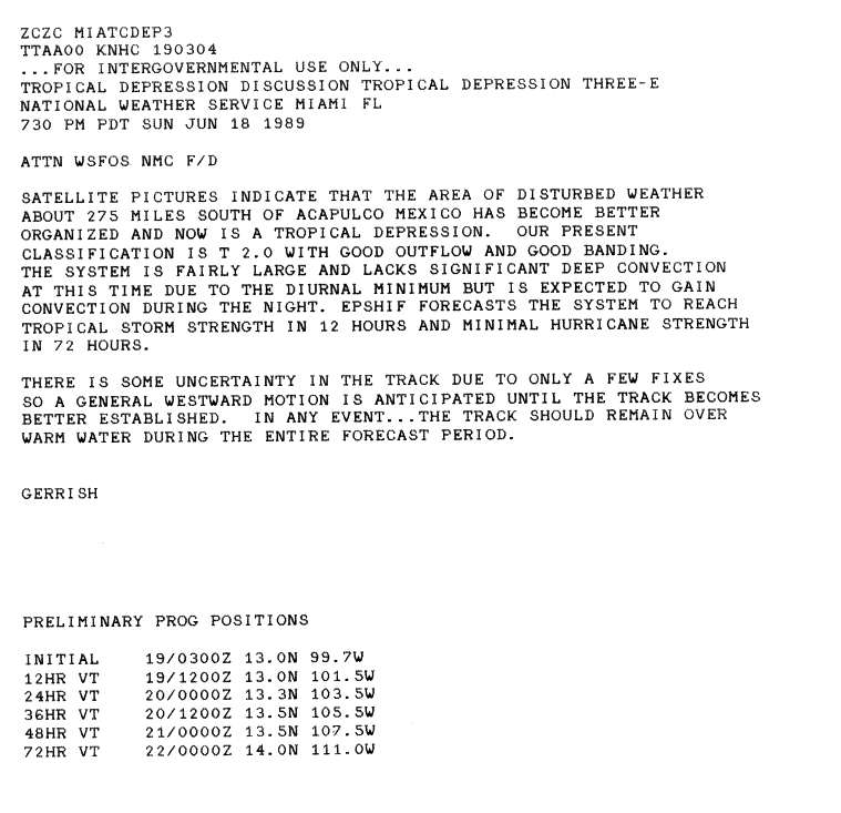
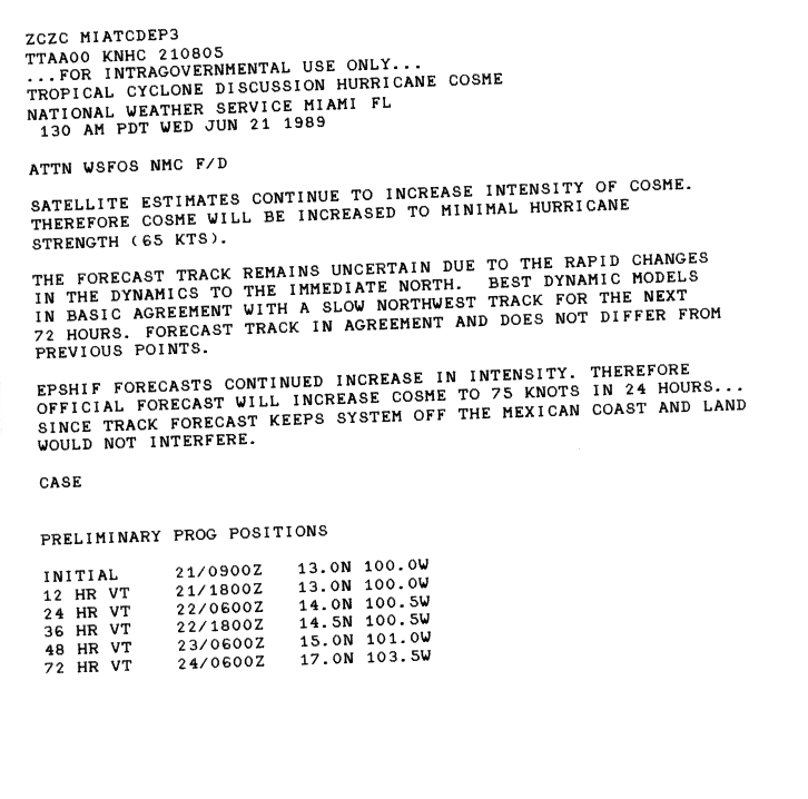
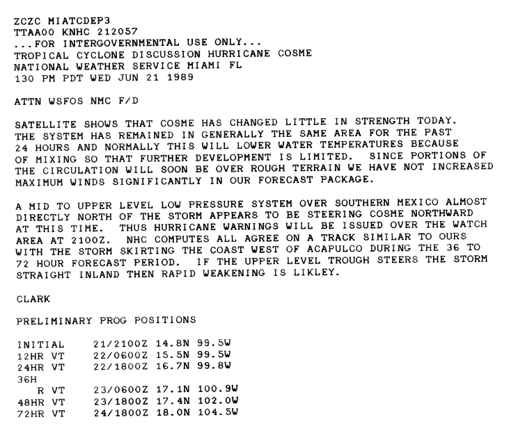
Hurricane Cosme was an unusually large tropical cyclone that made landfall in south-western Mexico in June 1989. The third tropical storm and second hurricane of the 1989 Pacific hurricane season,Cosme formed on June 19 from a tropical wave. The storm initially moved westward before being upgraded into Tropical Storm Cosme,ultimately intensifying into a Category 1 hurricane. Cosme turned northward and made landfall near Acapulco during the night of June 21. It rapidly weakened over land. The storm caused excessive rainfall on land,leading to deadly and destructive flooding. It is estimated that 30 people died in the hurricane.


