 Henri in the Bay of Campeche shortly after peak intensity on September 17 | |
| Meteorological history | |
|---|---|
| Formed | September 14,1979 |
| Remnant low | September 21,1979 |
| Dissipated | September 24,1979 |
| Category 1 hurricane | |
| 1-minute sustained (SSHWS/NWS) | |
| Highest winds | 85 mph (140 km/h) |
| Lowest pressure | 983 mbar (hPa);29.03 inHg |
| Overall effects | |
| Fatalities | None |
| Damage | Minimal |
| Areas affected | Mexico,Florida,Texas |
| IBTrACS | |
Part of the 1979 Atlantic hurricane season | |
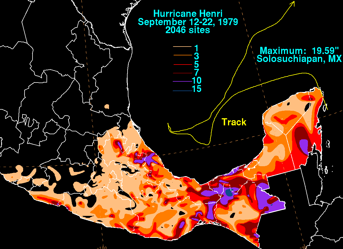
Hurricane Henri was a rare tropical cyclone that entered the Gulf of Mexico without having made landfall;it was the second of four times this occurred during the 20th century. [1] The eighth named storm and fifth hurricane of the 1979 Atlantic hurricane season,it formed on September 14 in the northwestern Caribbean Sea. Throughout much of its duration,Henri moved erratically and initially maintained a general westward track. On September 16 it attained tropical storm status,and a day later it reached hurricane status. By two days later,after experiencing hostile conditions,Henri weakened to tropical depression status as it turned to the northeast,before degenerating into a remnant low on September 21. On September 24,it merged with a frontal low in the northeast Gulf of Mexico. Due to its slow and erratic motion,the hurricane forced evacuations along the Mexican coastline. Its remnants brought rainfall and flooding to the Florida Panhandle.


