Ibi | |
|---|---|
LGA and town | |
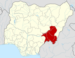
 Ibi Location in Nigeria | |
| Coordinates: 8°19′N9°51′E / 8.317°N 9.850°E | |
| Country | |
| State | Taraba State |
| Local Government Headquarters | Ibi Town |
| Government | |
| • Local Government Chairman and the Head of the Local Government Council | Iliya Muhammad Ajibu |
| Area | |
• Total | 2,672 km2 (1,032 sq mi) |
| Population (2006 census) | |
• Total | 84,054 |
| Time zone | UTC+1 (WAT) |
| 3-digit postal code prefix | 620 |
| ISO 3166 code | NG.TA.IB |
 | |
Ibi is a town and administrative district in Taraba State, Nigeria. The town is located on the south bank of the Benue River, opposite the influx of the much smaller Shemankar River. Both the Taraba River and the Donga River flow into the Benue within the LGA.
Contents
Ibi is one of the sixteen local government areas of Taraba State, and is governed by an elected chairman. There are 10 Wards in IBI local government area namely: DAMPAR I, DAMPAR II, DAMPAR III, IBI NWONYO I, IBI NWONYO II, IBI RIMI UKU I, IBI RIMI UKU II, SARKIN KUDU I, SARKIN KUDU II, SARKIN KUDU III